La Ferrière (Isère)
| La Ferrière | ||
|---|---|---|
|
|
||
| local community | Le Haut-Bréda | |
| region | Auvergne-Rhône-Alpes | |
| Department | Isère | |
| Arrondissement | Grenoble | |
| Coordinates | 45 ° 19 ′ N , 6 ° 5 ′ E | |
| Post Code | 38580 | |
| Former INSEE code | 38163 | |
| Incorporation | 1st January 2019 | |
| status | Commune déléguée | |
| Website | http://www.la-ferriere.fr/ | |
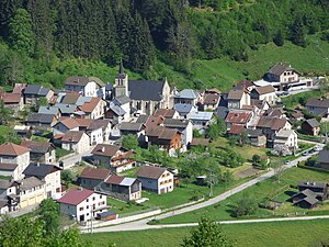
 View of La Ferrière |
||
La Ferriere is a town and commune Déléguée in the French commune of Le Haut-Bréda with 230 inhabitants (as of January 1, 2017) in the department of Isère in the region Auvergne Rhône-Alpes . The inhabitants call themselves Biassus or Ferriérins .
The municipality of La Ferrière merged with Pinsot on January 1, 2019 to form the Commune nouvelle Le Haut-Bréda. It belonged to the Arrondissement of Grenoble and the Canton of Haut-Grésivaudan (until 2015: Canton Allevard ).
geography
La Ferrière is located in the Grésivaudan countryside on the upper reaches of the Bréda river . The winter sports area Les Sept Laux extends into the Commune déléguée. The municipality of La Ferrière was surrounded by the neighboring municipalities of Pinsot in the north and northeast, Saint-Colomban-des-Villards in the east, Vaujany in the south, Allemond in the south and southwest, Laval in the southwest, Les Adrets in the west and southwest, Theys in the west as well Crêts en Belledonne in the northwest.
Population development
| 1962 | 1968 | 1975 | 1982 | 1990 | 1999 | 2006 | 2013 | |
|---|---|---|---|---|---|---|---|---|
| 252 | 245 | 189 | 204 | 191 | 214 | 225 | 231 | |
| Source: Cassini and INSEE | ||||||||
Attractions
- Saint-Maximin church from the 19th century
