Laughed
| Laughed | ||
|
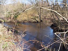
Laughed west of Lachendorf |
||
| Data | ||
| location | Lower Saxony , Germany | |
| River system | Weser | |
| Drain over | Aller → Weser → North Sea | |
| source | Southwest of Sprakensehl 52 ° 44 ′ 40 ″ N , 10 ° 28 ′ 9 ″ E |
|
| Source height | 96 m above sea level NHN | |
| muzzle | In the east of Celle , near Lachtehausen, coordinates: 52 ° 37 '17 " N , 10 ° 6' 11" E 52 ° 37 '17 " N , 10 ° 6' 11" E |
|
| Mouth height | 40 m above sea level NHN | |
| Height difference | 56 m | |
| Bottom slope | 1.5 ‰ | |
| length | 38 km, with Lutter 42.8 km | |
| Catchment area | 469 km² | |
| Discharge at the Lachendorf A Eo gauge : 433 km² Location: 9.4 km above the mouth |
NNQ (01.09.2009) MNQ 1961/2014 MQ 1961/2014 Mq 1961/2014 MHQ 1961/2014 HHQ (28.10.1998) |
521 l / s 1 m³ / s 2.66 m³ / s 6.1 l / (s km²) 16.4 m³ / s 37.3 m³ / s |
| Left tributaries | Kainbach, Jafelbach, Sothbach | |
| Right tributaries | Lutter , Aschau | |
| Communities | Auermühle, Lüsche , Steinhorst , Wohlenrode , Hohnhorst , Jarnsen , Beedenbostel , Lachendorf , Lachtehausen | |
The Lachte is an approximately 38 kilometers long right tributary of the Aller in Lower Saxony . It drains a very wooded catchment area of the eastern Südheide and has an average water flow of around 2.9 m³ / s at the mouth. The river system has a strikingly parallel water structure and is largely located in the Südheide Nature Park . It contains some ecologically very high quality water sections.
course

The Lachte rises in the northern district of Gifhorn, southwest of the town of Sprakensehl . It initially flows in a south-westerly direction and feeds a 5 km long chain of fish ponds at Gut Auermühle . Then it takes the Kainbach from the left and the Jafelbach below Steinhorst . In Steinhorst (with a water wheel in the municipal coat of arms ) a paved ford leads through the river. At Beedenbostel , district of Celle , the largest tributaries of the Lachte, the Lutter and the Aschau flow from the right . The Lutter is actually the larger river at the confluence with the Lachte. At Lachendorf the river turns west and flows into the Aller at Lachtehausen, a district of the city of Celle .
Even if it only follows the river on its western section, the Celle-Wittingen small railway is also called the Lachtalbahn .
Protected areas
In 1997 the nature reserve Obere Lachte, Kainbach, Jafelbach was established with a size of 1090 ha. Since 2009, the Lachte in the 489 hectare nature reserve Lachte has also been under nature protection in the district of Celle. A total of 4014 hectares of the river system of the Lachte including the Lutter and some tributaries are under nature protection, 5113 form the FFH area “Lutter, Lachte, Aschau (with some tributaries)”. Part of it is in the Südheide Nature Park .
Paddling on the laugh
Due to the great importance of nature conservation for this river, the boat operation on the Lachte leads to conflicts with the nature conservation groups; in particular through disturbance of the animal world, damage to bank vegetation and negative changes in the river bed. As a compromise solution, paddling is only permitted to a limited extent in the period from May 16 to October 14, from 9 a.m. to 6 p.m. on the Lachte. Only marked paddle boats ( kayak , canoe , canoe ) with a maximum length of 6 m and a width of 1 m are permitted . If the water level is sufficient (pay attention to the level indicator), the Lachte can be used from the Beedenbostel - Jarnsen road bridge downstream. Entry and exit points are in Jarnsen and Lachendorf.
Web links
Individual evidence
- ↑ a b Measurement in the topographic map 1: 25,000
- ^ German Hydrological Yearbook Weser-Ems 2014. Lower Saxony State Agency for Water Management, Coastal Protection and Nature Conservation, p. 182, accessed on October 4, 2017 (PDF, German, 8805 kB).
- ↑ MQ at the Lachendorf gauge (conservative) extrapolated to the entire catchment area
- ↑ Note: Laugh : A EO 121.5 km², length 20.36 km; Lutter : A EO 149.6 km², length 25.80 km (measurement in the topographic map 1: 25,000)
- ↑ "Obere Lachte, Kainbach, Jafelbach" nature reserve
- ↑ "Lachte" nature reserve in the database of the Lower Saxony State Office for Water Management, Coastal and Nature Conservation (NLWKN)
- ↑ Map services of the Federal Agency for Nature Conservation ( information )
- ^ Ordinance of the district of Celle for the protection of heathland brooks from March 18, 2005
- ↑ Directory of the traffic rules for the Lachte among others , published by the DKV (PDF accessed 12/2018)


