Lutter (laughed)
| Lutter | ||
|
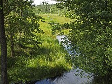
Lutter in Bargfeld , from the left which opens Schmalwasser a |
||
| Data | ||
| location | Germany , Lower Saxony | |
| River system | Weser | |
| Drain over | Laughed → Aller → Weser → North Sea | |
| source | north of Weyhausen (Ldkrs. Celle) 52 ° 48 ′ 3 ″ N , 10 ° 23 ′ 39 ″ E |
|
| Source height | 93 m above sea level NN | |
| muzzle | northeast of Lachendorf OT. Jarnsen in die Lachte coordinates: 52 ° 38 ′ 48 ″ N , 10 ° 17 ′ 22 ″ E 52 ° 38 ′ 48 ″ N , 10 ° 17 ′ 22 ″ E |
|
| Mouth height | 51 m above sea level NN | |
| Height difference | 42 m | |
| Bottom slope | 1.6 ‰ | |
| length | 25.8 km | |
| Catchment area | 149.6 km² | |
| Left tributaries | Ahrbeck, Schmalwasser , Köttelbeck , | |
| Communities | Marwede , Bargfeld , Eldingen , Luttern , | |
| Hydrologically, the main strand of the laughing system | ||
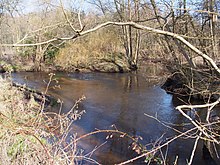
The Lutter is a 26 km long, near- natural heathland on the eastern edge of the Südheide Nature Park , a tributary of the Lachte . Its source is near the B 191 north of Weyhausen in the district of Celle .
course

The Lutter flows mainly in a southerly direction, takes on the Ahrbeck from the left and first reaches Marwede . On its way further south, the Lutter reaches Bargfeld . Here the narrow water flows in from the left . The largely canalized Köttelbeck flows behind Bargfeld . The Lutter then flows in a south-westerly direction past Eldingen , through its district Luttern and flows north of Jarnsen near Lachendorf into the Lachte. The Lutter surpasses the Lachte here in terms of water flow and length, so hydrologically it represents the main strand of the Lachte river system.
Use of the water
In Marwede there is a former water mill, which was first mentioned in 1438 at this location. The Wolfhagen miller family ran this mill from around 1687 to 1954. A grain mill , a sawmill and an oil mill with pan mill were powered by water power. In 1796 a fire destroyed the buildings. In 1906 the water wheels were replaced by a turbine. In the 1960s the mill was shut down. Today it is a listed building.
Since the acquisition of the mill in Eldingen as part of the major nature conservation project Lutter in 1992, the mill pond has not been drained. This means that no more fine sediment enters the Lutter in the course below . In 2000 the barrage was also removed and the turbine expanded. The mill lost its right to jam . The ecological permeability of the Lutter was restored and a prerequisite for the successful development of the nature conservation project was created.
Protected areas
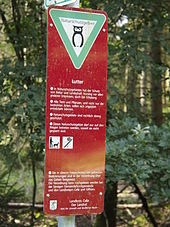
Virtually the entire Talung the Lutter and the narrow water Köttelbeck and some other tributary streams are under conservation and form the 2,435.3 hectares large nature reserve Lutter . This is part of the 5113 ha FFH area "Lutter, Lachte, Aschau (with some tributaries)" and borders the Lachte nature reserve with the mouth of the Lutter .
The course of the Lutter is located at the edge of the lower reaches of the Südheide Nature Park , but this does not apply to the entire nature reserve.
fauna and Flora

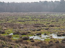
As a near-natural area of the Südheide, the area is of particular importance for nature conservation. Not only the streams themselves as a habitat for fish and otters , but also adjacent floodplain and swamp forests , moors , swamps and spring areas , in which bird species such as black stork , sea eagle , crane , kingfisher and rare river dragonflies, such as u. a. the endangered scarlet dragonfly and the critically endangered Little Blue Arrow are native.
Over 160 endangered animal and plant species live on and in these heathland streams. One of the last occurrences of the freshwater pearl mussel ( Margaritifera margaritifera ) is particularly significant here . These place particularly high demands on the quality of their living space. Successful conservation of the river pearl mussel has been achieved through a major nature conservation project. The stock here, as the only one in Europe, has shown a positive development. In the first experiments in 1985, brown trout caught in the Lutter were infected with freshwater pearl mussel larvae and returned to the stream. However, these first measures were initially unsuccessful. The cause lay in the unnaturally high sand load of the Lutter, which was only discovered later and removed as part of the nature conservation project. The scientific justification by Buddensiek (1991) and the confirmation in practice by Abendroth (1993) brought about the breakthrough. In 2008, more than 12,000 mussels were detected again (around 50,000 specimens were still living in Lachte and Lutter in the 1930s).
Development of the freshwater pearl mussel population in the Lutter
| year | Number of shells | year | Number of shells | |
|---|---|---|---|---|
| 1982 | approx. 2,700 | 2003 | approx. 4,100 | |
| 1992 | approx. 2,200 | 2004 | approx. 5,800 | |
| 1994 | approx. 1,800 | 2005 | approx. 6,000 | |
| 2000 | approx. 2,700 | 2006 | approx. 7,300 | |
| 2001 | approx. 2,900 | 2007 | approx. 8,800 | |
| 2002 | approx. 3,800 | 2008 | approx. 12,200 |
Large-scale conservation project
The Federal Agency for Nature Conservation , the State of Lower Saxony and the districts of Celle and Gifhorn supported the major nature conservation project "Lutter" from 1989 to 2006 with 16.5 million euros. The federal government bore 75%, the state of Lower Saxony 15% and the districts of Celle and Gifhorn 10% of the costs. The most important measures were carried out:
- Purchase of almost all floodplains , tributaries and bog areas from which water enters the Lutter,
- Rewetting of bogs ,
- Equipping the trenches with sand traps ,
- Purchase of the damming rights of mill weirs and dismantling of the weirs,
- Construction of bed slides on the still existing weirs,
- Mill ponds are no longer drained.
Surname
The name is Lutter Low German and related to the appellative "loud" that the Middle High German for , loud, bright, clean pure stands. Lutter is a common river or stream name , but also occurs in derived place names. The equivalent louder is still preserved in fixed expressions (e.g. a "louder character").
Web links
- Nature reserve "Lutter" in the database of the Lower Saxony State Office for Water Management, Coastal and Nature Conservation (NLWKN)
- The Lutter nature conservation project
Individual evidence
- ↑ a b Measurement in the topographic map 1: 25,000
- ↑ Note: Laugh : A EO 121.5 km², length 20.36 km; Lutter : A EO 149.6 km², length 25.80 km (measurement in the topographic map 1: 25,000)
- ↑ NLWKN information about the " Lutter nature reserve " .
- ↑ a b c Map services of the Federal Agency for Nature Conservation ( information )
- ↑ Lost and Found, No. 249 Shell returns .
- ↑ Buddensiek, V. (1991): Investigation of the growth conditions of the freshwater pearl mussel ... in their early post-parasitic phase . Diss. FB. Biol., Univ. Hanover.
- ↑ Abendroth, D. (1993): Establishment and securing of parts of nature and landscape worthy of protection with national representative significance. Project Lutter: The Lutter - a heathland flowing water in the districts of Celle and Gifhorn, Lower Saxony . Nature and Landscape 66 (1): 24–28.
- ↑ Species and biotope protection in heathland streams .
- ↑ Note: e.g. B. Lutterbeck, Lutter am Barenberge , Königslutter am Elm


