Upper Allerniederung near Celle
|
Upper Allerniederung near Celle
|
||
| location | East of the city center of Celle , district of Celle , Lower Saxony | |
| surface | 239 ha | |
| Identifier | NSG LÜ 276 | |
| WDPA ID | 378331 | |
| Geographical location | 52 ° 37 ' N , 10 ° 7' E | |
|
|
||
| Sea level | from 37 m to 44 m | |
| Setup date | 08/30/2007 | |
| administration | NLWKN | |
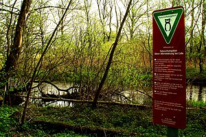
The Upper Allerniederung near Celle is a nature reserve in the Lower Saxony city of Celle .
The nature reserve with the sign NSG LÜ 276 is 239 hectares in size. It is almost completely part of the FFH area “Aller mit Barnbruch, lower Leine, lower Oker”. In the northeast it borders on the “ Lachte ” nature reserve . At the nature reserve are partly as a conservation area designated "Upper Allertal". The area has been a nature reserve since August 30, 2007. The responsible lower nature conservation authority is the city of Celle.
The nature reserve is located in the east of the city of Celle and borders in several places directly on the residential areas of Celle, u. a. to those of the districts of Blumlage in the west, Altencelle in the south and Lachtehausen in the area of the Lachte in the northeast. The area of the Immenhof on the north bank of the Lachte is excluded from the protected area.

The nature reserve protects the congestion-regulated Aller and the part of the Lachte from the confluence with the Aller to Lachtehausen as well as their lowlands and adjacent, higher-lying edge areas. The lowlands are flooded at all floods. They are characterized by small-scale floodplain and swamp forests , wet bushes, wet meadows and grassland, as well as reed beds and sedge beds . Most of the grassland is farmed extensively. There are also numerous smaller still waters in the nature reserve .
Several hiking trails run through the nature reserve. There are public bathing areas at the confluence of the Lachte and Aller in the north and at an oxbow lake in the south of the nature reserve.


