Lambsheimer Weiher
| Lambsheimer Weiher | ||
|---|---|---|

|
||
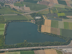
| Lambsheimer Weiher from the east | ||
| Geographical location |
Germany
|
|
| Tributaries | Feed by groundwater | |
| Islands | three sandbanks | |
| Places on the shore | Lambsheim | |
| Location close to the shore | Frankenthal ( Flomersheim district ) | |
| Data | ||
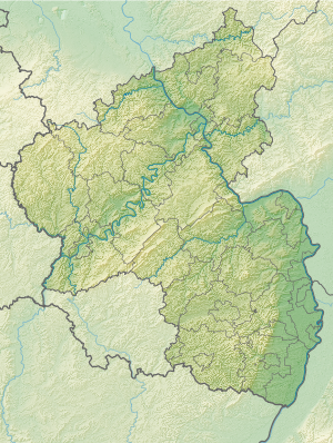
| Coordinates | 49 ° 31 '0 " N , 8 ° 18' 23" E | |
|
|
||
| Altitude above sea level | 93 m above sea level NHN | |
| surface | 20 ha | |
| length | 700 m | |
| width | 500 m | |
| Maximum depth | 9 m | |
|
particularities |
Part of the Nachtweide local recreation center |
|
The Lambsheimer pond in the Rhine valley in the eponymous Palatine local church Lambsheim ( Rheinland-Pfalz ) is one of the groundwater -fed quarry pond , the right next to the Fuchsbach in a former sand - and gravel pit has been created and the lake serves.
Geographical location
The water extends to 93 m above sea level. NHN in the Lambsheimer district Auf dem Hirschen in the Vorderpfalz northeast of Lambsheim, southwest of the core city of Frankenthal and west of its district Flomersheim . In the south, the site borders on Kreisstraße 4 and 6, which connects Lambsheim with Frankenthal. The Autobahn 61 ( Koblenz - Speyer ) runs past directly to the east, and its resting place Auf dem Hirschen is at the height of the northeastern tip of the water.
The Fuchsbach, which is largely directed to the northeast, passes the pond on its northwest side over a distance of about 400 m at a short distance; this is about 10 m at the narrowest point. Along the entire east side of the pond, the Brandgraben runs alongside the motorway in a northerly direction , which flows into the Fuchsbach from the right between the northeast tip of the pond and the rest area.
investment
The pond is about 20 hectares, up to 9 m deep and has three sandbanks. It is closed, there is no above-ground inflow or outflow. The water filling results from the groundwater, the level of which is very high due to the nearby Fuchsbach and whose flow to the east is delayed by the compacted substructure of the motorway route.
The pond shows no flow movement. Its water is clear and has a greenish-brown color, which comes from suspended organic matter ; When there is no wind and the water surface is not moving, the depth of view is up to 4 m. The banks are made of clay and sand, some of which are paved with stones or logs. The flat shore zone is mainly made of reeds , willows and alders grow around the lake .
history
The body of water was created as a quarry pond in the late 1960s when sand and gravel were extracted in the area in open-cast mining to be used in the construction of Autobahn 61. The removed topsoil was reapplied after the deeper layers were removed and today forms the soft, boggy lake bed.
use
The Lambsheimer Weiher belongs to the local recreation center Nachtweide and serves as a swimming lake for leisure activities; it is also used in triathlon competitions for swimming. For the Lambsheim sports fishing club , it is used as club water that the anglers have stocked with perch , whitefish , pike , pikeperch and catfish .
The entrance (address Nachtweide 2) in the north-west is reached via the Lambsheimer bypass road east , where there is a large parking lot, a small campsite and the club bar “Fischerhütte” with supply facilities. Every year in August, the fishing festival is held on the site ; A beach bar is operated during the summer and an ice bar during the winter .
Web links
- Location of the entrance to the Lambsheimer Weiher on: Map service of the landscape information system of the Rhineland-Palatinate nature conservation administration (LANIS map) ( notes )
Individual evidence
- ↑ a b c d Map service of the landscape information system of the Rhineland-Palatinate nature conservation administration (LANIS map) ( notes )
- ↑ a b c d e f Baggersee. Sport Angler's Association (SAV) Lambsheim, accessed on July 17, 2015 .
- ↑ Directions. Sport Angler's Association (SAV) Lambsheim, accessed on July 17, 2015 .
- ↑ Beachbar Lambsheim am See. beachbar-lambsheim.de, accessed on July 17, 2015 .

