Long dam meadows and Lower Annatal
|
Long dam meadows and Lower Annatal
|
||
|
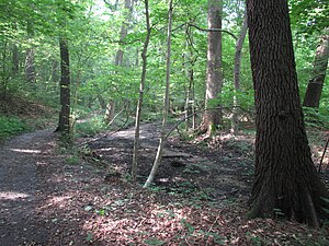
In the Annatal - Strausberg |
||
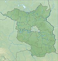
| location | Brandenburg , Germany | |
| surface | 1.26 ha | |
| Identifier | 164339 | |
| WDPA ID | 164339 | |
| Geographical location | 52 ° 31 ' N , 13 ° 51' E | |
|
|
||
| Setup date | May 16, 1990 | |
Lange-Damm-Wiesen and Unteres Annatal ( ) is a 1.26 hectare nature reserve in Brandenburg . The nature reserve Lange-Damm-Wiesen and Unteres Annatal is managed and looked after by the NABU Regional Association Strausberg - Märkische Schweiz .
location
The Lange-Damm-Wiesen and the Lower Annatal lie in the Ostbrandenburgische Platte, which forms a section of the young moraine land of the north German lowlands . The surface shape of the East Brandenburg plate was shaped in the Vistula Ice Age. A geological peculiarity are the Oser in the nature reserve , which gave the area its name as "long dams".
Landscape history
The forests of the plateaus of the area served before the Thirty Years' War of forest grazing . In contrast, the lowlands were densely overgrown until the middle of the 17th century and therefore not usable as pasture. People from the village of Strausberg used this area under the name "Hennickendorfer Winkel" as a hiding place when there was a risk of war. After the Thirty Years War, the distribution of the land to citizens was the starting point for the use of the meadow.
Pine trees were planted at the beginning of the 18th century . The overexploitation of the oak trees resulted in open spaces and forestry began in the Strausberg urban forest. The most serious intervention in the 19th century was the lowering of the lake level of Stienitzsee by 2.5 meters. On the one hand, new land was gained south of Torfhaus , and on the other hand, the lowering of the lake level certainly had an impact on the groundwater levels in the meadows up to the southern hills and possibly also on the microclimate .
Other relevant uses in the last few centuries were the construction of railways, arable land, sand and gravel mining, gas pipeline construction, military use and sewage irrigation.
Conservation and Management
In the nature reserve, the forest and meadow areas are tended naturally with the help of Heck cattle . In the ideal case, animals could live free there and take over all the "services" necessary for the maintenance of the green spaces without human influence. Thanks to their grazing behavior, for example, meadows are mowed and seeds are distributed. This has already led to a significant improvement in the state of the area, including an increase in the population of endangered species and the rediscovery of plant species believed to be extinct.
- Views
See also
- List of nature reserves in the Märkisch-Oderland district
- Herrensee, Lange Damm meadows and Barnim slopes (NSG)
Web links
- World Database on Protected Areas - Lange Dammwiesen and Unteres Annatal (English)
- Recording of the insect fauna in the nature reserve "Lange Dammwiesen und Unteres Annatal" near Strausberg in the Mark Brandenburg on entomologie-berlin.de, accessed on May 11, 2020
References and footnotes
- ↑ Geology on the information pages on the nature reserve "Lange-Damm-Wiesen und Unteres Annatal", accessed on September 30, 2018.
- ^ NSG Lange-Damm-Wiesen and Unteres Annatal


