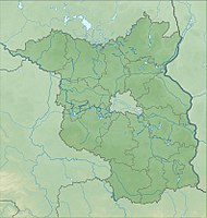
Clay pits Neuenhagen
|
Clay pits Neuenhagen
|
||
| location | Brandenburg , Germany | |
| surface | 119.6 ha | |
| Identifier | 1078 | |
| WDPA ID | 165919 | |
| Geographical location | 52 ° 49 ' N , 14 ° 3' E | |
|
|
||
| Setup date | October 1, 1990 | |
The Tongruben Neuenhagen nature reserve is located in the town of Bad Freienwalde (Oder) in the Märkisch-Oderland district in Brandenburg .
The area with the identification number 1078 was placed under nature protection by ordinance of October 1, 1990 . The approximately 119.6 hectare nature reserve extends south of Neuenhagen , a district of Bad Freienwalde (Oder), and northwest of Neutornow , a residential area in the Schiffmühle district of Bad Freienwalde (Oder). The B 158 runs to the east, the Wriezener Alte Oder flows to the west and south .
meaning
The area was placed under protection to preserve habitats of threatened animal and plant species, especially the communities of the former clay pits .
See also
- List of nature reserves in the Märkisch-Oderland district
- List of FFH areas in Brandenburg
- Neuenhagen Island
Web links
Individual evidence
- ↑ Ordinance on the establishment of nature reserves and a landscape protection area of central importance with the overall designation "Schorfheide-Chorin Biosphere Reserve" of September 12, 1990 ; therein: 44th NSG No. 31 "Tongruben Neuenhagen" on bravors.brandenburg.de, accessed on April 28, 2020

