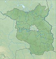
Ruhlsdorfer Bruch
|
Ruhlsdorfer Bruch
|
||
| location | Brandenburg , Germany | |
| surface | 162 ha | |
| Identifier | 1125 | |
| WDPA ID | 165250 | |
| Geographical location | 52 ° 33 ' N , 13 ° 59' E | |
|
|
||
| Setup date | October 1, 1990 | |
The Ruhlsdorfer Bruch nature reserve is located in the area of the municipality of Garzau-Garzin and the city of Strausberg in the Märkisch-Oderland district in Brandenburg .
The 162 ha area with the identification number 1125 was placed under nature protection by ordinance of October 1, 1990 . The nature reserve extends north and northeast of Garzin , a district of the municipality of Garzau-Garzin, and south of Ruhlsdorf , a residential area in the Hohenstein district of the city of Strausberg. The B 168 runs to the east and the L 34 state road to the north .
The area includes the upper reaches of the Lichtenower Mühlenfließ with the Ruhlsdorfer See and the Steigsee. It is almost congruent with the FFH area of the same name.

