Niederoderbruch
|
Niederoderbruch
|
||
|
Niederoderbruch nature reserve (May 2008) |
||
| location | Brandenburg , Germany | |
| surface | 8.63 km² | |
| WDPA ID | 164811 | |
| Geographical location | 52 ° 51 ' N , 14 ° 0' E | |
|
|
||
| Setup date | October 1, 1990 | |
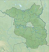
The Niederoderbruch nature reserve is located in the districts of Barnim and Märkisch-Oderland in Brandenburg .
The area with the identification number 1076 was placed under nature protection by ordinance of October 1, 1990 . The 863 hectare nature reserve, through which the Alte Finow Oderberg flows, extends west of the core town of Oderberg along the Oderberg waters flowing to the north . The state road L 29 runs to the west and north and the B 158 to the east . The Wriezer Alte Oder flows to the south and east .
meaning
The area is protected in order to preserve the habitats of threatened animal and plant species in the low moor areas of the glacial valley, which are equipped with diverse landscape elements .
See also
- List of nature reserves in the Barnim district
- List of nature reserves in the Märkisch-Oderland district
Web links
- World Database on Protected Areas - Niederoderbruch (English)
- Ordinance on the establishment of nature reserves and a landscape protection area of central importance with the overall designation "Schorfheide-Chorin Biosphere Reserve" from September 12, 1990 (see § 4 Protection Purpose; therein: 41. NSG No. 28 "Niederoderbruch") on bravors.brandenburg.de , accessed October 4, 2019


