Lower Oder Valley National Park
| Lower Oder Valley National Park | ||
|---|---|---|
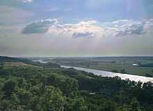
| Polder meadows between Krajnik Dolny (left) and Schwedt (right) | ||
|
|
||
| Location: | Brandenburg , Germany | |
| Next city: | Schwedt / Oder | |
| Surface: | 10,323 ha | |
| Founding: | June 28, 1995 | |
| Address: |
Website of the National Park Park 2 D – 16303 Schwedt, district Criewen |
|
The Unteres Odertal National Park , a sub-area of the Unteres Odertal International Park , is a national park in Germany founded in 1995 . It is located on the lower reaches of the Oder in northeast Brandenburg in the districts of Barnim and Uckermark , covers an area of 10,323 hectares and was inaugurated on September 10, 1995. The national park is surrounded on the German side by the 17,774 hectare nature reserve of the Lower Oder Valley National Park . The national park forms a spatial unit with the adjoining Polish landscape protection park Unteres Odertal (Park Krajobrazowy Dolina Dolnej Odry, approx. 6,000 ha) and the Zehden landscape protection park (Cedynski Park Krajobrazowy, approx. 30,850 ha) and its protection zone.
Since the declarations and resolutions of the German-Polish Environment Council in 1992, the area with its central part between the Hohensaaten-Friedrichsthaler waterway and the Oder river, including the adjacent area on the German side and the intermediate river country between East and West or from Widuchowa (Fiddichow) to the Skosnica Canal ( Klützer Querfahrt) on the Polish side is considered a cross-border protected area and bears the name Internationalpark Unteres Odertal . The cross-border protection zone covers a total of 1,172 km² and extends on both the German and the Polish side along the Oder over a length of a good 60 km.
Special features of the Lower Oder Valley National Park

The national park extends over a width of two to a maximum of eight kilometers. The east bank of the Oder (or from Friedrichsthal the Ostoder ) rises steeply to heights of up to 100 m above sea level. NN at. The west bank of the Westoder and the canal that runs parallel to the Oder, the Hohensaaten-Friedrichsthaler Wasserstraße , is a little less steep and very flat in the Schwedt / Oder area ( mouth of the Wels ).
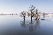
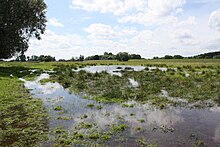
Here is the only intact polder landscape in Germany. A large area of the river basin was diked according to the Dutch model. High winter dykes that stretch along the western edge of the valley protect the villages. The summer dykes, which are opened every year in November, stretch along the Oder so that the water of the Oder can cover the entire width of the river valley and flow away unhindered. The polder meadows are therefore flooded in winter and spring. The river has more space and the risk of flooding for the port city of Szczecin is almost eliminated.
When the tide has subsided in April, the weirs of the summer dykes are closed again. The remaining water is pumped out within a few days. This enables the meadows to be used for grazing and mowing well into autumn.
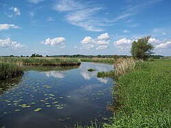
The extensive river and floodplain landscape is the habitat for many rare or protected plants and animals, including beavers . Large flocks of migratory birds rest on the flooded meadows. The valley of the Oder is limited by immediately steep hillsides. On some particularly rugged slopes, remnants of the original forests have been preserved to this day. Other areas are now dry grass due to centuries of grazing .
Fauna of the national park
The meadows flooded in winter offer numerous migratory birds resting places. The whooper swan is one of the birds that can be observed here . The breeding birds of this national park include such rare meadow breeders as the corncrake , the ruff and the black- tailed godwit, and the oriole nests in the alluvial forests and deciduous forests on the slopes of the Oder . The largest breeding colony of the Black Tern is also located in the national park.
The kingfisher and the reed warbler , one of the most endangered songbirds in Europe, can also be observed here . It breeds regularly in the wet meadows and reed beds of the floodplains. Larger populations of this songbird species can otherwise only be found in the swamp and floodplains of Poland and Belarus further to the east.
The white storks that breed on the roofs of the surrounding villages are particularly attractive to visitors to the national park . The very rare black storks can also be found , albeit very hidden, of which there are currently 3 to 5 breeding pairs.
However, otters , beavers , Montagu's Harriers and white-tailed eagles have settled here as permanent species .
In 2006 the largest colony of white-winged terns in Germany was breeding in the national park . 50 couples with 45 boys were counted. The relatively long flood of the Oder and the resulting shallow water areas provided good conditions for the birds. When the summer heat set in, the park administration ensured good breeding conditions.
In addition to the white-winged tern, the white- bearded tern also breeded in the national park in 2006 . 15 chicks were counted.
The cranes gather in the national park before they fly south; they can be observed from the tower in Mescherin, among other places. Crane weeks take place regularly in autumn.
Migrating moose are also rarely seen in the national park.
Flora of the national park
In addition to the polder areas, the national park also has important habitats for rare animal and plant species that are located on the heights and on the slopes of the edges of the Oder Valley. Here, for example, the downy oak , which is very rare in Central Europe, grows , a type of oak that has velvety leaves; Because the downy oak belongs to the Mediterranean vegetation, for this species it is too cold in large parts of Central Europe.
Tourist use

After the establishment of the national park, the Oder lowlands have developed into an insider tip for tourists. In 2004 the park had around 150,000 visitors. As early as the spring of 1997, the then Brandenburg Environment Minister Matthias Platzeck explained : “If you add up the day and multi-day visitors who only come to the Schwedt area because of the national park, the region has an annual financial benefit of a cautiously estimated 2.6 million DM ( today 1.3 million euros). "
The starting point for partly guided walking and cycling tours is the town of Schwedt / Oder or the National Park Center in Criewen. A section of the now 465-kilometer-long Oder-Neisse cycle path leads along one of the dikes . The park has a 200-kilometer network of trails, 52 marked cycling and hiking trails, three nature trails and three climbs with panoramic views.
A little further south are the remains of Stolpe Castle (popularly known as "Grützpott") on a hill . From the foot of the castle ruins you have a beautiful view of the Lower Oder Valley. The castle can be climbed at certain times.
Planned further development
According to the old National Park Act (NatPUOG) of 1995, at least half of the area of the national park should not be used commercially by December 31, 2010 at the latest and, with the exception of the flood protection systems, should otherwise be left to natural development without restrictions ( total reserves ).
From 2004 to 2006 the state of Brandenburg discussed an amendment to the National Park Act from 1995 due to acceptance problems in parts of the agricultural sector, the fishing associations, the local population and the water management. The amended National Park Act passed on October 25, 2006 by the Brandenburg State Parliament primarily provides for the repeal of the time objectives for the designation of usage-free zones. In addition, it is in favor of defining total reserves (protection zones Ia and Ib) with restricted use to exactly 50.1% (Section 5 (2) NatPUOG). With 0.1% less, the state would have violated the Federal Nature Conservation Act (BNatSchG). According to Section 24 (1) sentence 2 BNatSchG, an area can only be placed under protection as a national park if it fulfills the prerequisites for protection as a nature reserve (Section 23 BNatSchG) in the majority of its area . Mostly means more than 50%. However, if the protected area in the Lower Oder Valley National Park were 50.2%, this would be a violation of the National Park Act (NatPUOG) that has been in force since 2006.
Nature conservationists complain that the amendment to the National Park Act in 2006 once again gave way to the interests of farmers and anglers.
National Park Act
- Law on the Lower Oder Valley National Park (Lower Oder Valley National Park Act - NatPUOG). From November 9, 2006 , in: Law and Ordinance Gazette for the State of Brandenburg Part I, No. 14 of November 16, 2006, pp. 141–149. (PDF file; 236 kB)
- State of Brandenburg, Lower Oder Valley National Park : Amendment of the National Park Act 2006. Overview map of the Lower Oder Valley National Park . May 29, 2006 (PDF file; 1.87 MB)
- Law on the Lower Oder Valley National Park (Lower Oder Valley National Park Act - NatPUOG). From June 27, 1995, in: Law and Ordinance Gazette for the State of Brandenburg , Part I, No. 12 of June 28, 1995, pp. 114–119.
literature
- Günter Blutke, Ansgar Vössing (ed.): National Park Symphony Lower Odertal. A journey through pictures through the seasons. National Park Foundation Unteres Odertal, Schwedt / Oder 2005, ISBN 3-9810032-1-7 .
- Wolfgang Dohle : literature on ecology of the lower Oder valley. In: Ansgar Vössing (Hrsg.): National Park Yearbook Unteres Odertal 2004. National Park Foundation Unteres Odertal, Schwedt / Oder 2004, ISBN 3-9810032-0-9 , pp. 101–154 (bibliography mainly of German works on the ecology of the Lower Oder Valley)
- Wolfgang Dohle, Reinhard Bornkamm, Gerd Weigmann (eds.): The Lower Odertal. Schweizerbart, Stuttgart 1999, ISBN 3-510-53007-1 (Limnologie aktuell, Volume 9).
- Mieczyslaw Jasnowski, Michael Succow : Project study for a German-Polish national park “Lower Odertal”. unpublished project study on behalf of the Ministry for the Environment, Nature Conservation and Nuclear Safety of the Federal Republic of Germany, Berlin branch; Funded by the Munich Cultural Funding Foundation and the WWF Germany, Eberswalde and Szczecin Environmental Foundation in 1991.
- Wolfgang Mönninghoff: Lower Oder Valley National Park. VEBU, Berlin 1997, (German National Parks, Volume 8, Edition Commerzbank).
- Ansgar Vössing: The International Park Unteres Odertal. A work and hiking book. Stapp, Berlin 1998, ISBN 3-87776-934-9 .
cards
- State surveying and geographic base information Brandenburg (Ed.): National Park Unteres Odertal. Potsdam 2003, ISBN 3-7490-4099-0 (topographic map 1: 50,000).
Filmography
- In the Lower Oder Valley National Park . Documentary, 45 min., Germany, 1987, by Hanna Lehmbäcker and Alexander Huf, production: Complete-Media-GmbH, Grünwald ( ISBN 3-89672-487-8 )
See also
Web links
- Official website of the national park
- The website of the National Park Foundation
- WWF-Oder-Auen-Atlas
- Declaration by the parliamentary group Free-flowing rivers for the expansion of the Oder in the Lower Oder Valley National Park
- Law on the Lower Odertal National Park (National Park Act Lower Odertal - NatPUOG) of November 9, 2006 on bravors.brandenburg.de
Individual evidence
- ↑ Inauguration of the national park, video on tagesschau.de ; accessed on September 10, 2015
- ^ State Office for the Environment Brandenburg - Lower Oder Valley National Park ; accessed on September 29, 2017
- ↑ Rare terns breed in the Lower Oder Valley National Park. In: Märkische Oderzeitung. July 3, 2006
- ↑ LANDESUMWELTAMT BRANDENBURG ( page no longer available , search in web archives ) Info: The link was automatically marked as defective. Please check the link according to the instructions and then remove this notice.
- ↑ a b Dietmar Rietz: Sensation in the National Park. In: Märkische Oderzeitung. July 5, 2006, p. 14
- ↑ Announcement of the 13th crane week
- ↑ Bull elk sighted on the move in the Lower Oder Valley , rbb24 , August 9, 2019, accessed on August 9, 2019.
- ↑ Jürgen Schmidt-Räntsch : § 24 National Parks. In: Erich Gassner, Gabriele Bendomir-Kahlo, Annette Schmidt-Räntsch, Jürgen Schmidt-Räntsch (eds.): Federal Nature Conservation Act. Comment. 2nd Edition. Beck, Munich 2003, ISBN 3-406-45848-3 , p. 457


