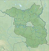
Randow slopes near Schmölln
|
Randow slopes near Schmölln
|
||
| location | Brandenburg , Germany | |
| surface | 158 ha | |
| Identifier | 1598 | |
| WDPA ID | 344830 | |
| Geographical location | 53 ° 19 ' N , 14 ° 9' E | |
|
|
||
| Setup date | February 9, 2005 | |
The nature reserve Randowhang bei Schmölln lies in the area of the municipality Randowtal in the district of Uckermark in Brandenburg .
The area with the identification number 1598, which consists of two sub-areas, was placed under nature protection by ordinance November 16, 2004 . The approximately 158 hectare nature reserve extends north-east and south-east of Schmölln , a district of the Randowtal community. East flows Randow extending border to Mecklenburg-Vorpommern and includes the 610-hectare conservation area Radewitzer heath (in Vorpommern-Greifswald ; see the landscape protection areas in Mecklenburg-Vorpommern list ) to. The state road L 251 runs to the west , in the southern area the two areas are separated from each other by the A 1 and the L 25.
See also
Web links
- World Database on Protected Areas - Randowhang near Schmölln (English)
- Ordinance on the “Randowhang bei Schmölln” nature reserve of November 16, 2004 on bravors.brandenburg.de, accessed on April 6, 2020

