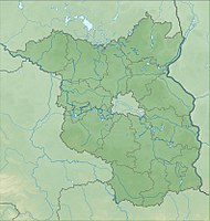
Stromtal
|
Stromtal
|
||
| location | Brandenburg , Germany | |
| surface | 6.11 km² | |
| Identifier | 1479 | |
| WDPA ID | 165768 | |
| Geographical location | 53 ° 18 ' N , 13 ° 46' E | |
|
|
||
| Setup date | June 30, 1992 | |
The Stromtal nature reserve was in the Uckermark district in Brandenburg .
The area with the identification number 1479 was placed under nature protection by ordinance of June 30, 1992 . The approximately 611 hectare nature reserve stretched south and southwest of Güstow , a district of the city of Prenzlau , along the river , a 55-kilometer tributary of the Ucker . The L 25 state road runs to the northeast, the B 109 to the southeast and the L 151 to the west. The L 15 runs through the area and to the northwest, and the 10.3 km² Unteruckersee extends to the east . In 2017, the larger Boitzenburger Tiergarten nature reserve and electricity went up.

