Platkowsee
| Platkowsee | ||
|---|---|---|

|
||
| Geographical location | Uckermark | |
| Drain | to the Zenssee | |
| Location close to the shore | Lychen | |
| Data | ||
| Coordinates | 53 ° 10 '38 " N , 13 ° 21' 52" E | |
|
|
||
| Altitude above sea level | 53.9 m above sea level HN | |
| surface | 70 ha | |
| volume | 4,412,000 m³ | |
| Maximum depth | 10 m | |
The Platkowsee is a lake near Lychen in the northeast of Brandenburg .
location
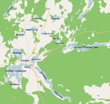
The Platkowsee belongs to the Uckermark lake landscape . Together with Wurlsee , Großer Lychensee , Zenssee , Stadtsee and Nesselpfuhl , it forms the Lychener Seenkreuz, which encompasses the inner area of Lychen almost like an island.
The body of water is a nutrient-poor channel lake and was created during the last Ice Age ( Worm Ice Age ) from a former meltwater channel that was permanently filled with water after the ice had receded. It represents the extension of the Zenssee, only separated by a narrow land bridge. It is connected to this by a narrow watercourse.
Sea data
The rather narrow lake is 69.9 hectares in size and a maximum of 15 m deep. The shape of the lake is elongated, stretched from northwest to southeast. The calcareous, stable layered lake has a relatively large catchment area and is about 2.25 kilometers long and mostly less than 300 meters wide. The surrounding area is largely forested and, together with the lake, is under nature protection.
Flora and fauna
There are no settlements on the completely wooded lakeshore. The main fish species that live in the lake are pike, perch, marble carp and catfish .
See also
Web links
- Lychener Seenkreuz at www.lychen.de
- www.mugv.brandenburg.de (PDF; 173 kB)


