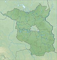
Redernswalde nature development area
|
Redernswalde nature development area
|
||
| location | Brandenburg , Germany | |
| surface | 3.05 km² | |
| Identifier | 1056 | |
| WDPA ID | 555558896 | |
| Geographical location | 53 ° 3 ' N , 13 ° 51' E | |
|
|
||
| Setup date | January 4, 2008 | |
The nature reserve nature development area Redernswalde is located in the area of the Barnim district in the Schorfheide-Chorin biosphere reserve in Brandenburg .
The area with the identification number 1056 was placed under nature protection by ordinance of January 3, 2008 . The approximately 305 hectare nature reserve in the Grumsiner Forest / Redernswalde, in which the Redernswalder See is located, extends west of the core town of Angermünde . The A 11 runs along the western edge . The state road L 239, which runs along the northern edge , also runs through the area.
See also
Web links
- World Database on Protected Areas - Redernswalde Nature Development Area (English)
- Ordinance on the nature reserve “Naturentwicklungsgebiet Redernswalde” of January 3, 2008 on bravors.brandenburg.de, accessed on October 5, 2019

