Boossener pond area
|
Boossener pond area
|
||
| location | Brandenburg , Germany | |
| surface | 104 ha | |
| Identifier | 1602 | |
| WDPA ID | 389578 | |
| Geographical location | 52 ° 23 ' N , 14 ° 29' E | |
|
|
||
| Setup date | March 21, 2000 | |
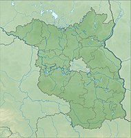
The nature reserve Boossener pond area is located in the area of the city of Lebus in the district of Märkisch-Oderland and in the area of the independent city of Frankfurt (Oder) in Brandenburg .
The area with the identification number 1602 was placed under nature protection by ordinance of March 26, 2008 . The around 104 hectare nature reserve extends southeast of Wulkow , a district of the city of Lebus, and northeast of Boossen , a district of the city of Frankfurt (Oder). The state road L 383 runs to the west, the B 112 to the east and the B 5 to the south . The Oder flows to the east and runs along the border with Poland .
meaning
The nature reserve includes "the valley area of a meltwater channel on the edge of the Lebuser Platte with the Boossener Mühlenfließ , accompanying wet habitats , reservoirs and adjacent valley slopes with dry biotopes ."
See also
- List of nature reserves in the Märkisch-Oderland district
- List of nature reserves in the city of Frankfurt (Oder)
- List of FFH areas in Brandenburg
Web links
Individual evidence
- ↑ Ordinance on the “Boossener Teichgebiet” nature reserve from March 26, 2008 on bravors.brandenburg.de, accessed on May 12, 2020


