
Radebeul-West forest park

The Radebeul-West Forest Park is a larger nature park area in the Niederlößnitz and Kötzschenbroda Oberort districts of the Saxon city of Radebeul . It is located on the northwest side of the actual Steinrücke , the namesake for the Radebeuler Steinrücke vineyard in the east-west extension . In the northern part is Schwarzes Teich , on the south side, on the slope edge above Niederlößnitz , is the water tower . The forest park is part of the Lößnitz landscape protection area in Radebeul . The southern edge strip of the forest park, where the edge of the slope from the south is visible and where the water tower stands, still belongs to the more southerly conservation area Historic vineyard landscape Radebeul , just as the opposite to the Mohr home area.
history


Already in 1850 put the champagne producer Ludwig Pilgrim, at the time owner of Moor House -Anwesens on the western side of the Moritzburger road , on the opposite side of the street, in Leimgrund the park-like, named after him, Pilgrim grove on. Towards the end of the 19th century, the Beautification Association opened up the park for the Loessnitz people by creating additional paths and setting up additional benches.
In 1905 the light-air bath Bilzbad opened a little further to the east with its large forest park for air and sun bathing, initially only with 9 hectares of green space, which subsequently expanded to 30 hectares. However, since the authorities officially ordered the fencing, this green area was withdrawn from those strolling in search of relaxation. This prompted the Niederlößnitz town council member, the major general z. D. Richard Sachse to campaign for the establishment of a public and recreational park from 1907. For this purpose he, together with Lieutenant Colonel z. D. Hans von Hartmann and the privateer Franz Oßwald, a public appeal to the citizens. Since it was clear from the start that no suitable Niederlößnitz areas were available, the forest areas of the Alte Leupe in Oberkötzschenbroda were thought of, "between Höhenweg and Leimgrund (Moritzburger Straße, Sonnenleite)". At the same time, the Beautification Association for the Loessnitz was pursuing the plan to build a public park in the east of the Loessnitz localities ( Waldpark Radebeul-Ost ).
At the beginning of 1910, the project was reported nationwide in the Berlin-based magazine Die Gartenwelt , and in the second half of the year the Waldparkstiftung was set up, which was supported by numerous financial donations from Niederlößnitz citizens (around 12,000 marks) as well as a donation to the south of the gravel pit path . 3.2 hectare large forest was made possible by the royal chamberlain Hans Friedrich von Minckwitz . The municipality of Kötzschenbroda brought an approximately 2.5 hectare parcel between Moritzburger Strasse. and Leimgrund, while the Niederlößnitz community contributed a 3.6-hectare wooded area to Oberkötzschenbrodaer Flur. The chairmanship of the foundation was taken over by the municipality board of Niederlößnitz, later it fell into the remit of the mayor of Kötzschenbroda and the mayor of Radebeul . The aim of the foundation was "to protect the natural beauties of the landscape from the ruthlessness of modern development"
The foundation had paths laid out and maintained, stairs and shelters built and the areas around Schwarzes Teich developed . In the area, which by 1928 expanded to around 17.6 hectares through acquisitions and lease agreements, the natural vegetation was preserved or restored.
In 1916 and 1917, the elevated tank, decided by the Niederlößnitz-Kötzschenbroda waterworks association in 1914, was erected near the König-Friedrich-August-Höhe , but set back slightly from the break edge, with the help of French prisoners of war .
After the Second World War, the foundation was wound up in 1949 and the forest area was taken over by the state forest enterprise. Part of the former park area became the Schwarzes Teich recreational area from 1971 . Today the Radebeul-West forest park is a landscape protection area .
Friedrich-August-Höhe
On the edge of the terrain above Niederlößnitz, where the water tower was to be built later, a lookout point was built in 1908 with an unobstructed view of the Elbe valley. On the occasion of the visit of King Friedrich August III. in the Lößnitz in the same year, the community council Oswald Hans received permission to name the newly created promenade just west of the Friedensburg König-Friedrich-August-Höhe . On the occasion of the same visit, the park in the east of the Lößnitz was given the name Friedrich-August-Park .

Friedrich-August-Höhe, right at the foot of the water tower

Friedrich-August-Höhe

Friedrich-August-Höhe: Entrance from Am Wasserturm

Friedrich-August-Höhe: Entrance from Am Wasserturm (1910)

Friedrich-August-Höhe: View of the Friedensburg
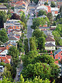
Friedrich-August-Höhe: View of Moritzburger Strasse with the railway bridge construction site in Bahnhofstrasse at the top (2012)


Giessmann tunnel
From 1876 to 1878 Max Gießmann, owner of the Badhotel located at Burgstrasse 2 (and brother of Ernst Louis Gießmann, owner of the Friedensburg above the Badhotel ), had the Gießmann tunnel drift through the syenite rock from the hill . This tunnel is almost 2 meters high and 1.2 meters wide and 368 meters long, 34 meters of which are lined. He should serve the water supply of his hotel from Schwarzes Teich . The tunnel entrance is about 200 meters southeast of the pond in today's forest park ( 51 ° 7 ′ 8.1 ″ N , 13 ° 38 ′ 22.5 ″ E ), formerly connected to the pond by a shallow ditch that is still recognizable in the landscape today . The formerly listed mouth hole comes out of the mountain on Burgstrasse within a crenellated sandstone wall ( 51 ° 6 ′ 57.5 ″ N , 13 ° 38 ′ 13.2 ″ E ). Gießmann wanted to use a siphon pipe from a well gallery along the Schwarzes Teich and the rock water that constantly seeped into the tunnel to extract water, but it was not sufficient. Today the water seeping in from the mountain is drained into the sewer system.
Inside there is a later added, now reopened arched opening with combatant ribbons and a keystone with a date.
"Knee-deep water has built up in the mouth hole areas." The calcareous water exiting the rock has "formed white, sinter-coated walls, small sinter basins and stalactites in the tunnel ."

Giessmann tunnel, entrance structure

Giessmann tunnel, the tunnel begins behind the entrance gate

Giessmann tunnel, side tunnel behind the entrance gate


Giessmann tunnel, exit mouth hole at the time of construction

Giessmann tunnel, exit mouth hole

Giessmann tunnel, exit mouth hole: entrance

Giessmann tunnel, exit mouth hole: entrance, deeper inside

Giessmann tunnel, exit mouth hole: entrance, even deeper


Jyrich's giant toboggan run

In March 1910, Hermann Jyrich asked the responsible administrative authority Dresden-Neustadt to be allowed to build a toboggan run for summer and winter operation along with an associated " ticket office " on the forest park area . After approval in April, the construction work was carried out by Adolf Menzel's construction company in Kötzschenbroda, which also carried out the project planning. The building inspections and the commissioning permit were already carried out in May.
The starting point of the toboggan run, a tower with a staircase, which was also the highest point of the run, was "60 m from Oberen Burgstrasse in a westerly direction along the Höhenweg, and then about 45 m to the north in the forest" about in the southeast corner of today's forest park. From there the toboggan run ran in a northerly direction, the outlet was just before the southeast corner of Schwarzes Teich, where the so-called concert square was later . There was also the entrance to the facility with the 3.5 x 3 m ticket booth.
“The track was 215.4 m long with a height difference of 34 m. The lane 1.2 m wide, next to it the sled elevator 0.5 m wide. The upper part of the track was 2.5 m wide, over a length of 60 m, through an attached staircase with stairs to the tower ”.
With the beginning of the First World War in 1914, the toboggan run closed again.
literature
- Frank Andert (Red.): Radebeul City Lexicon . Historical manual for the Loessnitz . Published by the Radebeul City Archives. 2nd, slightly changed edition. City archive, Radebeul 2006, ISBN 3-938460-05-9 .
- Frank Andert: 100 years of the Waldpark. (pdf) Part 46. In: Kötzschenbrodaer stories. November 2010, accessed June 16, 2012 .
Web links
- Manfred Richter: Waldpark Niederlößnitz / Kötzschenbroda, Schwarze's Teich. In: Niederlößnitz from yesteryear. Retrieved June 13, 2012 .
- Manfred Richter: The Giessmann water tunnel. In: Niederlößnitz from yesteryear. Retrieved June 16, 2012 .
- Manfred Richter: Jyrich's giant toboggan run. In: Niederlößnitz from yesteryear. Retrieved June 17, 2012 .
- City map of Niederlößnitz around 1924 (the forest park is in the middle of the Schwarzes Teich, on its left and upper edge the Leimgrund), accessed on June 23, 2012.
- Location of the area at OpenStreetMap
Individual evidence
- ↑ Volker Helas (arrangement): City of Radebeul . Ed .: State Office for Monument Preservation Saxony, Large District Town Radebeul (= Monument Topography Federal Republic of Germany . Monuments in Saxony ). SAX-Verlag, Beucha 2007, ISBN 978-3-86729-004-3 , p. 56 as well as enclosed map .
- ↑ a b c Manfred Richter: Waldpark Niederlößnitz / Kötzschenbroda, Schwarze's Teich. In: Niederlößnitz from yesteryear. Retrieved June 13, 2012 .
- ^ Frank Andert: 100 Years of the Forest Park. (pdf; 104 kB) Part 46. In: Kötzschenbrodaer stories. November 2010, accessed June 16, 2012 .
- ^ Frank Andert (Red.): Radebeul City Lexicon . Historical manual for the Loessnitz . Published by the Radebeul City Archives. 2nd, slightly changed edition. City archive, Radebeul 2006, ISBN 3-938460-05-9 , p. 212 .
- ↑ a b According to the information provided by the city administration on the information sign outside.
- ↑ Manfred Richter: The Giessmann'sche water tunnel. In: Niederlößnitz from yesteryear. Retrieved June 16, 2012 .
- ↑ Manfred Richter: Jyrich's giant toboggan run. In: Niederlößnitz from yesteryear. Retrieved June 17, 2012 .
Coordinates: 51 ° 7 ′ 7 ″ N , 13 ° 38 ′ 6 ″ E