Lerbach (Söse)
| Lerbach | ||
|
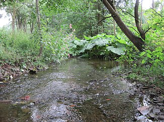
The Lerbach above the hut pond |
||
| Data | ||
| Water code | DE : 4882816 | |
| location | Europe , Germany , Lower Saxony | |
| River system | Weser | |
| Drain over | Söse → Rhume → Leine → Aller → Weser → North Sea | |
| source | Natural spring in the forest south of Buntenbock 51 ° 46 ′ 5 ″ N , 10 ° 19 ′ 56 ″ E |
|
| Source height | 596 m above sea level NN | |
| muzzle | in the Söse in Osterode am Harz , near the Johannistor Bridge Coordinates: 51 ° 43 ′ 46 ″ N , 10 ° 15 ′ 9 ″ E 51 ° 43 ′ 46 ″ N , 10 ° 15 ′ 9 ″ E |
|
| Mouth height | 220 m above sea level NN | |
| Height difference | 376 m | |
| Bottom slope | 47 ‰ | |
| length | 8 kilometers | |
| Reservoirs flowed through | Hut pond | |
| Small towns | Osterode am Harz, districts Lerbach and Freiheit | |
|
Biotope at the damming up to the hut pond |
||
The Lerbach is an approximately 8 km long right source river of the Söse .
geography
The river rises from a groundwater source south of Buntenbock in the Upper Harz, flows through the districts of Lerbach , to which it gave its name, and Freiheit and flows into the Söse in the core town of Osterode am Harz .
history
The name of the river and the place Lerbach come from a legend according to which a knight wanted to water his horse with water from the river on the way to Clausthal . Due to a drought, however, it was dried out, whereupon it is said to have said on the way back up the mountain: "Hey you damn empty stream!"
environment
There are two fish ponds along the river: the hut pond , which is designated as a specially protected biotope under the Lower Saxony Nature Conservation Act, and the mill pond on a tributary above the village of Lerbach.
Drinking water production
The Osteroder district of Lerbach, located in the upper course of the river, draws most of its drinking water from the river sources . In order to avoid contamination of the extraction systems through suspension , the water is not taken directly from the river, but from its immediate seepage water sources. The resin energy begins annual average of approximately 100,000 cubic meters of water and turns it into drinking water. Due to drought on the one hand and heavy precipitation and meltwater on the other, the drinking water yield fluctuates between 2 and 40 cubic meters per hour. The supply quota through the river for the district of Lerbach is between 75 and 100 percent, which means that it not only has historical significance for the place, but also contributes a large part to its self-sufficiency. At times when the volume of water is particularly heavy , the excess drinking water is fed to the district of Freiheit.
Web links
Individual evidence
- ↑ Lower Saxony Ministry for the Environment and Climate Protection - interactive environmental maps. (No longer available online.) Archived from the original on June 4, 2011 ; Retrieved August 13, 2011 . Info: The archive link was inserted automatically and has not yet been checked. Please check the original and archive link according to the instructions and then remove this notice.
- ↑ Heinrich Pröhle - Harz sagas. Retrieved August 8, 2011 .
- ↑ District of Osterode am Harz - specially protected biotopes. Retrieved August 8, 2011 .

