Nugget Point Lighthouse
| Nugget Point Lighthouse | ||
|---|---|---|
| View along the access path towards Nugget Point Lighthouse. In the background you can see the rocks that give the cape its name ("The Nuggets"). | ||
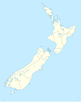
| Place: | Nugget Point , South Island , New Zealand | |
| Location: | Otago , New Zealand | |
| Geographical location: | 46 ° 26 '53.4 " S , 169 ° 49' 0.6" E | |
| Height of tower base: | 76 m | |
| Fire carrier height : | 9 m | |
|
|
||
| Identifier : | Fl W 12s | |
| Scope knows: | 10 nm (18.5 km ) | |
| Optics: | Fresnel lens | |
| Operating mode: | 1870 oil lamp 1949 electrification 2006 LED beacon |
|
| Function: | lighthouse | |
| Construction time: | 1870 | |
| Operating time: | since 1870 | |
Nugget Point Lighthouse is a lighthouse on Cape Nugget Point in New Zealand's Otago region and a station on the Southern Scenic Route .
General
The lighthouse was completed in 1869 and commissioned in 1870. After its initial operation, it was equipped with an oil lamp from 1949 onwards with electrical lighting fed by a diesel generator. The lighthouse was later connected to the power grid. In 1989 the tower was fully automated and, like all other New Zealand lighthouses, is now controlled from a control room in Wellington . In 2006, the lighting was by a LED - Beacon replaced with backup battery.
From 1901 the lighthouse served as a post office.
Web links
Commons : Nugget Point Lighthouse - collection of images, videos and audio files
Individual evidence
- ↑ a b Nugget Point Lighthouse . Maritime New Zealand , accessed October 17, 2018 .
- ^ Mark Phillips: New Zealand Lighthouses - Nugget Point (1870) . Retrieved October 24, 2012.

