List of architectural monuments in the Mengede district
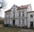
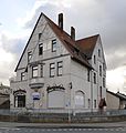
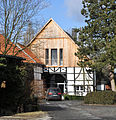
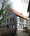
The list of architectural monuments in the Mengede district contains the listed buildings in the Dortmund-Mengede district in North Rhine-Westphalia (as of April 6, 2018). These architectural monuments are entered in the monuments list of the city of Dortmund; The basis for the admission is the Monument Protection Act North Rhine-Westphalia (DSchG NRW).
Architectural monuments are "monuments that consist of structures or parts of structures". The list of monuments of the city of Dortmund includes 79 monuments in the Mengede district, including 21 residential houses, villas or housing estates and agricultural buildings, 16 residential and commercial buildings, five public buildings and small monuments , three sacral buildings and industrial plants, two aristocratic residences and one cemetery, a commercial building and a transport system.
Furthermore, House Mengede on Waltroper Straße 2-10 and the chapel House Westhusen on Schloß-Westhusener-Straße are registered as ground monuments in Part B and tram No. 290 as a movable memorial in Part C of the monuments list of the city of Dortmund .
The Mengede district includes the districts of Bodelschwingh , Brüninghausen , Ellinghausen , Groppenbruch , Mengede , Mengeder Heide , Nette , Niedernette , Oestrich , Schwieringhausen and Westerfilde .
List of architectural monuments
The list includes, if available, a photograph of the monument, the name if available as a description, otherwise the type of building, the address and the registration number of the monument authority of the city of Dortmund in italics. The name corresponds to the designation by the monument authority of the city of Dortmund. Abbreviations have been resolved for better understanding, the typography has been adapted to that used in Wikipedia and typos have been corrected.
| image | designation | location | description | construction time | Registered since |
Monument number |
|---|---|---|---|---|---|---|

|
Residential and commercial building | Siegenstrasse 9 map |
A 0043 |
|||
 more pictures |
Sacred building of the Protestant Church of St. Remigius, Mengede | Wiedenhof 1 card |
Hall church as a three-nave, single-bay church with transept, choir square and west tower. | Built in 1250, the west tower was renewed around 1900 | A 0044 |
|
 more pictures |
Bodelschwingh moated castle |
Schlossstrasse 75–79 map |
A 0045 |
|||

|
Widum Mengede | Wiedenhof 11 map |
A 0046 |
|||
 more pictures |
former moated castle Haus Westhusen |
Schloß Westhusener Strasse 71 map |
A 0047 |
|||

|
Widum Mengede | Wiedenhof 8 map |
A 0048 |
|||

|
Widum Mengede | Wiedenhof 6 map |
A 0049 |
|||
 more pictures |
Malakow Tower, former Westhausen colliery | Bodelschwingher Strasse map |
A 0088 |
|||

|
Pay hall, former Westhausen colliery | Bodelschwingher Strasse map |
A 0089 |
|||

|
Gut Königsmühle | Ellinghauser Strasse 309 map |
A 0090 |
|||
 more pictures |
former Adolf von Hansemann colliery | Barbarastrasse map |
A 0142 |
|||
 more pictures |
Protestant Church Westerfilde Luisenkirche | Westerfilder Strasse 13 map |
A 0194 |
|||

|
agricultural building | Rittershofer Strasse 22 map |
A 0240 |
|||

|
school | Mengeder market map |
A 0263 |
|||

|
War memorial | Adalmundstrasse / Jonathanstrasse map |
A 0285 |
|||

|
War memorial |
at Deininghauser Straße 9 card |
A 0286 |
|||

|
Mengede hall building | Mengeder Markt 10 Rigwinstrasse 33 map |
A 0287 |
|||
 more pictures |
Protestant Church of St. Maria, Bodelschwingh | Parkstrasse / Zur Hunnenboke Map |
A two-bay hall church in Gothic form with a retracted choir. The tower with an eight-sided helmet stands on the west side. | 1312 | A 0288 |
|
 more pictures |
Platform roofing, Mengede train station | Castroper Strasse 51 map |
A 0354 |
|||

|
Post office, Mengede |
Strünkedestrasse 26 map |
A 0357 |
|||

|
Widum Mengede | Wiedenhof 5 card |
A 0386 |
|||

|
former rectory | Freihofstrasse 3 map |
A 0389 |
|||

|
Residential and commercial building | Williburgstrasse 27 map |
The Ellinghaus restaurant is now home to the Widum | The building was documented as early as 1666 | A 0394 |
|

|
Fountain | Mengeder market map |
A 0396 |
|||

|
agricultural building | Mosselde 137 map |
A 0400 |
|||

|
Residential building | Mengeder Schulstrasse 23 map |
A 0465 |
|||

|
agricultural building | Niedernetter Strasse 62 map |
A 0466 |
|||

|
agricultural building | Deininghauser Strasse 8 map |
A 0467 |
|||

|
agricultural building | Deininghauser Strasse 39 map |
A 0468 |
|||

|
Residential and commercial building | Siegenstrasse 7 map |
A 3-storey plastered building, its Art Nouveau facade with a mixture of historicism and reform style | 1914 | A 0469 |
|

|
Residential building | Williburgstrasse 14 map |
A 0470 |
|||

|
Residential building | Williburgstrasse 23 map |
A 0471 |
|||

|
Residential and commercial building |
Schragmüllerstraße 65 map |
A 0472 |
|||

|
Residential building | Deininghauser Strasse 53 map |
A 0473 |
|||

|
agricultural building | Eckei 96a card |
A 0474 |
|||

|
Residential and commercial building | Freihofstrasse 2 map |
A 0475 |
|||
 more pictures |
agricultural building | Große Riedbruchstrasse 1 map |
A 0476 |
|||

|
agricultural building | Mengeder Strasse 607 map |
A 0477 |
|||

|
Residential building | Mengeder Strasse 674 map |
A 0478 |
|||

|
agricultural building | Mosselde 149 map |
A 0480 |
|||

|
Residential building | Parkstrasse 12 map |
A 0482 |
|||

|
agricultural building |
Schlossstrasse 49 map |
A 0483 |
|||

|
agricultural building |
Schlossstrasse 51 map |
A 0484 |
|||

|
agricultural building | Schwieringhauser Strasse 16 map |
A 0485 |
|||

|
Residential building | Williburgstrasse 9 map |
A 0486 |
|||

|
Residential and commercial building | Williburgstrasse 10 map |
A 0487 |
|||

|
Residential and commercial building | Williburgstrasse 11 map |
A 0488 |
|||

|
Residential and commercial building | Williburgstrasse 19 map |
Half-timbered building, two-storey house with a saddle roof and a transverse extension with a gable. The upper floor is slated to the south. The house, surrounded on two sides by streets, has been completely changed on the ground floor by a shop fitting and completely clinkered. In the half-timbered area, long struts over three compartments for reinforcement, in the roof area some dormers. | 19th century | A 0490 |
|

|
Residential building | Williburgstrasse 21 map |
A 0491 |
|||

|
Residential building | Williburgstrasse 25 map |
A 0492 |
|||

|
Residential and commercial building | 68 Castroper Strasse map |
A 0494 |
|||

|
Residential and commercial building | 85 Castroper Street map |
A 0495 |
|||

|
Residential building | Castroper Strasse 132 map |
A 0496 |
|||

|
Residential and commercial building | Siegenstrasse 6 map |
A 0497 |
|||

|
agricultural building | Deininghauser Strasse 10 map |
A 0498 |
|||

|
agricultural building | Deininghauser Strasse 1 map |
A 0499 |
|||

|
villa | Siegenstrasse 11 map |
A 0500 |
|||

|
Parish hall | Wiedenhof 2 map |
A 0501 |
|||

|
Widum Mengede | Wiedenhof 3 map |
A 0503 |
|||

|
Widum Mengede | Wiedenhof 7 map |
A 0505 |
|||

|
Residential and commercial building | Castroper Strasse 65 map |
A 0515 |
|||

|
agricultural building |
Schlossstrasse 33 map |
A 0516 |
|||

|
Residential and commercial building | Mengeder Strasse 686 map |
Gable-independent half-timbered house with a half-hipped roof, a traditional half-timbered construction with long stiffened head and foot struts, a 2-storey building with a loft. | First half of the 19th century | A 0517 |
|

|
Administrative office | 1 card at the office building |
The front of the building is made in the style of the early Renaissance with a modern design and largely faced with tuff stone using basalt lava for the base. The free areas of the front have received cement plaster. The other fronts of the house are designed in a simple brick shell with plastered surfaces. In the front you can see the conference room through the high gable with the large five-part window. | 1904 | A 0518 |
|

|
Residential building | At the Amtshaus 20 card |
A 0526 |
|||

|
Residential and commercial building | At the Amtshaus 16 card |
A 0527 |
|||

|
Residential and commercial building | At the Amtshaus 18 card |
A 0528 |
|||

|
agricultural building | Altmengeder Strasse 119 map |
A 0529 |
|||

|
Residential and commercial building | At the Amtshaus 7 card |
A 0535 |
|||

|
agricultural building | Richterstrasse 13 map |
A 0543 |
|||

|
Good Altmengede | Eckei 167/169 map |
A 0549 |
|||
| War memorial | Groppenbruch / Königsheide | A 0577 |
||||

|
Volksgarten restaurant | Eckei 96 | A 0670 |
|||

|
agricultural building | Deininghauser Strasse 6 | A 0676 |
|||
| agricultural building | Im Dahl 7 | A 0691 |
||||

|
Residential building | At the Amtshaus 24 Castroper Strasse 42 |
A 0748 |
|||
| Hansemann | Hansemannstrasse 18–80 (even), 84, 86 | A 0922 |
||||

|
Jewish cemetery Mengede | Groppenbrucher Strasse Siegenstrasse map |
A 0999 |
|||
 more pictures |
War memorial |
Bürenstrasse map |
A 1005 |
literature
- Hans Magoley, Norbert Wörner: Architecture Guide Dortmund . Ed .: Bund Deutscher Architekten (= architecture in the Ruhr area . Volume 1 ). Ruhfus, Dortmund 1984, ISBN 3-7932-5012-1 .
- Albert Ludorff : The architectural and art monuments of the Dortmund-Land district . Ed .: Provinzial-Verband der Provinz Westfalen (= The architectural and art monuments of Westphalia . Volume 3 ). Schöningh, Münster 1895 ( archive.org ).
- Ursula Quednau, Christoph Bellot: Westphalia . Ed .: Dehio-Vereinigung (= Handbook of German Art Monuments . North Rhine-Westphalia II). 2nd, revised edition. Deutscher Kunstverlag, Munich 2011, ISBN 978-3-422-03114-2 .
Web links
- Monument authority of the city of Dortmund
- List of monuments of the city of Dortmund. (PDF; 180 kB) In: dortmund.de - The Dortmund city portal. Monument Authority of the City of Dortmund, April 14, 2014, accessed on June 18, 2014 .
Individual evidence
- ↑ § 2 (2) DSchG NRW
- ↑ a b List of monuments of the city of Dortmund. (PDF;) In: dortmund.de - The Dortmund city portal. Monument authority of the city of Dortmund, April 6, 2018 .
- ^ Fr. Heinrich Veuhoff: Heimathaus. In: Heimatverein Mengede eV Retrieved on February 9, 2020 .
- ↑ Williburgstrasse 19. In: Heimatverein Mengede eV Accessed on February 10, 2020 .
- ↑ Westfalenhof- Mengeder Straße 686. In: Heimatverein Mengede eV. Accessed on February 10, 2020 .
- ↑ The Mengeder Amtshaus. Retrieved February 9, 2020 .


