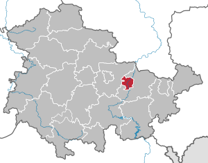
List of incorporations in the city of Jena
Before the incorporation into Jena began in 1909, the area of the city was 1,323.2 hectares. With the last incorporations in 1994, the urban area doubled from 5,558.8 hectares to 11,421.6 hectares of the reorganization law in Thuringia. The places incorporated at the time are only partially independent communities. All integrated places (except Isserstedt) had already taken on one or more neighboring communities, namely Cospeda the communities Lützeroda and Closewitz, Drackendorf the community Ilmnitz, Krippendorf the community Vierzehnheiligen, Kunitz the community Laasan, Münchenroda the community Remderoda, Maua the community Leutra and Jenaprießnitz the municipality of Wogau. The following communities and districts were incorporated into Jena.
| year | places | Increase in ha |
|---|---|---|
| October 1, 1909 | Wenigenjena with Camsdorf | 603.3 |
| January 1, 1913 | Lichtenhain | 245.0 |
| January 1, 1913 | Goat grove | 448.8 |
| October 1, 1922 | Ammerbach | 599.6 |
| October 1, 1922 | Burgau | 190.4 |
| October 1, 1922 | Löbstedt | 262.5 |
| October 1, 1922 | Winzerla | 500.0 |
| October 1, 1922 | Zwätz | 546.0 |
| October 1, 1922 | Göschwitz | 226.1 |
| October 1, 1922 | Lobeda | 655.1 |
| October 1, 1922 | Wöllnitz | 262.3 |
| October 1, 1922 | Kunitz | 593.7 |
| October 1, 1924 | Göschwitz¹ | −226.1 |
| October 1, 1924 | Lobeda¹ | -655.1 |
| October 1, 1924 | Wöllnitz¹ | −262.3 |
| October 1, 1924 | Kunitz¹ | −593.7 |
| August 1, 1946 | Lobeda | 655.1 |
| August 1, 1946 | Wöllnitz | 262.3 |
| April 1st 1969 | Göschwitz | 226.1 |
| April 1, 1994 | Drackendorf with Ilmnitz | 609.9 |
| April 1, 1994 | Maua with Leutra | 801.6 |
| July 1, 1994 | Münchenroda with Remderoda | 506.6 |
| July 1, 1994 | Nativity village with fourteen saints | 512.8 |
| July 1, 1994 | Isserstedt | 685.4 |
| July 1, 1994 | Cospeda with Closewitz and Lützeroda | 889.4 |
| July 1, 1994 | Kunitz with Laasan | 801.3 |
| July 1, 1994 | Jenaprießnitz with Wogau | 751.8 |
¹ Ausgemeindungen (the places were later reintegrated)
