List of cultural monuments in Konz
The list of cultural monuments in Konz includes all cultural monuments of the Rhineland-Palatinate city of Konz, including the districts of Filzen , Hamm , Kommlingen , Könen , Krettnach , Niedermennig , Oberemmel and Obermennig . The basis is the list of monuments of the state of Rhineland-Palatinate (as of June 6, 2017).
Conc
Monument zones
| designation | location | Construction year | description | image |
|---|---|---|---|---|
| Monument zone railway settlement | Kurtstrasse 1–8 location |
1887 | four two-storey twin houses with stables and gardens, 1887 |

|
| Karthaus monastery monument zone | Brunostraße 23 / 23a location |
1680 ff. | former Carthusian monastery and former St. Johann monastery church; baroque, originally four-wing complex with two cloisters, 1680 ff .; Preserved: Church with a magnificent facade (1708–1716, rebuilt in 1885), western wing structures, cellar of the eastern wing structures, gate house, surrounding wall with gate system; the surrounding area around the church and former monastery with cemetery and forecourt is part of the overall complex |
 more pictures more pictures
|
Individual monuments
| designation | location | Construction year | description | image |
|---|---|---|---|---|
| War memorial | Adolf-Kolping-Straße, in the cemetery location |
1920s | War memorial 1914/18, 1920s, expressionist features, mixing of Christian and national symbols |
 more pictures more pictures
|
| Karthaus station building | At the Karthaus station 2/4 location |
1903/04 | Reception building, auxiliary building and platform halls; picturesque group of buildings, Heimatstil, 1903/04 |
 more pictures more pictures
|
| town hall | At market 11 location |
1949/51 | traditionalist hipped roof building, 1949/51 |
 more pictures more pictures
|
| locomotive | Bahnhofstrasse location |
1936 | Locomotive 64 393 , 1936 |

|
| Station building conc | Bahnhofstrasse 36 location |
1860 | station building parallel to the track; stately neo-renaissance building, 1860 |
 more pictures more pictures
|
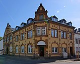
| Residential and commercial building | Brunostraße 1, Merzlicher Straße 19b location |
Early 20th century | Corner house with restaurant and hall building, neo-renaissance motifs, early 20th century |
|
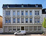
| Residential and commercial building | Brunostraße 82 location |
around 1890 | Wilhelminian style residential and commercial building, around 1890 |
|
| Wayside chapel | Domain street, below the Roscheider Hof in the museum area on the way to the Charterhouse Lage |
around 1820 | Wegekapelle, neo-Gothic sandstone-framed plastered building, around 1820; 1984 von Trier translocated |

|
| Westwall bunker | Granastrasse 25 location |
1936/37 | Westwall bunker Saar-Mosel-Klause and Westwall bunker Villa Gartenlaube , the latter today renovated and used as the Westwall Museum in Konz ; Part of the "route and area monument 'West fortification'" |
 more pictures more pictures
|
| Evangelical Church of Konz-Karthaus | Karthauser Strasse 153 location |
1896/97 | small neo-Gothic hall, 1896/97, architect Georg Lübke |
 more pictures more pictures
|
| Wayside cross | Löllberg | 1758 | Shank cross, marked 1758 | |
| Steeple | Martinstrasse location |
around 1500 | Basement of the choir tower of the Catholic parish church of St. Nicholas, around 1500 |

|
| Late Roman imperial villa | Martinstrasse location |
at 350 | Remains of the summer residence of Emperor Valentinian I, late Roman portico villa with corner projections, around 350, on the site of the parish church of St. Nicholas, in whose crypt remains of the villa |
 more pictures more pictures
|
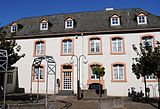
| Rectory | Martinstrasse 22 location |
1770 | Half-hip roof construction, 1770, extension in 1897 |
|
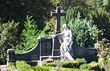
| Funerary monuments | Martinstrasse, in the cemetery location |
late 19th century | Grave monuments from the late 19th century, partially moved to the Roscheider Hof open-air museum next to the wayside chapel in 2012; Cemetery of honor with Madonna from the main portal of the Church of St. Nicholas, 1874 |
|
| statue | Martinstrasse, in front of the church Lage |
1810 | Statue of Emperor Constantine, inscribed 1810 |

|
| Wayside cross | Merzlicher Straße, between No. 11 and 13 Lage |
1625 | Shank cross, marked 1625 |

|
| Roscheider Hof | Roscheiderhof 1 location |
16th Century | stately four-sided courtyard, core building from the 16th century, extensions in the 19th and early 20th centuries |
 more pictures more pictures
|
| Wayside shrine | Roscheiderhof, in the open-air museum Lage |
1818 | Wayside shrine in the baroque tradition, marked 1818; Preserved in situ in today's open-air museum |

|
| War memorial | Panoramaweg; Hallway at the monument location |
1920s | War memorial 1914/18; Pillar rotunda, 1920s, restoration 1959 |

|
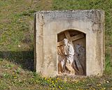
| High relief | Roscheiderstrasse; Hallway in the Kelterberg location |
1758 | High relief; Christ carrying the cross, inscribed 1758 |
|
| Courtyard of the Order of Teutons | Schulstrasse 1 location |
1774 | Late baroque side house, 1774 |

|
| Wayside shrine | Schulstrasse, at No. 1 location |
1613 | Wayside shrine, marked 1613 |

|
| Wayside cross | Wiltinger Strasse, corner of Olkstrasse Lage |
1788 | Shank cross, marked 1788 |

|
| Lady Chapel | east of the city in the extension of Lindenstrasse location |
1910 | Plastered building, 1910 |
 more pictures more pictures
|
Former cultural monuments
| designation | location | Construction year | description | image |
|---|---|---|---|---|
| Courtyard | Olkstrasse 3 location |
in the middle of the 19th century | Streckhof, mid-19th century; demolished around 2010 |
Felting
Monument zones
| designation | location | Construction year | description | image |
|---|---|---|---|---|
| Historic center of Filzen | Saartalstrasse 14, 17, 19, Maximinerstrasse 1 location |
19th and 20th centuries | Buildings from the 19th and early 20th centuries around the intersection of Saartalstraße, Maximinerstraße and Steinberger Straße, characteristic, village street scene consisting of a church, schoolhouse and cross houses |

|
Individual monuments
| designation | location | Construction year | description | image |
|---|---|---|---|---|
| Courtyard | Maximinerstraße 1 location |
1728 | Half-hip roof building, 1728, increase around 1878; Associated two-window house with stable and barn, early 19th century |

|
| Piedmont winery | Saartalstrasse 1 location |
1721 | stately baroque side house, 1721 |

|
| Reverchon winery | Saartalstrasse 3 location |
around 1840 | Two to three-storey vintner's villa on an L-shaped floor plan in the Swiss country house style, around 1840, extension around 1880 |

|
| Cross house | Saartalstrasse 14 location |
1849 | Quereinhaus, marked 1849, extension in 1878 |

|
| Catholic branch church of St. Nicholas | Saartalstrasse 17 location |
1854 | small hall building, 1854 |
 more pictures more pictures
|
Hamm
Monument zones
| designation | location | Construction year | description | image |
|---|---|---|---|---|
| Hammer ferry monument zone | southeast of the place (Hammerfähre 25/26) location |
1802 | Property made up of a residential building (1802) and an old ferry house, a walled garden, garden land and the bank of the Saar arm of the river planned as a boat harbor |

|
Individual monuments
| designation | location | Construction year | description | image |
|---|---|---|---|---|
| Residential building | Marienstraße 1 location |
1720 | former rectory; Baroque gable building, 1720 |

|
| Catholic Parish Church of St. Mary and St. Lucia | Marienstraße 2 location |
1745 | baroque hall building, 1745; late Romanesque west tower; on the churchyard wall fragments of the grave cross and priest's grave, 1831 |

|
| Wayside cross | Marienstraße, at No. 26 location |
around 1900 | Altar cross, around 1900 | |
| Memorial plaque | southwest of the place in the opposite rock | 1824 | Sandstone relief plate, 1824, commemorates a boat accident during floods with three dead. |
Comming
Individual monuments
| designation | location | Construction year | description | image |
|---|---|---|---|---|
| Catholic branch church of St. Donatus and St. Catherine | Donatusstrasse 19a location |
1862 | Hall building, round arch style, 1862; Way cross, 19th century |
 more pictures more pictures
|
| Cross house | To the Urlauf 1 location |
Mid 18th century | Quereinhaus, mid-18th century, remodeled in the 19th century |

|
Can
Monument zones
| designation | location | Construction year | description | image |
|---|---|---|---|---|
| Jewish cemetery monument zone | Reiniger Straße, above No. 5 location |
in the middle of the 19th century | small enclosed complex, mid-19th century, gravestones from the first third of the 20th century have been preserved |
 more pictures more pictures
|
Individual monuments
| designation | location | Construction year | description | image |
|---|---|---|---|---|
| Parish and school house | 3/5 location on the Hohberg |
1826 | Double house, 1826 | |
| Catholic Parish Church of St. Amandus | 1 position in the horse garden |
1836 | Classicist hall construction, 1836, side aisle and extension 1951, architect Heinrich Otto Vogel ; Processional altar in the cemetery, marked 1899 |

|
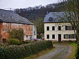
| Mill | Above the mill 1 layer |
17th century | former mill; House, marked 1864, stable and barn building, core from the 17th century (marked 1624) |
|
| winery | Saarburger Strasse 1 location |
1765 | former rectory; castle-like baroque building, 1765; in the courtyard walling wayside cross, 17th century, park |

|
| Cross house | Saarburger Strasse 8 location |
1909 | Transverse house, expansion and renovation in 1909 |

|
Krettnach
Monument zones
| designation | location | Construction year | description | image |
|---|---|---|---|---|
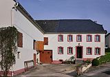
| Monument zone in the center of Krettnach | Karlstrasse 1, Krettnacher Strasse 12, 14 location |
18th and 19th centuries | characteristic, village street scene from cross houses, including rectory and school house, 18th and 19th centuries |
|
Individual monuments
| designation | location | Construction year | description | image |
|---|---|---|---|---|
| Wayside chapel | Main street, next to No. 24 location |
at the end of the 19th century | Wegekapelle, late 19th century |

|
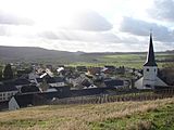
| Catholic parish church of St. Ursula | St.-Ursula-Straße 21 location |
1733/34 | baroque hall building, 1733/34; Romanesque choir tower; Steinkreuz in the churchyard, marked 1753 |
|
Niedermennig
Monument zones
| designation | location | Construction year | description | image |
|---|---|---|---|---|
| Monument zone in the center of Niedermennig | Kapellenstrasse 9 and 13 location |
18th century | characteristic village street scene consisting of a branch church and the former courtyard house of the Mettlach Abbey (Kapellenstrasse 13), stately hipped roof building, marked 1741 |

|
Individual monuments
| designation | location | Construction year | description | image |
|---|---|---|---|---|
| Catholic branch church St. Wendelinus | Kapellenstrasse 9 location |
1876 | small hall building with roof turret, round arch style, 1876 |

|
| Oil mill | south of the village at the Niedermenniger Bach location |
Early 19th century | former oil mill; single-storey building with hipped roof, early 19th century |
 more pictures more pictures
|
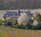
| Falkensteinerhof winery | west of the village location |
1928 | overall structural system consisting of two eaves houses stacked in parallel, reform architecture, 1928; 1991 awarded the monument plaque of the state of Rhineland-Palatinate for exemplary restoration; Badly damaged by fire on December 18, 2014 |
 more pictures more pictures
|
Oberemmel
Monument zones
| designation | location | Construction year | description | image |
|---|---|---|---|---|
| Jewish cemetery monument zone | Altenbergstrasse location |
19th century | small walled complex, 19th century, about twelve tombstones |
 more pictures more pictures
|
| Monument zone Maximinerhofgut | Agritiusstrasse 4, 5 and 6 location |
1732 | so-called castle ; Baroque two-wing complex (No. 5 denotes 1732), four-edged farmyard (No. 4, 18th and 19th centuries) and plastered building (No. 6 around 1900) |
 more pictures more pictures
|
Individual monuments
| designation | location | Construction year | description | image |
|---|---|---|---|---|
| Rectory | Agritiusstrasse 1 location |
1727 | Baroque three-sided courtyard, residential building with a half-hip roof, 1727 |
 more pictures more pictures
|
| Cemetery chapel | Agritiusstrasse 3 location |
1734/35 | former Catholic parish church of St. Briktius; Baroque hall building, 1734/35 |
 more pictures more pictures
|
| Wayside cross | At the Rosenberg, at No. 2 location |
1720 | Shank cross, marked 1720 |

|
| Cross house | Kirchstrasse 21/23 location |
1729 | Quereinhaus, 1729 | |
| school | Kirchstrasse 39 location |
1914 | School, Heimatstil, marked 1914 |

|
| Wayside chapel | Mühlenstrasse, at No. 2 location |
1854 | Wegekapelle, marked 1854 |

|
| winery | Scharzbergstrasse 25 location |
1846 | former winery; Quereinhaus with courtyard, residential part marked 1846, economic part marked 1854 (?), Wine cellar marked 1882 |

|
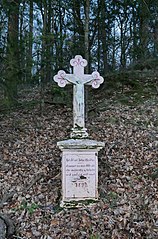
| Wayside cross | north of the village location |
19th century | Road cross, neo-Gothic, sandstone, 19th century |
|
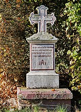
| Wayside cross | south of the village on the L 138 location |
1850 | Shank cross, red sandstone, 1850 (?) |
|
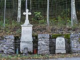
| Wayside cross and wayside shrine | south of the village at the bridge over the Mawelbach Lage |
1877 | Granite shaft cross on marble base (1877?); Sandstone fragment of a wayside shrine, 19th century |
|
| Plenkkreuz | southwest of the village on the L 138, near Scharzhofberg | 1829 | Way cross in the style of a holy house, marked 1829 |

|
| Wayside cross | west of the place on the district boundary of Lage |
1837 | Cast iron crucifix on a sandstone base, marked 1837 |

|
| Bauschertsmühle | west of the village (Mühlenstraße 40) location |
19th century | Half-hip roof building, 19th century; with mill technology |
 more pictures more pictures
|
Obermennig
Individual monuments
| designation | location | Construction year | description | image |
|---|---|---|---|---|
| Catholic branch church St. Barbara | Obermenniger Strasse 10a location |
1723 | Plastered construction using older parts, marked 1723 |

|
literature
- Ewald Wegner (arrangement): District of Trier-Saarburg. Verbandsgemeinden Hermeskeil, Kell, Konz, Saarburg (= cultural monuments in Rhineland-Palatinate. Monument topography Federal Republic of Germany . Volume 12.1 ). Wernersche Verlagsgesellschaft, Worms 1994, ISBN 3-88462-100-9 .
- General Directorate for Cultural Heritage Rhineland-Palatinate (Ed.): Informational directory of the cultural monuments in the district of Trier-Saarburg (PDF; 6.5 MB). Mainz 2017.
Web links
Commons : cultural monuments in Konz - collection of images
- To search for cultural assets of the city of Konz in the database of cultural assets in the Trier region .
Individual evidence
- ↑ a b http://www.roscheiderhof.de/index.php/de/museumshaeuser/kapelle-zum-guten-hirten , accessed on September 11, 2016
- ^ General Directorate for Cultural Heritage Rhineland-Palatinate (ed.): Informational directory of cultural monuments: West Wall and air defense zone West . Mainz 2009 ( denkmallisten.gdke-rlp.de [PDF; accessed on December 6, 2010]).
- ↑ Thomas Keck: Niedermennig. Südwestrundfunk , November 6, 2007, accessed December 19, 2014 .
- ^ A fire in Konz-Niedermennig lays the cultural monument in ruins. Trierischer Volksfreund , December 18, 2014, accessed on December 19, 2014 .