List of cultural monuments in Weimar (individual monuments)
The list of cultural monuments in Weimar (individual monuments) includes the cultural monuments of the Thuringian city of Weimar recorded as individual monuments , which were recorded by the Thuringian State Office for Monument Preservation and Archeology as architectural and art monuments in the area of the city as of November 20, 2013.
The cultural monuments recorded as aggregates and ensembles according to the Thuringian Monument Protection Act (ThDSchG) are listed in the list of cultural monuments in Weimar (aggregates and ensembles) .
Legend
- Name: gives the name, the description or the type of the cultural monument.
- Location: States the street name and, if available, the house number of the cultural monument. The list is basically sorted according to this address. The link "Map" leads to various map displays and gives the coordinates of the cultural monument.
- Dating: indicates the date; the year of completion or the period of construction. Sorting by year is possible.
- Description: Provides structural and historical details of the cultural monument, preferably the characteristics of the monument.
- ID: If available, indicates the Wikidata object ID of the Wikipedia article on the cultural monument.
List of monuments
| image | designation | location | Dating | description | ID |
|---|---|---|---|---|---|
 |
Insurance building | Abraham-Lincoln-Strasse 1 (map) |
Commercial building |
|
|
 More pictures |
Residential and commercial building | Abraham-Lincoln-Strasse 2 (map) |
Residential and commercial building |
|
|
 |
Residential building | Abraham-Lincoln-Strasse 4 (map) |
Residential building |
|
|
 More pictures |
Residential and commercial building | Abraham-Lincoln-Strasse 6 (map) |
Residential and commercial building |
|
|
 More pictures |
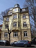
Residential building | Abraham-Lincoln-Strasse 8 (map) |
Residential building |
|
|
 More pictures |
Residential building | Abraham-Lincoln-Strasse 12 (map) |
Residential building |
|
|
 More pictures |
Residential building | Abraham-Lincoln-Strasse 20 (map) |
Residential building |
|
|
 More pictures |
Residential building | Abraham-Lincoln-Strasse 23 (map) |
Residential building |
|
|
 |
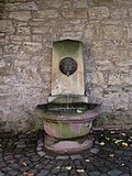
Fountain | Arable wall (map) |
1847 | Fountain at Frau von Stein's house , sandstone , created by Carl Dornberger, stonemason in Bad Berka ; donated by Maria Pavlovna ; |
|
 |
kindergarten | Ackerwand 13 (map) |
kindergarten |
|
|
 |
Administration building | Ackerwand 15/17 (map) |
Administration building / residential building |
|
|
 |
Residential building | Ackerwand 23 (map) |
Residential building |
|
|
 More pictures |
Residential building | Ackerwand 25/27 (map) |
House of Frau von Stein |
|
|
| Bauhaus University | Albrecht-Dürer-Strasse 2 (map) |
Former officers' quarters, today Bauhaus University |
|
||
| Chamber building | Albrecht-Dürer-Strasse 6b (map) |
Chamber building (for the Leibnizallee barracks, see also Carl-Alexander-Platz, Carl-Ferdinand-Streichhan-Straße, Leibnizallee) |
|
||
| Pogwischhaus | Am Horn 4a (map) |
Pogwischhaus with garden and half-timbered pavilion |
|
||
| Villa Ithaca | Am Horn 25 (map) |
Villa Ithaca |
|
||
| Residential building | Am Horn 39 (map) |
Residential house with land |
|
||
| Residential building | Am Horn 53 (map) |
Residential house with land |
|
||
| Residential building | Am Horn 55 (map) |
Residential house with land |
|
||
 More pictures |
House on the Horn | Am Horn 61 (map) |
Haus Am Horn, with land |
|
|
| Workshop | Am Industriepark 7 (map) |
Hall I of the former Weimar factory, cf. also Otto-Schott-Strasse |
|
||
 More pictures |
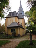
Jakobskirche | Am Jakobskirchhof (map) |
Ev.-luth. Jakobskirche and Jakobsfriedhof - within and including the walling Am Jakobskirchhof, Friedensgasse, western buildings on Jakobstraße with cash vaults and various graves |
|
|
 More pictures |
Jakobskirche and Jakobsfriedhof | Am Jakobskirchhof 2 (map) |
see Ev.-luth. Jakobskirche and Jakobsfriedhof |
|
|
 |
Feodoraheim | Am Jakobskirchhof 4 (map) |
Feodoraheim |
|
|
| Tram depot | Am Kirschberg 4 (map) |
Tram depot and power station with cooling tower |
|
||
| villa | Am Kirschberg 35 (map) |
Villa Drohsin |
|
||
| Club mill | Am Kirschberg 36 (map) |
Club mill |
|
||
 |
Residential and commercial building | Am Palais 1 (map) |
Residential and commercial building |
|
|
 |
Residential building | Am Palais 2 (map) |
Residential building |
|
|
 More pictures |
Wittumspalais | Am Palais 3 (map) |
former Wittumspalais of Anna Amalia with outbuildings |
|
|
 |
Music college | Am Palais 4 (map) |
Music college, former Franciscan church |
|
|
 |
monument | At the Poseckschen Garten (map) |
Monument to Ernst von Wildenbruch |
|
|
 More pictures |
Historic cemetery | At the Poseckschen Garten (map) |
Historical cemetery, see also main cemetery |
|
|
 More pictures |
Shooting house | Am Schießhaus 1 (map) |
Shooting house including shooting range and military barracks |
|
|
| Residential building | Am Schönblick 4 (map) |
Residential building |
|
||
| Residential building | Am Schönblick 9 (map) |
Residential building |
|
||
 |
hotel | Amalienstraße 2 (map) |
Christian hotel |
|
|
 |
high school | Amalienstraße 4 (map) |
Goethe high school with gym |
|
|
 |
museum | Amalienstraße 6 (map) |
Donndorf Museum, s. Humboldtstrasse 11 |
|
|
 |
Residential building | Amalienstraße 15 (map) |
Residential building |
|
|
 |
Residential building | Amalienstraße 17 (map) |
Residential building with studio building |
|
|
| Residential building | Arnold-Böcklin-Strasse 5 (map) |
Residential house with garage and garden |
|
||
 |
Residential building | Asbachstrasse 10a (map) |
Residential building |
|
|
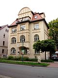 |
Residential building | Asbachstrasse 18 (map) |
Residential building |
|
|
| Residential building | August-Bebel-Platz 3 (map) |
Residential building |
|
||
 |
Residential building | August-Bebel-Platz 4 (map) |
Residential building, see also Schubertstrasse 37 and Trierer Strasse 38 |
|
|
 More pictures |
Catholic Church | August-Frölich-Platz (map) |
Roman Catholic Herz-Jesu Church, s. Paul-Schneider-Strasse 1 |
|
|
| Water tower | Bahnstrasse 1 (map) |
Water tower with overnight building |
|
||
 |
Residential building | Bauhausstrasse 8, 8a (map) |
Residential house with outbuildings |
|
|
 |
Bauhaus University | Bauhausstrasse 11 (map) |
former medical center, today Bauhaus University |
|
|
 |
Residential building | Bauhausstrasse 18 (map) |
Residential building |
|
|
 |
Dingelstedt House | Beethovenplatz 2 (map) |
Dingelstedt House |
|
|
 |
State Archives | Beethovenplatz 3 (map) |
Thuringian main state archive |
Q1589619 |
|
 |
Residential building | Belvederer Allee 1 (map) |
Residential building |
|
|
 |
Residential building | Belvederer Allee 2, 2a (map) |
Residential building with side wing |
|
|
 |
Residential building | Belvederer Allee 3 (map) |
Residential house with coach house and garden |
|
|
 |
House of Streichhan | Belvederer Allee 5 (map) |
House Streichhan with outbuildings and garden |
|
|
 |
Administration building | Belvederer Allee 6 (map) |
Administration building |
|
|
 |
Prellerhaus | Belvederer Allee 8 (map) |
Prellerhaus with outbuildings, patio and garden |
|
|
 |
Residential building | Belvederer Allee 12 (map) |
Residential building |
|
|
 |
Residential building | Belvederer Allee 17 (map) |
Residential house with outbuildings and land |
|
|
 |
Administration building | Belvederer Allee 19 (map) |
Administration building |
|
|
| Residential building | Belvederer Allee 28 (map) |
Residential building |
|
||
| Residential building | Belvederer Allee 30 (map) |
Residential building |
|
||
| Residential building | Belvederer Allee 37 (map) |
Residential building |
|
||
| Residential building | Belvederer Allee 48 (map) |
Residential building |
|
||
 |
House "High Poplars" | Belvederer Allee 58 (map) |
Museum of the Weimar Classic Foundation . Former home of Henry van de Velde in Weimar . |
Q1236266 |
|
| Studio building | Belvederer Allee 59 (map) |
Van de Velde's studio building |
|
||
 |
Residential building | Berkaer Strasse 1 (map) |
Residential building |
|
|
| Old people's home | Berkaer Strasse 2 (map) |
Retirement home, formerly Albert-Voigt-Stift |
|
||
 |
Residential building | Berkaer Strasse 9 (map) |
Residential building |
|
|
 |
Residential building | Berkaer Strasse 15 (map) |
Residential building |
|
|
 |
Residential building | Berkaer Strasse 17 (map) |
Residential building |
|
|
 |
Residential building | Berkaer Strasse 19 (map) |
Residential building |
|
|
 |
Residential building | Berkaer Strasse 21 (map) |
Residential building |
|
|
| Residential building | Berkaer Strasse 51 (map) |
Residential building |
|
||
| Fürnberg School | Bodelschwinghstraße 78 (map) |
Fürnberg school with sports hall and open space design |
|
||
 |
Kreuzkirche | Böhlaustraße 2 (map) |
Ev.-Luth. Kreuzkirche, architect: Rudolf Zapfe |
|
|
| Residential building | Böhlaustraße 7/9 (map) |
Residential building |
|
||
| Residential building | Brahmsstrasse 1 (map) |
Residential building, s. Brucknerstrasse 11 |
|
||
| Residential building | Brahmsstrasse 12 (map) |
Residential building |
|
||
| Residential building | Brauhausgasse 2 (map) |
Residential building, see Schillerstraße 1 |
|
||
| Bernstorff's house | Brauhausgasse 10 (map) |
Bernstorff's house |
|
||
 |
Eckermannhaus | Brauhausgasse 13 (map) |
Eckermannhaus |
|
|
 |
Residential and commercial building | Brauhausgasse 17 (map) |
Residential and commercial building Deinhardtsche Brewery, see p. also Schützengasse 9 and Steubenstraße 6a and 8 |
|
|
| Residential building | Brennerstrasse 2 (map) |
Residential building |
|
||
| Residential building | Brennerstraße 8 (map) |
Residential building |
|
||
| Residential building | Brucknerstrasse 11 (map) |
Residential building, s. Brahmstrasse 1 |
|
||
| Residential building | Brucknerstrasse 29 (map) |
Residence of the Scheidemantelsche factory s. Schwanseestr. 41 |
|
||
 |
Residential building | Bruehl 6 (map) |
Residential building |
|
|
 |
Carlsmühle | Brühl 28, 28a (map) |
Carlsmühle |
|
|
 More pictures |
Thälmann monument | Buchenwaldplatz (map) |
Monument to Ernst Thälmann with the design of the square |
|
|
| Residential and commercial building | Burgplatz 1 (map) |
Residential and commercial building |
|
||
 |
Residential and commercial building | Burgplatz 3/5/7 (map) |
Residential and commercial building |
|
|
 |
Residential palace | Burgplatz 4 (map) |
Former residential palace with so-called Bastille, court ladies' house and castle tower |
|
|
 |
Streichhan barracks | Carl-Alexander-Platz 1 (map) |
Streichhan barracks, s. also Carl-Ferdinand-Streichhan 4, 4a, 5, Leibnizallee 10, 10a and 10b, Albrecht-Dürer-Straße 2, 6b |
|
|
 |
Geological State Office | Carl-August-Allee 8/10 (map) |
Geological State Office |
|
|
 |
Stegmann's house | Carl-August-Allee 9 (map) |
Stegmann's house |
|
|
 |
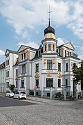
Residential building | Carl-August-Allee 12 (map) |
Residential building |
|
|
 More pictures |
Commercial building | Carl-August-Allee 16 (map) |
former hotel, commercial building |
|
|
| Crew building | Carl-Ferdinand-Streichan-Str. 4 (card) |
Crew building of the rifle company |
|
||
| Crew building | Carl-Ferdinand-Streichan-Str. 4a (card) |
Crew building |
|
||
| Married home | Carl-Ferdinand-Streichan-Str. 5 (card) |
Married home |
|
||
 More pictures |
Justice building | Carl-von-Ossietzky-Strasse 60 (map) |
Judicial building with prison; Weimare District Court |
|
|
 More pictures |
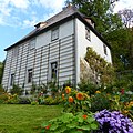
Goethe's garden house | Corona-Schröter-Weg 1 (map) |
Goethe's garden house |
|
|
| Agricultural barns | Coudraystrasse 1, 3, 5 (map) |
Agricultural barns |
|
||
 More pictures |
Technical school for social pedagogy | Coudraystrasse 10/12 (map) |
former Landbundhaus with printing, today technical school for social pedagogy, s. also Schwanseestrasse 9/11 |
|
|
| Bauhaus University | Coudraystrasse 11 (map) |
Building of the Bauhaus University, Friedrich-August-Finger-Bau |
|
||
 More pictures |
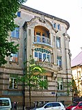
Bauhaus University | Coudraystrasse 13 (map) |
Bauhaus University building |
|
|
 More pictures |
Residential building | Cranachstrasse 1 (map) |
Residential building |
|
|
 More pictures |
Residential building | Cranachstrasse 2 (map) |
Residential building |
|
|
 More pictures |
Residential building | Cranachstrasse 3 (map) |
Residential building |
|
|
 More pictures |
Residential building | Cranachstrasse 4 (map) |
Residential building |
|
|
 More pictures |
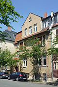
Residential building | Cranachstrasse 6 (map) |
Residential building |
|
|
 More pictures |
Residential building | Cranachstrasse 8 (map) |
Residential building |
|
|
 More pictures |
Residential building | Cranachstrasse 9 (map) |
Residential building |
|
|
 More pictures |
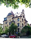
Residential building | Cranachstrasse 10 (map) |
Residential building |
|
|
 More pictures |
Residential building | Cranachstrasse 11 (map) |
Residential building |
|
|
 More pictures |
Residential building | Cranachstrasse 12 (map) |
Residential building |
|
|
 More pictures |
Residential building | Cranachstrasse 13 (map) |
Residential building |
|
|
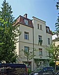 More pictures |
Residential building | Cranachstrasse 15 (map) |
Residential building |
|
|
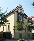 More pictures |
Residential building | Cranachstrasse 21 (map) |
Residential building |
|
|
 More pictures |
Residential building | Cranachstrasse 25 (map) |
Residential building |
|
|
 More pictures |
Residential building | Cranachstrasse 28a (map) |
Residential building |
|
|
 More pictures |
Residential building | Cranachstrasse 29 (map) |
Residential building |
|
|
 More pictures |
Residential building | Cranachstrasse 30 (map) |
Residential building |
|
|
 More pictures |
Residential building | Cranachstrasse 38 (map) |
Residential building, s. also Richard-Wagner-Str. 18th |
|
|
 More pictures |
Residential building | Cranachstrasse 42 (map) |
Residential house with land |
|
|
 More pictures |
Dürckheim Palace | Cranachstrasse 47 (map) |
Dürckheim Palace |
|
|
 More pictures |
Official residences | Cranachstrasse 48, 49 (map) |
Official residences, s. Schwabestrasse 9, 11, 18, 20, 22, 24 |
|
|
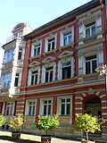 |
Residential building | Dingelstedtstrasse 1 (map) |
Residential building |
|
|
 |
Residential building | Dingelstedtstrasse 2 (map) |
Residential building |
|
|
| Depot | Eduard-Rosenthal-Strasse (map) |
Weimar depot with technical equipment |
|
||
| villa | Eduard-Rosenthal-Strasse 30 (map) |
Villa and Pensionat Weiß with garden |
|
||
| Residential building | Eduard-Rosenthal-Strasse 41 (map) |
Residential building |
|
||
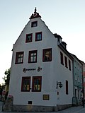 |
Inn | Eisfeld 12 (map) |
"Sächsischer Hof" inn |
|
|
 More pictures |
Gatehouse | Erfurter Strasse 1 (map) |
Gatehouse |
|
|
| Residential building | Erfurter Strasse 19a (map) |
Residential building |
|
||
 |
Insurance building | Erfurter Strasse 38 (map) |
Insurance building |
|
|
| Duplex house | Ernst-Kohl-Strasse 2/4 (map) |
Duplex house |
|
||
| Duplex house | Ernst-Kohl-Strasse 27/29 (map) |
Duplex house |
|
||
| Duplex house | Ernst-Kohl-Strasse 31/33 (map) |
Duplex house |
|
||
| Residential building | Ernst-Thälmann-Strasse 11 (map) |
Residential building |
|
||
| Residential and commercial building | Ernst-Thälmann-Strasse 31/33/35 (map) |
Residential and commercial building |
|
||
| Residential building | Ernst-Thälmann-Strasse 65 (map) |
Residential building |
|
||
| Flak barracks | Ettersburger Strasse (map) |
Flak barracks (demolished in 2011) |
|
||
| Death march stele | Ettersburger Strasse (map) |
Death march stele |
|
||
| Herder's peace | Ettersburger Strasse (map) |
Herder's peace |
|
||
| Officers' mess | Ettersburger Strasse 110 (map) |
former officers' mess |
|
||
 |
Bronze relief | Falkstrasse 7 (map) |
Bronze relief by J. Falk at the former Falkheim |
|
|
 |
Goethe fountain | Women's plan (card) |
Goethe fountain |
|
|
 |
Goethe House | Women's plan 1-5 (map) |
Goethe House with Vulpius houses and garden as well as museum |
|
|
 More pictures |
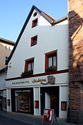
Residential and administrative buildings | Women's plan 6 (card) |
Hansa-Haus, residential and administrative building, architect: Rudolf Zapfe |
|
|
 |
Residential building | Frauentorstrasse 1 (map) |
Residential building |
|
|
 |
Bank building | Frauentorstrasse 3 (map) |
Bank building |
|
|
 |
Residential and commercial building | Frauentorstrasse 21 (map) |
Residential and commercial building |
|
|
 |
Residential building | Freiherr-vom-Stein-Allee 1 (map) |
Residential house with land |
|
|
 |
Residential building | Freiherr-vom-Stein-Allee 2 (map) |
Residential house with land |
|
|
 |
Residential building | Freiherr-vom-Stein-Allee 3 (map) |
Residential building |
|
|
 |
Residential building | Freiherr-vom-Stein-Allee 4 (map) |
Residential house with land |
|
|
 |
Residential building | Freiherr-vom-Stein-Allee 5 (map) |
Residential building |
|
|
 |
Residential building | Freiherr-vom-Stein-Allee 7 (map) |
Residential building |
|
|
 |
Residential building | Freiherr-vom-Stein-Allee 11 (map) |
Residential house with land |
|
|
 |
Residential building | Freiherr-vom-Stein-Allee 12 (map) |
Residential building |
|
|
 |
Residential building | Freiherr-vom-Stein-Allee 14 (map) |
Residential building |
|
|
 |
Residential building | Freiherr-vom-Stein-Allee 15 (map) |
Residential house with land |
|
|
 |
Residential building | Freiherr-vom-Stein-Allee 18 (map) |
Residential house with land |
|
|
 |
Residential building | Freiherr-vom-Stein-Allee 22 (map) |
Residential house with land |
|
|
 |
Residential building | Freiherr-vom-Stein-Allee 24 (map) |
Residential house with outbuildings and land |
|
|
 |
Residential building | Freiherr-vom-Stein-Allee 25 (map) |
Residential building |
|
|
 |
Residential building | Freiherr-vom-Stein-Allee 26 (map) |
Residential house with outbuildings |
|
|
 |
Residential building | Freiherr-vom-Stein-Allee 30 (map) |
Residential house with land |
|
|
| Residential building | Freiherr-vom-Stein-Allee 32 (map) |
Residential house with land |
|
||
 |
Villa "Tusculum" | Freiherr-vom-Stein-Allee 34 (map) |
Residential house with land |
|
|
 |
Residential building | Friedensgasse 5 (map) |
Residential building |
|
|
 |
Residential building | Friedensgasse 7 (map) |
Residential building |
|
|
 More pictures |
Atrium | Friedensstrasse 1 (map) |
The multi-purpose hall, or market hall, now houses several fashion and food markets, an electronics market, a bowling alley, a 3D cinema and an ice cream parlor with a sun terrace facing Weimarplatz. |
|
|
 |
Volkshaus | Friedrich-Ebert-Strasse 8 (map) |
Volkshaus |
|
|
 More pictures |
Donndorfbrunnen | Escort road (map) |
Donndorfbrunnen |
|
|
 |
Residential building | Gerhart-Hauptmann-Strasse 5 (map) |
Residential building |
|
|
 |
office building | Gerhart-Hauptmann-Strasse 6 (map) |
Office building, former tax office |
|
|
 |
Residential building | Geschwister-Scholl-Strasse 4 (map) |
Residential building with outbuildings |
|
|
 |
Prellerhaus | Geschwister-Scholl-Strasse 6 (map) |
Prellerhaus and former Brendelsche studio |
|
|
 |
Bauhaus University | Geschwister-Scholl-Strasse 7 (map) |
School of Applied Arts, today building of the Bauhaus University |
|
|
 |
Main building of the Bauhaus University | Geschwister-Scholl-Strasse 8 (map) |
Art school, today the main building of the Bauhaus University |
|
|
 |
Fountain at the reading museum | Goetheplatz (map) |
Fountain at the reading museum |
|
|
 |
Lion pharmacy | Goetheplatz 1 (map) |
Lion pharmacy |
|
|
 |
Residential and commercial building | Goetheplatz 6 (map) |
Residential and commercial building |
|
|
 |
Main post | Goetheplatz 7/8 (map) |
Main post |
|
|
 |
Rent Office | Goetheplatz 9 (map) |
Rent office with art cabinet on Goetheplatz |
|
|
 More pictures |
Kasseturm (student club) | Goetheplatz 10 (map) |
Kasseturm (student club) (part of the urban fortifications) |
|
|
 |
Youth club | Goetheplatz 11 (map) |
Recreation building, today the Mon Ami youth club with piers |
|
|
 |
Reading Museum | Goetheplatz 12 (map) |
Reading Museum |
|
|
 More pictures |
Remnants of the city wall | dig | Remnants of the city wall (part of the city fortifications) |
|
|
 More pictures |
Lion fountain | dig | Lion fountain |
|
|
 More pictures |
Falk monument | dig | Falk monument with green area and small architecture |
|
|
 |
Fountain | dig | Fountain at the Böhlauhaus |
|
|
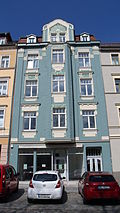 |
Residential and commercial building | Trench 11 (map) |
Residential and commercial building |
|
|
 |
Residential and commercial building | Trench 33 (map) |
Residential and commercial building |
|
|
 More pictures |
Residential and commercial building | Graben 39 (map) |
Residential and commercial building |
|
|
 More pictures |
Residential and commercial building | Graben 41 (map) |
Residential and commercial building |
|
|
 |
school | Gropiusstrasse 1 (map) |
Teachers' seminar, today Christoph-Martin-Wieland-Schule |
|
|
 |
Residential and commercial building | Gropiusstrasse 8 (map) |
Residential and commercial building |
|
|
 |
Villa Ingrid | Gutenbergstrasse 1 (map) |
Residential building |
|
|
 More pictures |
House Henneberg | Gutenbergstrasse 1a (map) |
House Henneberg |
|
|
 |
Residential building | Gutenbergstrasse 8 (map) |
Residential building |
|
|
 |
Residential building | Gutenbergstrasse 14 (map) |
Residential building |
|
|
 |
Residential building | Gutenbergstrasse 16 (map) |
Home of the Bauhaus master Lyonel Feininger (1871–1956) from 1919–1926. |
|
|
 More pictures |
graveyard | Main cemetery (map) |
inside and including the wall ring middle wall, Am Poseckschen Garten, Cranachstraße with various graves, celebration hall and crematorium, memorial (see also historical cemetery) of those who fell in March (lightning), |
|
|
 |
Commercial building | Hegelstrasse 2a (map) |
Commercial building |
|
|
 |
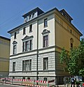
Commercial building | Hegelstrasse 3/5 (map) |
Commercial building |
|
|
 |
Residential building | Hegelstrasse 16 (map) |
Residential building |
|
|
| Residential building | Hegelstrasse 18 (map) |
Residential building |
|
||
 |
Residential building | Hegelstrasse 22 (map) |
Residential house with land |
|
|
| Residential and commercial building | Heinrich-Heine-Strasse 2 (map) |
Residential and commercial building |
|
||
 |
Residential building | Heinrich-Heine-Strasse 9 (map) |
Residential building |
|
|
 |
Residential and commercial building | Heinrich-Heine-Strasse 12/14 (map) |
Residential and commercial building, residential building CW Coudrays |
|
|
| Experimental and prototype construction | Heldrunger Strasse 27, 29, 31, 33, 35, 37 (map) |
Experimental and prototype construction from 1964/65 |
|
||
 |
Residential building | Helmholtzstrasse 1 (map) |
Residential building |
|
|
| Atelier v. Hofmann | Helmholtzstrasse 4 (map) |
Atelier v. Hofmann |
|
||
 |
Residential building | Helmholtzstrasse 6 (map) |
Residential building |
|
|
 |
Residential building | Helmholtzstrasse 8 (map) |
Residential building |
|
|
 |
Residential building | Helmholtzstrasse 12 (map) |
Residential house with coach house |
|
|
 |
Residential building | Helmholtzstrasse 14 (map) |
Residential house with coach house |
|
|
 |
school | Helmholtzstrasse 15 (map) |
school |
|
|
| Residential building | Herbststrasse 18 (map) |
Residential building |
|
||
| Residential building | Herbststrasse 26 (map) |
Residential building |
|
||
 More pictures |
City Church | Herderplatz (map) |
Ev.-luth. City Church of St. Peter and Paul (Herder Church) |
|
|
 More pictures |
Herd monument | Herderplatz (map) |
Herd monument |
|
|
 More pictures |
Herderbrunnen | Herderplatz (map) |
1832 | Herderbrunnen, cast iron, designed in 1830 by Clemens Wenzeslaus Coudray (1775–1845) |
|
 |
Residential building | Herderplatz 5 (map) |
Residential building |
|
|
 |
Residential building | Herderplatz 6 (map) |
Residential building |
|
|
 |
Residential building | Herderplatz 7 (map) |
Residential building |
|
|
 |
Herderhaus | Herderplatz 8 (map) |
Herder house with garden and garden shed |
|
|
 |
school | Herderplatz 9 (map) |
school |
|
|
 |
Wilhelm-Ernst-Gymnasium | Herderplatz 14 (map) |
Wilhelm-Ernst-Gymnasium |
|
|
 |
so-called Deutschritterhaus | Herderplatz 16 (map) |
So-called Teutonic Knights House with courtyard and all auxiliary buildings |
|
|
 |
villa | Hoffmann-von-Fallersleben-Str. 2 (card) |
Villa with land |
|
|
 |
Residential and commercial building | Humboldtstrasse 2/4/6 (map) |
Residential and commercial building |
|
|
 |
Residential building | Humboldtstrasse 8 (map) |
Residential building with outbuildings |
|
|
 |
Residential building | Humboldtstrasse 9 (map) |
Residential building |
|
|
 |
Poseckscher Hof | Humboldtstrasse 11 (map) |
Poseckscher Hof with mansion and side wings and Donndorf Museum, today Museum for Pre- and Early History and LDA, see. Amalienstraße 6 |
|
|
 |
Residential building | Humboldtstrasse 12 (map) |
Residential building |
|
|
 |
House bet | Humboldtstrasse 14 (map) |
House bet |
|
|
 |
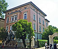
youth hostel | Humboldtstrasse 17 (map) |
youth hostel |
|
|
 |
Residential building | Humboldtstrasse 19 (map) |
Residential building |
|
|
 |
Residential and commercial building | Humboldtstrasse 21 / 21a (map) |
Residential and commercial building. Architect: Rudolf Zapfe , originally his residential and commercial building |
|
|
 |
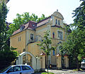
Residential building | Humboldtstrasse 22 / 22a (map) |
Residential building |
|
|
 |
Residential building | Humboldtstrasse 23 (map) |
Residential building |
|
|
 |
Residential building | Humboldtstrasse 25 (map) |
Residential building |
|
|
 |
Residential building | Humboldtstrasse 26 (map) |
Residential building |
|
|
 |
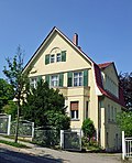
Residential building | Humboldtstrasse 31 (map) |
Residential building |
|
|
 |
Residential building | Humboldtstrasse 34 (map) |
Residential building |
|
|
 |
Rock cellar | Humboldtstrasse 35, 37 (map) |
Rock cellar |
|
|
 |
Nietzsche archive | Humboldtstrasse 36 (map) |
Nietzsche archive |
|
|
 |
Broadcasting building | Humboldtstrasse 36a (map) |
Broadcasting building, former Nietzsche memorial hall |
|
|
 |
Residential building | Humboldtstrasse 40 (map) |
Residential house with land |
|
|
 |
Residential and commercial building | Hummelstrasse 3 (map) |
Residential and commercial building |
|
|
 |
Residential building | Hummelstrasse 4 (map) |
Residential house with outbuildings |
|
|
 |
Residential building | Hummelstrasse 6 (map) |
Residential building |
|
|
 |
Residential building | Jahnstrasse 11a (map) |
Residential building |
|
|
 |
Residential building | Jahnstrasse 22 (map) |
Residential building |
|
|
 |
Residential building | Jahnstrasse 24 (map) |
Residential house with garden and pavilion |
|
|
 |
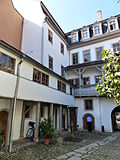
Residential building | Jahnstrasse 26 (map) |
Residential building |
|
|
 More pictures |
Kirms-Krackow-Haus | Jakobstrasse 10 (map) |
Kirms-Krackow-Haus |
|
|
 |
Residential and commercial building | Jakobstrasse 18 (map) |
Residential and commercial building |
|
|
 |
Meeting place | Jenaer Strasse 2 (map) |
European youth education and meeting place |
|
|
 |
Altenburg | Jenaer Strasse 3/5 (map) |
Altenburg, with garden and former outbuildings [No. 5] |
|
|
 |
Meeting place | Jenaer Strasse 4 (map) |
European youth education and meeting place |
|
|
 |
Residential building | Johann-Sebastian-Bach-Str. 7 (card) |
Residential building |
|
|
 |
former Gauforum | Jorge-Semprún-Platz 1-4 (map) |
former Gauforum, building I-III and multi-purpose hall, today Thuringian state administration office ; s. Friedenstrasse 1 |
|
|
 More pictures |
museum | Jorge-Semprún-Platz 5 (map) |
New Museum, s. Rathenauplatz 4 |
|
|
 |
Residential building | Kantstrasse 1 (map) |
Residential house with coach house and gardens |
|
|
 |
Residential building | Kantstrasse 2 (map) |
Residential house with gardens |
|
|
 |
Residential building | Kantstrasse 5 (map) |
Residential house with garden and garden pavilion |
|
|
 |
Residential building | Kantstrasse 10 (map) |
Residential building |
|
|
 |
Residential building | Kantstrasse 12 (map) |
Residential building |
|
|
 |
Residential building | Kantstrasse 14 (map) |
Residential building |
|
|
 |
herbarium | Karl-Haußknecht-Strasse 7 (map) |
Herbarium Haußknecht |
|
|
 |
Nursing home | Karl-Haußknecht-Strasse 19 (map) |
Nursing home |
|
|
 |
Studio house | Karl-Haußknecht-Strasse 21 (map) |
Studio house |
|
|
 |
Pump with plastic | Karl-Liebknecht-Strasse (map) |
Pump in front of the former community school with plastic reading boy |
|
|
 More pictures |
music school | Karl-Liebknecht-Strasse 1 (map) |
Citizen school, now a music school |
|
|
 |
Residential and commercial building | Karl-Liebknecht-Strasse 4 (map) |
Residential and commercial building |
|
|
 |
city Museum | Karl-Liebknecht-Strasse 5/7/9 (map) |
City Museum, former Bertuchhaus |
|
|
 |
Residential and commercial building | Karl-Liebknecht-Strasse 10 (map) |
Residential and commercial building |
|
|
 |
former warehouse and office building | Karlstrasse 5 (map) |
former warehouse and office building |
|
|
 |
Residential and commercial building | Kaufstrasse 9 (map) |
Residential and commercial building |
|
|
 |
Residential and commercial building | Kaufstrasse 15 (map) |
Residential and commercial building |
|
|
 |
Residential and commercial building | Kaufstrasse 16 (map) |
Residential and commercial building |
|
|
 |
Residential and commercial building | Kaufstrasse 22 (map) |
Residential and commercial building |
|
|
 |
Residential and commercial building | Kaufstrasse 24 (map) |
Residential and commercial building |
|
|
 |
Residential and commercial building | Kaufstrasse 26 (map) |
Residential and commercial building |
|
|
 More pictures |
Mickiewicz monument | Bowling alley (map) |
Mickiewicz monument |
|
|
 |
Albert Schweitzer Monument | Bowling alley (map) |
Albert Schweitzer Monument |
|
|
 More pictures |
Stables | Kegelplatz 1 (map) |
Marstall, s. also Marstallstrasse 2 |
|
|
 |
Residential building | Kegelplatz 3 (map) |
Residential building |
|
|
 More pictures |
Albert Schweitzer Memorial | Kegelplatz 4 (map) |
Albert Schweitzer Memorial, former Musäus House |
|
|
 |
Portal garments | Kleine Kirchgasse 1 (map) |
Portal garments |
|
|
 |
Frankescher Hof | Kleine Teichgasse 8 (map) |
Frankescher Hof or landscape ticket office building |
|
|
| Weimar factory | Kromsdorfer Strasse (map) |
Weimar-Werk (Halls I, IIa and IIb, III, 4c) s. At Industriepark 7 / Otto-Schott-Straße 1, 2, 3 and 8, |
|
||
 |
Residential and commercial building | Kuhlmannstrasse 1 (map) |
Residential and commercial building |
|
|
 More pictures |
Jewish Cemetery | Leibnizallee (map) |
Jewish cemetery (with the remains of the enclosure and various grave sites) |
|
|
 |
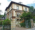
Castle bridge and bridge on the Horn | Leibnizallee (map) |
Castle bridge and bridge on the Horn (see the park on the Ilm), |
|
|
 |
Residential building | Leibnizallee 1 (map) |
Residential building |
|
|
 |
Residential building | Leibnizallee 2 (map) |
Residential building with outbuildings |
|
|
| Residential building | Leibnizallee 4 (map) |
Residential building |
|
||
 |
Dormitory | Leibnizallee 10, 10a (map) |
Court martial, today a student residence |
|
|
 |
Dormitory | Leibnizallee 10b (map) |
Gun chamber, now a student residence |
|
|
 |
Residential building | Lenbachweg 1 (map) |
Residential building |
|
|
 |
Residential building | Lenbachweg 3 (map) |
Residential building |
|
|
 |
Residential building | Lisztstrasse 3/5 (map) |
Residential building |
|
|
 |
Residential and commercial building | Lisztstrasse 4 (map) |
former Villa Alvary, residential and commercial building with land |
|
|
 |
Residential building | Lisztstrasse 24 (map) |
Residential building |
|
|
 |
Residential building | Lisztstrasse 28 (map) |
Residential house with outbuildings |
|
|
 |
Publishing house and residential building | Ludwig-Feuerbach-Strasse 9 (map) |
Publishing house and residential building |
|
|
 |
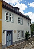
Lutherhof | Luthergasse (map) |
Lutherhof |
|
|
 |
Vulpius house with plaque | Luthergasse (map) |
Vulpius house with plaque |
|
|
| Lützendorfer Gut | Lützendorf 2, 3 (map) |
Lützendorfer Gut |
|
||
 |
Hetzerhallen | Building behind Marcel-Paul-Straße 57 | 1914/17 | Factory building on the railroad tracks, where the small Hetzerhalle adjoins the big one, from south to north. Roof and hall structure based on Otto Hetzer construction (Hetzerbinder). |
|
 |
Residential and commercial building | Marienstraße 1 (map) |
Residential and commercial building with side wing / Reform light games |
|
|
 |
Residential building | Marienstraße 4/6 (map) |
Residential building |
|
|
| Bumblebee house | Marienstraße 8 (map) |
Bumblebee house |
|
||
 |
Bauhaus University | Marienstraße 9 (map) |
Institute building of the Bauhaus University |
|
|
 |
Residential building | Marienstraße 10 (map) |
Residential building |
|
|
| Bauhaus University | Marienstraße 13 (map) |
Institute building of the Bauhaus University |
|
||
 More pictures |
Printing and residential buildings | Marienstraße 14 (map) |
Printing and residential buildings |
|
|
 More pictures |
Bauhaus University | Marienstraße 15 (map) |
Institute building of the Bauhaus University |
|
|
 |
Residential building | Marienstraße 16 (map) |
Residential building |
|
|
 More pictures |
Liszthaus | Marienstraße 17, 17a (map) |
Liszthaus with gardener's house |
|
|
 |
Bauhaus University | Marienstraße 18 (map) |
Institute building of the Bauhaus University |
|
|
 More pictures |
Fountain of Neptune | Market (map) |
Fountain of Neptune |
|
|
 |
Fountain | Market (map) |
medieval fountain (archaeological monument) |
|
|
 More pictures |
town hall | Market 1 (map) |
town hall |
|
|
 More pictures |
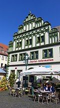
Bay window | Market 4 (map) |
Bay window of the court pharmacy (formerly Markt 6) |
|
|
 More pictures |
Townhouse | Market 10 (map) |
Townhouse |
|
|
 |
Cranachhaus | Market 11 (map) |
Cranachhaus |
|
|
 |
Pestel's house | Markt 12 (map) |
Pestel's house |
|
|
 |
Administration building | Market 14 (map) |
Administration building |
|
|
 |
Red lock | Market 15 (map) |
Red Castle, see Democracy Square 4 |
|
|
 |
hotel | Markt 18 (map) |
Hotel "Elephant" |
|
|
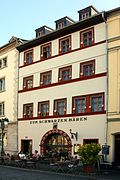 |
Inn | Market 20 (map) |
"Black Bear" inn |
|
|
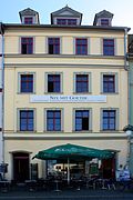 |
Residential and commercial building | Markt 21 (map) |
Residential and commercial building |
|
|
 |
Residential and commercial building | Markt 22 (map) |
Residential and commercial building |
|
|
 |
Inscription plaque | Marktstrasse 1 (map) |
Inscription tablet from 1557 |
|
|
 |
Residential and commercial building | Marktstrasse 3 (map) |
Residential and commercial building |
|
|
 |
Residential and commercial building | Marktstrasse 5 (map) |
Residential and commercial building |
|
|
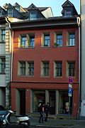 |
Residential and commercial building | Marktstrasse 7 (map) |
Residential and commercial building |
|
|
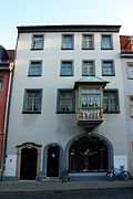 |
Residential and commercial building | Marktstrasse 9 (map) |
Residential and commercial building |
|
|
 |
Residential and commercial building | Marktstrasse 11 (map) |
Residential and commercial building |
|
|
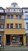 |
Residential and commercial building | Marktstrasse 15 (map) |
Residential and commercial building |
|
|
 |
State Archives | Marstallstrasse 2 (map) |
Marstall , Thür. Main State Archives, s. Bowling area 1 |
Q1589619 |
|
| Residential building | Marstallstrasse 3 (map) |
House with retaining wall, parapet and garden |
|
||
 |
Residential building | Max-Liebermann-Strasse 8 (map) |
Residential house with land and pavilion |
|
|
| Residential building | Merketalstrasse 23 (map) |
A. Olbricht house with land |
|
||
 |
Residential building | Mozartstrasse 11 (map) |
Residential building |
|
|
 |
Residential building | Mozartstrasse 13/15 (map) |
Residential building |
|
|
| Workshop | Otto-Schott-Strasse 1 (map) |
Hall IIb of the former Weimar factory |
|
||
| Workshop | Otto-Schott-Strasse 2 (map) |
Hall IIa of the former Weimar factory |
|
||
| Workshop | Otto-Schott-Strasse 3 (map) |
Hall III / “Red October” of the former Weimar factory |
|
||
| Workshop | Otto-Schott-Strasse 8 (map) |
Machine hall of the former Weimar factory |
|
||
 More pictures |
Catholic Church | Paul-Schneider-Strasse 1 (map) |
Herz-Jesu Kirche (Catholic Church) |
|
|
 |
cath. Rectory | Paul-Schneider-Strasse 3 (map) |
cath. Rectory; formerly Lottenmühle |
|
|
 |
Residential building | Paul-Schneider-Strasse 7 (map) |
Residential building |
|
|
 |
Residential building | Paul-Schneider-Strasse 10 (map) |
Residential building |
|
|
 |
Residential building | Paul-Schneider-Strasse 11 (map) |
Residential building |
|
|
 |
Residential building | Paul-Schneider-Strasse 12 (map) |
Residential house with outbuildings |
|
|
 |
Residential building | Paul-Schneider-Strasse 13 (map) |
Residential building |
|
|
 |
Residential building | Paul-Schneider-Strasse 19 (map) |
Residential building |
|
|
| Ehrensperger House | Paul-Schneider-Strasse 52 (map) |
Ehrensperger house with land |
|
||
 More pictures |
Carl August Memorial | Democracy Square (map) |
Carl August Memorial |
|
|
 |
Ildefonso Fountain | Democracy Square (map) |
Ildefonso fountain in front of the wooden stables (see Platz der Demokratie 4) |
|
|
 |
Duchess Anna Amalia Library | Democracy Square 1 (map) |
Duchess Anna Amalia Library |
|
|
 More pictures |
Music college | Democracy Square 2 (map) |
Conservatory main building |
|
|
 |
Roessler's house | Democracy Square 3 (map) |
Rößlersches Haus, today the administration building |
|
|
 More pictures |
Red lock | Democracy Square 4 (map) |
Red castle with the same courtyard, yellow castle, new guard and wooden stables [and file man's fountain], today the HAAB study center |
|
|
 More pictures |
Riding house | Democracy Square 5 (map) |
1715/1718 | Today the riding house is one of the buildings of the “European Youth Education and Meeting Center Weimar” foundation. With its hall and seminar rooms, it serves the foundation as a conference and event location. With a few rooms used for administrative technology, it currently houses the Klassik Stiftung Weimar as a tenant. |
|
 |
Residential building | Prellerstraße 18/20 (map) |
Residential building |
|
|
 |
Residential building | Pushkinstrasse 2 (map) |
Residential building |
|
|
| Residential building | Pushkinstrasse 3 (map) |
Residential building |
|
||
 |
Residential building | Rainer-Maria-Rilke-Strasse 8 (map) |
Residential building |
|
|
| Residential building | Rainer-Maria-Rilke-Strasse 10 (map) |
Residential house with garden and outbuildings |
|
||
 |
Louis Fürnberg Archive | Rainer-Maria-Rilke-Strasse 17 (map) |
Louis-Fürnberg-Archiv, house with garden |
|
|
 |
Residential building | Rainer-Maria-Rilke-Strasse 18 (map) |
Residential building |
|
|
 |
Residential building | Rainer-Maria-Rilke-Strasse 29 (map) |
House with garden |
|
|
 |
Residential building | Rainer-Maria-Rilke-Strasse 32 (map) |
House with garden |
|
|
 |
New farmhouse | Rainer-Maria-Rilke-Strasse 46 (map) |
New farmhouse |
|
|
 |
Sophiengymnasium | Rathenauplatz 1 (map) |
Sophiengymnasium |
|
|
 |
Johannes Falk primary school | Rathenauplatz 3 (map) |
Johannes Falk primary school |
|
|
| Residential building | Rathenauplatz 6/7 (map) |
Residential building |
|
||
 |
Ratstannenweg 1a (map) |
see Rainer-Maria-Rilke-Straße 10 |
|
||
 |
House Trettner | Ratstannenweg 21 (map) |
House Trettner with property |
|
|
 |
Residential building | Ratstannenweg 22 (map) |
Residential house with land |
|
|
 |
Residential building | Richard-Wagner-Strasse 16 (map) |
Residential building |
|
|
 |
Residential building | Richard-Wagner-Strasse 18 (map) |
Residential building, s. also Cranachstr. 38 |
|
|
 |
Residential building | Richard-Wagner-Strasse 24 (map) |
Residential house with outbuildings |
|
|
 |
Residential building | Richard-Wagner-Strasse 26 (map) |
Residential building |
|
|
 More pictures |
Cattle auction hall | Riessnerstrasse | 1937 | The breeding cattle auction hall burned down completely after an arson in April 2015. |
|
| Residential building | Rittergasse 3 (map) |
Residential building |
|
||
| Residential building | Röhrstrasse 1 (map) |
Residential building, s. Ernst-Thälmann-Str. 31/33/35 |
|
||
 More pictures |
Käthe Kollwitz School | Röhrstrasse 19 (map) |
Käthe Kollwitz School with gym, toilet building and mallard fountain |
|
|
 |
Residential and commercial building | Taxiway 6 (map) |
Residential and commercial building |
|
|
 More pictures |
Residential and commercial building | Taxiway 7 (map) |
Residential and commercial building |
|
|
 |
Residential and commercial building | Taxiway 9 (map) |
Residential and commercial building |
|
|
 |
Medical center | Taxiway 10 (map) |
Employment office, today a medical center |
|
|
 |
Residential building | Rudolf-Breitscheid-Strasse 33 (map) |
Residential building |
|
|
 More pictures |
Escort well | Scherfgasse | Escort well |
|
|
 More pictures |
former escort house | Scherfgasse 1 (map) |
former escort house |
|
|
 More pictures |
Shardche house | Scherfgasse 3 (map) |
former Schardtsches house with pavilion |
|
|
 More pictures |
Escorts | Scherfgasse 4 (map) |
Escorts |
|
|
 More pictures |
Pavillonpresse e. V. | Scherfgasse 5 (map) |
former print shop, Pavillonpresse e. V. |
|
|
 More pictures |
Goose man fountain | Schiller Street | Goose man fountain |
|
|
 |
Residential and commercial building | Schillerstrasse 1 (map) |
Residential and commercial building, cf. Brauhausgasse 2 |
|
|
 |
Residential and commercial building | Schillerstraße 5 (map) |
Residential and commercial building |
|
|
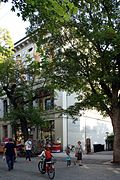 |
Commercial building | Schillerstraße 5a (map) |
Haar department store, commercial building |
|
|
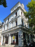 |
Residential and commercial building | Schillerstraße 10 (map) |
Residential and commercial building |
|
|
 More pictures |
Schiller House | Schillerstraße 12 (map) |
Schiller House |
|
|
 More pictures |
Residential and commercial building | Schillerstraße 13/15 (map) |
Residential and commercial building |
|
|
 |
Residential and commercial building | Schillerstraße 14 (map) |
Residential and commercial building |
|
|
 |
Residential and commercial building | Schillerstraße 18 (map) |
Residential and commercial building |
|
|
 |
Residential and commercial building | Schillerstraße 20 (map) |
Residential and commercial building |
|
|
| slaughterhouse | Schlachthofstrasse 4 (map) |
Slaughterhouse (administration building, slaughterhouse, workshop building, former open-air bank, surrounding wall facing the street and courtyard design) |
|
||
| Cold store | Schlachthofstrasse 6 (map) |
Cold store |
|
||
 |
Residential building | Schlossgasse 4 (map) |
House with the palm, residential building |
|
|
 |
Residential and commercial building | Schlossgasse 6 (map) |
Kotzebuehaus, residential and commercial building |
|
|
 |
Residential and warehouse | Schlossgasse 11 (map) |
Residential and warehouse |
|
|
 More pictures |
Central Station | Schopenhauerstraße 2, 2a, 2b (map) |
Main station (reception building, prince station and service building as well as platform roofing) |
|
|
| Nursing home | Schopenhauerstraße 11 (map) |
Nursing home |
|
||
 |
Residential building | Schubertstrasse 2 (map) |
Residential building |
|
|
 |
Residential building | Schubertstrasse 2a (map) |
Residential building |
|
|
 |
Residential building | Schubertstrasse 15 (map) |
Residential building |
|
|
 |
Residential building | Schubertstrasse 19/21 (map) |
Residential building |
|
|
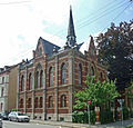 |
Residential building | Schubertstrasse 23 (map) |
Christ Church, now a residential building |
|
|
 |
Residential building | Schubertstrasse 25 (map) |
Residential building |
|
|
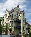 |
Residential building | Schubertstrasse 36 (map) |
Residential building |
|
|
 |
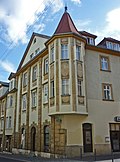
Residential building | Schubertstrasse 37 (map) |
Residential building, s. August-Bebel-Platz 4 and Trierer Straße 38 |
|
|
 |
Residential and commercial building | Schützengasse 9 (map) |
Residential and commercial building, s. Brauhausgasse 17 |
|
|
 |
Residential and commercial building | Schützengasse 10 (map) |
Residential and commercial building with side wing and rear building |
|
|
 |
Official residences | Schwabestrasse 9, 11, 18, 20, 22, 24 (map) |
Official residences, s. also Cranachstrasse 48 and 49 |
|
|
 |
Shell fountain | Schwanseestrasse (map) |
Shell fountain on the wall of the Weimarhallenpark |
|
|
 More pictures |
Technical school | Schwanseestrasse 9/11 (map) |
Technical school for social education, cf. Coudraystrasse 10/12 |
|
|
 |
Administration building | Schwanseestraße 13 (map) |
Administration building |
|
|
 |
City administration | Schwanseestraße 15/17 (map) |
former district office, today city administration |
|
|
 |
City administration | Schwanseestrasse 19 | City administration |
|
|
 |
Scheidemantelsche factory | Schwanseestrasse 41 | Scheidemantelsche factory, s. also Brucknerstrasse 29 |
|
|
| Former Gasworks | Schwanseestraße 92 (map) |
Former Gasworks |
|
||
 |
Oppelscher garden | Seifengasse 9 (map) |
Oppelscher garden with pavilion; at the same time garden monument within the meaning of Section 2, Paragraphs 2 and 6 of the ThürDSchG |
|
|
 |
Residential building | Seifengasse 10 (map) |
Residential building |
|
|
 |
Residential building | Seifengasse 12 (map) |
Residential building |
|
|
 |
Residential building | Seifengasse 14 (map) |
House, painting and drawing school |
|
|
 |
Residential building | Seifengasse 16 (map) |
House, painting and drawing school |
|
|
 |
Residential building | Seifengasse 16a (map) |
House, painting and drawing school |
|
|
 |
Hummel memorial | Sophienstiftsplatz (map) |
Hummel memorial |
|
|
 |
Theater fountain | Sophienstiftsplatz (map) |
Theater fountain |
|
|
 |
Johann-Peter-Eckermann-School | Sophienstiftsplatz 1 (map) |
Johann-Peter-Eckermann-School with gym |
|
|
 More pictures |
Frog well | Steubenstrasse (map) |
Frog well |
|
|
 |
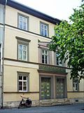
library | Steubenstrasse 1 (map) |
Messhaus, today the city library |
|
|
 |
Residential building | Steubenstrasse 3/5 (map) |
Residential building |
|
|
 |
Bauhaus University | Steubenstrasse 6a (map) |
Brewery building, today Bauhaus University s. Brauhausgasse 17 and Schützengasse 9 |
|
|
 |
Library of the Bauhaus University | Steubenstrasse 8 (map) |
Deinhardtsche Brewery, today the library of the Bauhaus University |
|
|
 |
Bank building | Steubenstrasse 15 (map) |
Bank building |
|
|
 |
Administration building | Steubenstrasse 23/25 (map) |
Administration building |
|
|
 |
Residential building | Steubenstrasse 32 (map) |
Residential building |
|
|
| Furnishing | Steubenstrasse 35 (map) |
Furnishing |
|
||
 |
Plaque | Steubenstrasse 40/42 (map) |
Memorial plaque for Franz economist |
|
|
 |
Residential and commercial building | Steubenstrasse 48 (map) |
Residential and commercial building |
|
|
 |
Residential building | Teichgasse 14 (map) |
Residential building |
|
|
 |
Dolphin fountain | Teichplatz (map) |
Dolphin fountain |
|
|
 More pictures |
Goethe and Schiller monument | Theaterplatz (map) |
Goethe and Schiller monument |
|
|
 More pictures |
German National Theater Weimar | Theaterplatz 2 (map) |
German National Theater Weimar |
|
|
 More pictures |
Art Gallery | Theaterplatz 4 (map) |
Kunsthalle (Bauhaus Museum) |
|
|
| Friedrich Schiller School | Thomas-Mann-Strasse 2 (map) |
Friedrich Schiller School |
|
||
 More pictures |
Residential building | Thomas-Müntzer-Strasse 1 (map) |
Residential building |
|
|
 More pictures |
Residential building | Thomas-Müntzer-Strasse 2 (map) |
Residential building |
|
|
 More pictures |
Residential building | Thomas-Müntzer-Strasse 3 (map) |
Residential building |
|
|
 More pictures |
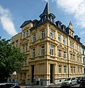
Residential building | Thomas-Müntzer-Strasse 4 (map) |
Residential building |
|
|
 More pictures |
Residential building | Thomas-Müntzer-Strasse 6 (map) |
Residential building |
|
|
| More pictures | Residential building | Thomas-Müntzer-Strasse 7 (map) |
Residential building |
|
|
 More pictures |
Residential building | Thomas-Müntzer-Strasse 18 (map) |
Residential building |
|
|
 More pictures |
Residential building | Thomas-Müntzer-Strasse 27 (map) |
Residential building |
|
|
 More pictures |
Residential building | Thomas-Müntzer-Strasse 31/33 (map) |
Residential building |
|
|
 More pictures |
Residential building | Thomas-Müntzer-Strasse 35 (map) |
Residential building |
|
|
 More pictures |
Residential building | Thomas-Müntzer-Strasse 43 (map) |
Residential building |
|
|
 More pictures |
Residential building | Thomas-Müntzer-Strasse 48 (map) |
Residential building |
|
|
 |
Johanniskirche | Tiefurter Allee (map) |
Ev.-luth. Johanniskirche |
|
|
 |
Residential building | Tiefurter Allee 2 (map) |
Residential house with land |
|
|
 |
Rectory | Tiefurter Allee 2b (map) |
Parsonage of the ev.-luth. Johanniskirche |
|
|
 |
Johanniskirche | Tiefurter Allee 2c (map) |
Ev.-luth. Johanniskirche |
|
|
 |
Residential and commercial building | Tiefurter Allee 4 (map) |
Residential and commercial building |
|
|
 |
villa | Tiefurter Allee 6 (map) |
Villa Moers with property and outbuildings |
|
|
 |
Marie Seebach pen | Tiefurter Allee 8 (map) |
Marie-Seebach-Stift, House I, with stele and bust for Marie Seebach |
|
|
 |
Residential building | Tiefurter Allee 10 (map) |
Residential house with land |
|
|
 |
Marie Seebach pen | Tiefurter Allee 37 (map) |
Marie-Seebach-Stift, House II, with property |
|
|
 |
Sophien Hospital | Trierer Strasse 2 (map) |
Sophienkrankenhaus mother house |
|
|
 |
Residential building | Trierer Strasse 6 (map) |
Residential building |
|
|
 |
Residential building | Trierer Strasse 36 (map) |
Residential building |
|
|
 |
Residential building | Trierer Strasse 38 (map) |
Residential building, s. August-Bebel-Platz 4 and Schubertstraße 37 |
|
|
 |
Residential building | Trierer Strasse 48 (map) |
Residential house with land |
|
|
| Residential building | Trierer Strasse 50 (map) |
Residential building |
|
||
 |
Residential building | Trierer Strasse 55 (map) |
Residential building |
|
|
 |
Residential building | Trierer Strasse 63 (map) |
Residential house with land |
|
|
 |
Residential building | Trierer Strasse 65 (map) |
Residential building |
|
|
 |
Residential building | Trierer Strasse 67 (map) |
Residential building |
|
|
 |
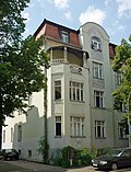
Residential building | Trierer Strasse 69 (map) |
Residential building |
|
|
 |
Residential building | Trierer Strasse 71 (map) |
Residential building |
|
|
 |
Residential building | Trierer Strasse 73 (map) |
Residential building |
|
|
 |
Residential building | Trierer Strasse 75 (map) |
Residential building |
|
|
 |
Park pool | Above the cone gate 1 (map) |
1859/60 | Parkbad (Weimar) ; (Address formerly Hans-Wahl-Straße) |
|
 More pictures |
Goethe-Schiller Archive | Above the cone gate 4 (map) |
1893-1896 | Goethe-Schiller-Archive with gardens and property (address formerly Hans-Wahl-Straße) |
|
 |
Residential building | Undermine 1 (Map) |
Residential building |
|
|
 |
Residential building | Undermine 13 (Map) |
Residential building |
|
|
 |
Inn | Undermine 15 (Map) |
Gasthaus "Zum Löwen", with storage building |
|
|
 |
Residential building | Undermine 17 (Map) |
Residential building |
|
|
 |
Residential building | Vorwerkgasse 4 (map) |
Residential building |
|
|
| Residential building | Wagnergasse 28 (map) |
Residential building - House no longer exists in September 2015 - |
|
||
 |
Residential building | Wallendorfer Strasse 8 (map) |
Residential building |
|
|
 |
Residential building | Washingtonstrasse 30 (map) |
Residential building |
|
|
 |
Residential building | Washingtonstrasse 53 (map) |
Paulinenstift, residential building |
|
|
 More pictures |
Wieland monument | Wielandplatz (map) |
Wieland monument |
|
|
 |
Wieland fountain | Wielandplatz (map) |
Wieland fountain |
|
|
 More pictures |
Residential building | Wielandplatz 2/3 (map) |
Residential building |
|
|
 |
Residential building | Wilhelm-Külz-Strasse 2 (map) |
Residential building |
|
|
 |
Residential building | Wilhelm-Külz-Strasse 7 (map) |
Residential building |
|
|
 |
Residential building | Wilhelm-Külz-Strasse 12 (map) |
Residential building |
|
|
 |
Residential building | Wilhelm-Külz-Strasse 14 (map) |
Residential building |
|
|
 |
Residential building | Wilhelm-Külz-Strasse 15 (map) |
Residential house with land |
|
|
 |
Residential building | Wilhelm-Külz-Strasse 18 (map) |
Residential building |
|
|
 |
Residential building | Wilhelm-Külz-Strasse 22 (map) |
Residential building |
|
|
 |
Residential building | Wilhelm-Külz-Strasse 29 (map) |
Residential building |
|
|
 |
Residential building | Wilhelm-Külz-Strasse 30 (map) |
Residential building |
|
|
 |
Residential building | William-Shakespeare-Strasse 2/4 (map) |
Residential building with studio buildings |
|
|
 |
Residential building | William-Shakespeare-Strasse 10 (map) |
Residential building |
|
|
 |
Residential building | William-Shakespeare-Strasse 12 (map) |
Residential building |
|
|
 |
Kreuzkirche | William-Shakespeare-Strasse 13 (map) |
see Ev.-Luth. Kreuzkirche, architect: Rudolf Zapfe |
|
|
 |
kindergarten | William-Shakespeare-Strasse 13a (map) |
kindergarten |
|
|
 |
Pestalozzi School | William-Shakespeare-Strasse 15, 15a, 17 (map) |
Pestalozzi School with plastic "Girls" |
|
|
 |
Residential and commercial building | Windischenstrasse 8 (map) |
Residential and commercial building |
|
|
 |
Residential and commercial building | Windischenstrasse 10 (map) |
Residential and commercial building |
|
|
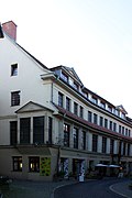 |
Commercial building | Windischenstraße 19/21/23 (map) |
Commercial building, back building at Schillerstraße 16 |
|
|
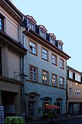 |
Portal garments | Windischenstrasse 25 (map) |
Portal walls with keystone and door leaf |
|
|
 |
Residential and commercial building | Windischenstrasse 33 (map) |
former Branco house, residential and commercial building |
|
|
 |
Residential building | Windmühlenstrasse 11 (map) |
Residential house with land |
|
|
| Residential building | Windmühlenstrasse 15 (map) |
Residential house with land |
|
||
| Residential building | Windmühlenstrasse 16 (map) |
Residential house with land |
|
||
| Residential building | Windmühlenstrasse 19/21 (map) |
Residential house with outbuildings facing the street, the remains of the windmill tower and property |
|
||
 More pictures |
Käthe Kollwitz memorial | Zeppelinplatz (map) |
Käthe Kollwitz memorial |
|
|
| Ruin of the armory | Zeughof (map) |
Ruin of the armory |
|
||
| Gate pillar | Zeughof (map) |
Gate pillars at the entrance from the Geleitstrasse |
|
||
 |
Residential building | Zöllnerstrasse 11 (map) |
Residential building |
|
|
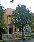 |
Residential building | Zöllnerstrasse 13 (map) |
Residential building |
|
|
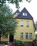 |
Residential building | Zöllnerstrasse 15 (map) |
Residential building |
|
|
 |
House of Muthesius | Zöllnerstrasse 16 (map) |
House of Muthesius |
|
|
 |
Residential building | Zöllnerstrasse 17 (map) |
Residential house with gardens, outbuildings and tea house |
|
|
| Home for the blind | Zöllnerstrasse 28 (map) |
Home for the blind, Max Zöllner Foundation |
|
||
 |
Youth hostel | Zum Wilden Graben 12 (map) |
Youth hostel |
|
swell
- List of monuments of the independent city of Weimar ( Memento from November 12, 2014 in the Internet Archive ) (pdf), Weimar City Administration, as of November 20, 2013
- List of monuments of the independent city of Weimar (pdf), Weimar City Administration, as of September 15, 2015
Web links
Commons : Kulturdenkmale in Weimar - Collection of images, videos and audio files
Individual evidence
- ↑ Flugplatz Nohra eV , accessed on April 24, 2015
