List of cultural monuments in the city center (Bautzen), A – K
In the list of cultural monuments in the city center, A – K , the cultural monuments of the Bautzen city center are recorded that were recorded by the State Office for Monument Preservation of Saxony until March 2018 (excluding archaeological cultural monuments). The notes are to be observed.
List of cultural monuments in the city center, A – K
| image | designation | location | Dating | description | ID |
|---|---|---|---|---|---|
 |
Historic city center of Bautzen (proposed) | (Map) | from 1200 (monument protection area) | Historic city center of Bautzen |
09252277 |
 |
City fortifications (totality); Outer city wall | - (card) |
1290-1810; 1859–1861 (northern part of Lauenwall); 1863 (granular oaks); 1871 (Friedenseiche); from 1873 (southern part of Lauenwall); 1890-1892 (Königswall); around 1900 (fountain); 1905 (black oak) | Total city fortifications and promenades with the following individual monuments: as evidence of the fortification, parts of the outer city wall and former battlements in the area Am Stadtwall, Am Ziegelwall, Am Zwinger, Muskauer Strasse, Schilleranlagen, Vor dem Schülertor and Wallstrasse (see Obj. 09250176), Gerberbastei (Am Zwinger 1, Obj. 09250798), Mühlbastei (Burglehn 11a, Obj. 09251457), former Gerberstraße 34, Obj. 09250818), Mönchsbastei (Heringstraße 15, Obj. 09250507), Lauenturm (Innere Lauenstraße, Obj. 09250981) as inner courtyard boundary (Mühltorgasse 1, Obj. 09250411), Röhrscheidt-Bastei (Mühltorgasse 3, Obj. 09251490), Nicolaiturm (Nicolaipforte 1, Obj. 09250796), Nicolaistufen (Obj. 09250841), Reichenturm (Reichenstraße 33, Obj. 09250990) Schülerturm (Schülerstrasse 11, Obj. 09250858), Wendischer Turm (Wendischer Graben 3, Obj. 09250875), Alte Wasserkunst (Wendischer Kirchhof 2, Obj. 09251001) and the Mühltor (Wendischer Kirchhof 3, Obj. 09251002), as well he garden monument ring complex "Promenaden" with three memorial trees (obj. 09306594), fountain (in front of Am Stadtwall 12, obj. 09305370), group of figures (in front of Lotzestraße 17, obj. 09305372) and high relief (Wallstraße / Tuchmacherstraße, obj. 09305373), as well as all furnishing elements of the ring system as a whole; Significant evidence of the medieval Bautzen city fortifications as well as their transformation into an urban green area in the 19th century, only to be found in individual examples in Saxony in this interaction and preserved complexity, characterizing the townscape, urban history, urban development history, gardening and urban planning significance. Wall in parts, but at least the lines preserved, a preserved battlement between the post office and Dr.-Ernst-Mucke-Straße .
|
09301008 |
| Garden shed | Am Schützenplatz 1 (map) |
Around 1800 | Architecturally and historically of importance, the original, simple Biedermeier building on the city wall, the core building in the ground plan preserved, with an archway in the city wall as an opening to the garden, externally removed from the original state by recent renovations, newer extension with window openings that do not appear to be adapted to the old building, former Garden currently defaced by built-in garage |
09251466 |
|
 More pictures |
Parts of the outer city wall and former battlements (individual monument for ID No. 09301008) | Am Stadtwall (map) |
13./14./15. century | Individual monument of the urban fortifications as a whole; Evidence of the fortification and its partial transformation into public promenade facilities, historically and in terms of urban development. Wall in parts, but at least the lines are preserved, from the middle of the 19th century the area of the wall and ditch converted into public promenades, a preserved battlement between the post office and Dr.-Ernst-Mucke-Straße, from the middle of the 19th century area of Wall and moat converted into public promenades |
09250176 |
 |
Villa with hall extension and enclosure (parish hall St. Petri) | Am Stadtwall 12 (map) |
Around 1905/1910 | Evangelical parish hall of St. Petri and bookstore, of architectural significance. The central part is emphasized by the curved gable, arched bay window with roof structure, on the ground floor side balconies, on the first floor in the middle a small balcony. Strong plaster relief and ornamentation (back), in the gable depicting the Bible, alpha and omega as well as dove of the Holy Spirit (saying: “To honor God, to increase his kingdom”). Until 2001 Villa was erroneously listed under "Töpferstrasse 23" in the list of monuments. Enclosure consisting of brick pillars and wrought iron fence panels, with regard to its design, refers to the residential building that was built in parallel, complements it as a monument unit. The youth club founded in 1861 (which joined the CVIM), built in 1905 as a club house on Töpferstrasse, transferred to church property in 1933. On Reformation Day 2009, the parish hall was inaugurated after renovation. New address now at Am Stadtwall 12, as access is now via ramparts. |
09250780 |
 |
Soviet-Polish military cemetery (entity) | At the brick wall (map) |
After 1945 | The Soviet-Polish military cemetery with the following individual monuments: Obelisk on the Soviet Grove of Honor (see also individual monument 09250082, same address), memorial plaque made of red marble and five tombstones on the Soviet-Polish Grove of Honor (see also individual monument 09250197, same address), on another completed one Memorial stone made of gray granite for the soldiers of the 13th Panzer Guard Regiment, as well as tombstones and grave fields of the Soviet cemetery of honor, green area with small staircases on the side and fencing as a garden monument or parts of the whole; Tomb of 3,053 Soviet war dead and a further 92 victims from Poland and the USSR, historically significant.
|
09250376 |
 More pictures |
Commemorative plaque made of red marble and five gravestones on the Soviet-Polish grove of honor (individual monument for ID No. 09250376) | At the brick wall (map) |
1961 | Individual monument belonging to the Soviet-Polish military cemetery; large commemorative plaque made of red marble and five memorial stones, burial place of 92 Soviet and Polish prisoners of war, of local historical importance and of historical testimony value |
09250197 |
 More pictures |
Obelisk on the Soviet Grove of Honor (individual monument for ID No. 09250376) | At the brick wall (map) |
1946/47 | Individual monument belonging to the Soviet-Polish military cemetery; historically and locally of importance |
09250082 |
 More pictures |
Parts of the outer city wall and former battlements (individual monument for ID No. 09301008) | At the brick wall (map) |
13./14./15. century | Individual monument of the urban fortifications as a whole; Evidence of the fortification and its partial transformation into public promenade facilities, historically and in terms of urban development |
09250176 |
 |
Garden house and wall | Am Ziegelwall 6 (map) |
1st half of the 19th century | Architectural-historical testimony, of architectural and urban development history, belongs to a series of similar, Biedermeier buildings on the city wall, also stylistically aesthetic, single-storey plastered building with mansard roof, dormitories, arched windows on the ground floor, windows and doors changed in design, some with shutters (wooden slats) , but largely authentic in terms of cubature, proportions and roof structure |
09299923 |
 More pictures |
Gerberbastei am Zwinger between Schülertor and Nicolaipforte and remnants of the city wall (individual monument to ID no. 09301008) | Am Zwinger 1 (map) |
1503 | Individual monument of the urban fortifications as a whole; It is of local and architectural importance, built in 1503 as the last and strongest of the bastions of the inner defensive ring of the city, burned out twice in the Thirty Years War, renovated in 1703, served as a rifle bastion, plague hospital, gymnasium and has been a youth hostel since 1922 |
09250798 |
 More pictures |
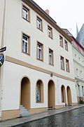
Residential house in closed development and corner location | At the meat banks 2 (map) |
Early 18th century | Baroque house, historically important, horizontal emphasis of the floors by ledges, marked in the door grille (ES) |
09251097 |
 More pictures |
Residential house with shop fitting in half-open development | At the meat banks 4 (map) |
Marked 1695 | Baroque house with built-in shop, of architectural significance, central emphasis by portal, below it coat of arms (inscription: Martin Gubritz) |
09251098 |
 More pictures |
Shop in open development (cathedral bookstore) | At the meat banks 5 (map) |
Around 1850 | Architecturally important and defining the street scene, narrow, elongated building, round arches, stepped gable |
09251099 |
 More pictures |
Residential house in half-open development and corner location | At the meat banks 7 (map) |
After 1720 | Baroque residential building, of importance in terms of the building history and the street scene, old patrician house, center accentuated by portal with coat of arms, twin windows, dormer window, accentuation of the ground floor with plastered ashlar, rich plaster relief on the first floor |
09250866 |
 More pictures |
Friedensbrücke (former Kronprinzenbrücke), Spreetalbrücke / road bridge over the Spree | At the Friedensbrücke (map) |
Marked 1909, built in 1908/09 | Landscaping as well as shaping the townscape, of technical and local historical importance. Spreetalbrücke, called Kronprinzenbrücke until 1949. About 180 m long, four-arched, massive bridge, arches and pillars made of granite quarry stone masonry in cement mortar (concrete concrete) with granite stone facing, soffits smoothly plastered.
|
09250980 |
 More pictures |
Petrikirche with sundial | At the Petrikirche 1 (map) |
1213 | Three-aisled, Gothic hall church, of architectural, art-historical and local significance. three-aisled hall longhouse, asymmetrically extended to the south by a fourth nave, net vaults over slender octagonal pillars above the choir and nave, since 1524 a simultaneous church.
|
09251084 |
 More pictures |
Residential building in closed development | At the Petrikirche 2 (map) |
Around 1720 | Baroque residential building, of architectural and urban significance, central emphasis by portal with keystone (denoted JI) and twin windows on the first floor, crowned by triangular gable |
09251088 |
 More pictures |
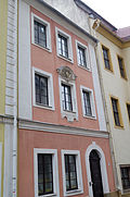
Residential building in closed development | At the Petrikirche 3 (map) |
Around 1720 | Baroque residential building, of architectural and urban significance, emphasis on the middle on the first floor with the crowning of the middle window in strong relief, inscription: OUR HILFE KOMPT VON HERRN |
09251087 |
 More pictures |
Former monastery house in a corner and semi-open development | At the Petrikirche 4 (map) |
Marked 1722 | Baroque building, of architectural and local importance, strongly asymmetrical structure with main portal, round arch in the facade, portal with keystone (coat of arms) marked 1722 - CS.AM, vault, today telecom and office |
09251086 |
 More pictures |
Residential building in closed development | At the Petrikirche 5 (map) |
Around 1720 | Baroque residential building, of importance in terms of architectural history, architecture and the street scene, central emphasis by portal with floral decorated keystone, richly decorated entrance door, twin windows on the first and second floors with rich window crowning, vaults |
09251080 |
 More pictures |
St. Petri Cathedral Monastery with Cathedral Treasury | At the Petrikirche 6 (map) |
1683 | Bishop's seat until 1980, architecturally and historically significant, horseshoe-shaped complex with inner courtyard, magnificent portal with coat of arms and representation of the Trinity, cathedral treasury |
09251081 |
 |
Cathedral school / residential building in closed development as well as high walling of the property fence along Fleischergasse | At the Petrikirche 7 (map) |
1870 | Former cathedral school, today Caritas, of architectural, historical and urban significance, residential building with ledge above the ground floor, wall section |
09251082 |
 More pictures |
Semi-detached house in corner location and in semi-open development, as well as a wall as a property enclosure along Breitengasse and Fleischergasse and a portal in the wall on Breitengasse | At the Petrikirche 8, 9 (map) |
Around 1700 (double house); 17th century (portal) | Significant in terms of building history, urban development and architectural design, portal with rich crowning and arched gate portal (both with keystone), door crowning with triangular gable, wall of quarry stone plastered with solid corner pillars (natural stone) at the corner of Breitengasse / Fleischergasse, property today only listed under house number 9, summarized with number 8 |
09251083 |
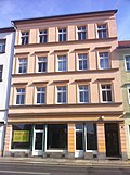 |
Residential house with shop fitting, in closed development | Äussere Lauenstrasse 5 (map) |
Around 1890 | Architecturally important, horizontal structure through ledges, original entrance door, demolition permit from April 26, 2012 (Bautzen District Office) |
09250953 |
 More pictures |
Residential house with shop in a corner | Äussere Lauenstrasse 9 (map) |
Around 1870/1880 | House in corner location (Äußere Lauenstraße 9) with shop, adjoining building without its own access staircase, with height offset (formerly Goschwitzstraße 1), building facing Goschwitzstraße with courtyard passage, of architectural and urban importance.
|
09250655 |
| Garden shed in the rear of the property and historical laundry shortages in the front building | Äussere Lauenstrasse 16 (map) |
Around 1800 (garden house); 4th quarter of the 19th century (lack of laundry) | Garden house evidence of architectural history, of importance in terms of urban planning and history, lack of laundry of importance in terms of technical history. Two-storey garden house with a raised central section, mansard roof and fine-grained windows, belongs stylistically to the series of garden houses built on the city wall or in its vicinity. Quite stylish property, recently renovated, newer round arched skylight in the mansard roof, old roof covering with beaver tails in double covering. Linen shortage: oldest operational linen shortage in the city of Bautzen (LA Thomas Maschinenfabrik Großröhrsdorf, shortage from the same company and probably also of the same type is in Dresden, Overbeckstrasse 26 January 2012), the last testimony to the former hotel and restaurant operation in the historic Vorspanngasthof “Zum halben Mond ”, originally hand-operated, 1928 installation of an electric motor and the Herrschuh mangle system, use to this day, stood in the back building at Äußere Lauenstrasse 40 until September 2013, was then moved here. |
09251459 |
|
 |
Former orphanage | Outer Lauenstrasse 23 (map) |
Vault marked 1699 | Significant in terms of building history and local history, plaque with inscription in the entrance hall: Johann Richer - “This is the Waysen house that God's father-hand has erected here to comfort poor children. The same now protects it that neither war nor fire, nor theuration or plague will ever do away with it! Let everyone take care of the Waysen faithfully, because what is done to you has been done to God. " |
09250958 |
 |
Residential house with built-in shop in a corner and closed development | Äussere Lauenstrasse 32 (map) |
Around 1890 | Architecturally important, the first floor is emphasized by the window crowning |
09250975 |
 |
Former urban breeding and spinning house / residential building | Äussere Lauenstrasse 33 (map) |
Around 1680 | Free-standing two-storey solid construction with a high degree of originality, architectural and local historical significance, building made of natural stone, today a children's home |
09250960 |
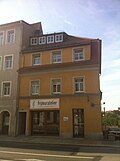 |
Residential building with shop fitting in corner location (formerly Karl Lohse - master electrician) | Äussere Lauenstrasse 34 (map) |
Around 1830 | Architecturally important, ledge above the ground floor, hipped roof |
09250972 |
| Residential building with two entrances in closed development | Äussere Lauenstrasse 36 (map) |
Marked 1827 | Architecturally important. Deletion in 2007 because the monument value is insufficient; After a detailed inspection of the property from the inside, it was again designated as a monument, as there are monumental features: the inside is original staircase with open arches with decorative wooden fields in the stair stringers, granite steps, wooden staircase, presumably preserved granite floor slabs under terrazzo in the entrance area, chimney as well as vaults and relief arches in individual rooms on all floors, original door frame with date and beautiful double-leaf entrance door from the construction period. |
09250971 |
|
 |
Residential house with shop fitting, gate entrance and rear buildings in closed development | Äussere Lauenstrasse 40 (map) |
Marked 1827 | In terms of building history, local history and urban development, the vaults and lack of laundry stood here in the rear building until September 2013, then moved to the front building at Äußere Lauenstrasse 16 |
09250969 |
 |
Residential house with shop fitting, in closed development | Äussere Lauenstrasse 42 (map) |
Keystone marked 1827 | Significant in terms of building history and urban development, marked in the keystone: "1827 - KR" |
09250968 |
 |
Residential house with shop fitting, in closed development | Äussere Lauenstrasse 44 (map) |
Mid 18th century | Significant in terms of building history and urban development |
09250967 |
 |
Residential building with a former bakery, in a closed area | Outer Lauenstrasse 48 (map) |
Mid 18th century | Significant in terms of building history and urban development, simple facade structure |
09250966 |
 |
Double house in closed development | Äußere Lauenstrasse 50, 52 (map) |
18th century | Architecturally and urbanistically important, simple facade structure, base made of quarry stone, with original entrance door |
09250965 |
 More pictures |
New water art with stone bench and quarry stone retaining wall at the Neutor, including a connecting passage to the keeper's house | Outer Lauenstrasse 58 (map) |
Inscribed with 1606 (water art); 1692 (stone bench) | Architecturally, historically and technically of importance, shaping the townscape. To secure the increasing demand for water by the council builder Wenzel Rohrscheidt d. J. built, badly damaged in 1620 and rebuilt in 1724/25, shut down in 1890.
At the beginning of the 17th century, Alte Wasserkunst no longer met the requirements of the city of Bautzen in terms of water requirements. Therefore and also for the future increased supply of extinguishing water in case of fire 1606 Laying of the foundation stone for a second elevator by Wenzel Röhrscheidt the Younger. Completion of the extraction structure in 1606, 1607 start of work on the roofed tube passage and the tower, July 1608 collapse of the tower, by December 1608 re-erection of the same including putting on the hood, inauguration July 1610. 1618 the tower burned, 1620 destruction of the upper part of the tower during siege by Swedish troops, until 1720 increasing decay of the new water art, several fires. 1721 completely new building made of stone and with a dome, repairs to the elevator and pumps repeated decades after construction, 1874 installation of a steam engine at the extraction station. 1893 shutdown, 1937 tower renovation, extensive renovation 1999–2000. See also Werkhaus der Neue Wasserkunst, Obj. 09251179, whose foundation stone was laid in 1606 in connection with Neuer Wasserkunst. In the massive substructure of the water art, the so-called Neutor, which was originally part of the Outer Lauentor. Due to the location of the water art at the southern end of the city, the building was not only used to supply the city with drinking and extinguishing water, but also part of its defense systems. With regard to the architectural design and the technical mode of operation, this is an important work by the well-known master builder Wenzel Röhrscheidt the Younger, of formative importance for the cityscape, local history, building history and history of technology. |
09250962 |
 |
Residential building with shop fitting, in open development | Äussere Lauenstrasse 60 (map) |
Late 18th century | Architecturally and urbanistically important, portal with keystone, dormer windows |
09250963 |
 More pictures |
Former customs house of the Heilig-Geist-Brücke with enclosure, rear building as well as stone path and stone bench in front of the house (outer Lauentor) | Äussere Lauenstrasse 62, 64 (map) |
15th century | In terms of building history, urban planning and urban development history, it was the most important access route into the city until the Kronprinzenbrücke was opened in 1909. Residential building: Half-hip roof with bat dormers, beaver tail covering, cantilevered roof for recess. The rear building used to be a wheelwright, one-story with a hipped roof, stylistically belongs to the series of Biedermeier garden houses that were built on or near the city wall. Path stone and stone bench granite. |
09250961 |
 More pictures |
House with coat of arms above the portal | Burglehn 1 (map) |
In the core 17th century (house); around 1650 (coat of arms) | Significance in building and house history. Residential house with a high degree of authenticity, renovated with monument preservation requirements while maintaining the conventional cubature, proportions, roof pike. Originally preserved coat of arms stone. |
09251004 |
 |
Residential house in the corner of Mönchsgasse in open development | Burglehn 2 (map) |
Around 1885 | Significant in terms of building history and urban development, sloping corner with balcony, original railing, accentuation of the first floor through the crowning of windows |
09251023 |
 |
Residential house in closed development with coat of arms over portal | Burglehn 5 (map) |
Marked with 1699 (in the coat of arms above the portal) | Significant in terms of building history and urban development |
09251005 |
 More pictures |
Residential house in closed development with coat of arms over portal | Burglehn 7 (map) |
Marked with 1699 | Architecturally and urbanistically important, four floors, coat of arms over the portal marked 1699 - GEV Rechenberg |
09251006 |
| Basement of the former residential building (in the half of the building that adjoins No. 7) | Burglehn 9 (map) |
Early 16th century, late medieval (cellar systems); after 1634 (residential building) | Significance in terms of architectural history, cellar system largely preserved in its original form, quarry stone barrel vault, probably of late medieval origin, house demolished except for the ground floor masonry of the left half of the building |
09251007 |
|
 More pictures |
Mühlbastei (single monument to ID no.09301008) | Burglehn 11a (map) |
Around 1486 | Individual monument of the urban fortifications as a whole; Significant in terms of local history, urban development and architectural history, built around 1486, besieged and destroyed by Sweden in 1639, new roof in 1676, burned out in 1945, current use: converted and expanded as a residential building |
09251457 |
| Residential building in closed development | Burglehn 15 (map) |
Around 1750 | Significant in terms of building history and urban development, emphasis on the middle due to the wide gate and the crooked hip roof |
09251008 |
|
 More pictures |
Semi-detached house in corner location and in half-open development | Burgplatz 1 (map) |
Around 1910 | Significant in terms of building history and the appearance of the square, emphasis on the center by the roof gable |
09251022 |
 More pictures |
Residential house (with attached workshop) in a corner and in closed development as well as a former stable building | Burgplatz 2 (map) |
Marked 1899–1900 (residential building); 1st half of the 18th century (stable) | Significant in terms of building history and urban development, corner emphasis by balcony with original railing, original entrance door, side emphasis by twin windows, rich window crowning on the first floor, stable: natural stone, crooked hip roof |
09251009 |
 More pictures |
Residential house in corner location and open development | Burgplatz 4 (map) |
Around 1870 | Significant in terms of building history and urban development, simple plaster structure, original door |
09251021 |
 |
Former inn (Schlossschänke) | Burgplatz 5 (map) |
Marked 1430 | Quarry stone building with fortress-like wall, building, house and local history of importance, vaults |
09251018 |
 More pictures |
Residential house in open development (Gersdorfsches Haus) | Burgplatz 6 (map) |
Around 1680 | Baroque residential building, of importance in terms of architectural history and character of the square, symmetrical construction with central projectile and supporting pillars (due to the hillside location), colossal pilasters, plaster structure, portal with wrought-iron, gold-painted and richly decorated arch, richly designed coat of arms above the central window |
09251020 |
 |
Residential and commercial building in a corner and in closed development | Buttermarkt 1 (map) |
Around 1890 | Structurally and in terms of urban development, the plaster structure, window crowning on the first floor, cornices |
09250878 |
| Residential house in corner location and in closed development | Thornbill 2 (card) |
Marked 1755 | Architecturally significant, with shop fitting, emphasis on the center with plaster elements, labeled "1755 - JPG" (in the coat of arms above the gate of the brick archway to the inner courtyard on the Dornschnabel street), rear building no memorial |
09250714 |
|
 |
House in a corner and in a semi-open development |
Dr.-Ernst-Mucke-Strasse 2 (map) |
Around 1900/1905 | Significant in terms of building history and urban development, two floors, symmetrical façade design, emphasis on the center with the window crowning and oculus |
09250696 |
 |
Residential house in semi-open development | Dr.-Ernst-Mucke-Strasse 4 (map) |
Around 1890 | Architecturally important, side emphasis by gable, original door and window |
09250697 |
 |
Memorial plaque for Dr. Maria Grollmuß on the ground floor on the outside wall of a residential and commercial building | Dr.-Maria-Grollmuß-Strasse 2 (map) |
After 1945 | In memory of the Sorbian teacher and anti-fascist resistance fighter Dr. Maria Grollmuß (Marje Grólmusec, 1896–1944), historical (especially personal history) significance, on the ground floor under the street sign there is a memorial plaque with the wording: “Dr. Maria Grudmuss. Saxon anti-fascist fighter born April 24, 1896, died August 6, 1944 in the Ravensbrück concentration camp ”. Residential and commercial building with originally simple plaster structure, emphasis on the first floor, original front door, painted in 2007 in agreement with the Lower Monument Protection Authority, because it was considerably smoothed after renovation, window installation contrary to the requirements, monument value now insufficient. |
09250749 |
 |
Residential house with shop fitting in closed development | Dr.-Maria-Grollmuß-Strasse 4 (map) |
Keystone marked 1890 | Architecturally important, marked 1890 - L - (in the keystone), central emphasis, light plaster ornamentation under the roof ledge, plaster ashlar on the ground floor, mansard roof |
09250750 |
 |
House in a corner and in a semi-open development | Dr.-Maria-Grollmuß-Strasse 17 (map) |
Around 1890/1895 | Architecturally important, central projection with triangular gable, crowning of windows over twin windows on the first floor, plaster structure, lateral verandas, original door |
09250752 |
 |
Wastewater pumping station (pump house) | Fischergasse (map) |
1929 | Single-storey clinker brick building with an extension adapted to the level of the terrain as access to the roof terrace (with iron railing), with arched window and door openings, retracted entrance, of architectural and technological significance. Built in 1929 as a "dirty water pumping station" on the Walke, the design came from the civil engineering department of the city of Bautzen, single-storey, clinker-clad solid building with a square floor plan, western main view with large arched windows (changed), recessed porch with arched pillars on the southwest corner, elegant rhombic windows on the southern and northern narrow side, flat roof with rhombus railing from the construction period, accessible on an eastern slope, on the ground floor there is the engine and switch room for the 15 HP diesel engine (renewed), basement with engine and pump room, computer room and collecting tank, high-quality system as Testimony to the urban wastewater disposal of architectural and technical historical importance. Part of the technical systems for the city's water supply, in the vicinity of the Neue Wasserkunst (see Obj. 09250962). Door and window openings framed with colored clinker cladding arches (slightly raised). Upper end of the single-storey building with flat roof and surrounding clinker frieze. |
09286964 |
 |
Residential house in semi-open development | Fischergasse 8 (map) |
Marked 1759 | Architecturally important, angular portal with keystone |
09251168 |
 |
Residential house in semi-open development | Fischergasse 9 (map) |
Early 18th century | Structurally important, emphasis on the portal |
09251164 |
 |
Residential house in open development | Fischergasse 12 (map) |
Late 18th century | Architecturally important, two-story, saddle roof, with wide window reveals and basket arch portal |
09250190 |
 |
Residential house with inscription plaque, in half-open development | Fischergasse 13 (map) |
Marked 1904 | Significant in terms of building history and urban development, inscription: "Work is the citizen's ornament, blessing is the price of effort, KC 1904", asymmetrical structure, emphasis on the center through a bay-like porch from the first floor, emphasis on the sides, curved gable with plaster ornaments |
09251166 |
 |
Former factory building of the Neue Wasserkunst (see object 09250962) with remains of the enclosure | Fischergasse 20 (map) |
1606-1610 | Of outstanding importance in terms of building history and technology history. Formerly with a connection to the New Water Art, formerly a water wheel for water art installed in the building, fountain, huge vault. Laying of the foundation stone on July 24, 1606. 1606–1610 Reconstruction and construction of the Werkhaus as part of the construction of the New Water Art at the Äußere Lauentor by the city of Bautzen, architect: Wenzel Röhrscheidt d. J., the predecessor building was first mentioned in 1360 as a drapery walk and rebuilt around 1500, parts of the traditional building including a late Gothic, ogival vestibule portal with bar overlap (moved in the 1st third of the 20th century and re-erected as a pedestrian gate above the Werkhaus) probably from this period, two-storey solid construction, plastered, with irregular windowing of the facade fronts, hipped roof, at the southeastern gable corner crooked hips, main portal with pointed-arched brick walls, building originally above a structurally identical and later filled-in artificial moat, with vaults and partly wooden ceilings, originally changed due to the floor plans to the west with a wooden water wheel and printing mechanism, from which wooden pipelines led to the Neue Wasserkunst in an east facing wall, built in 1607, the eastern part of the building probably as a foreman since it was built into the early 20th century used, building of outstanding importance in terms of construction and technology. |
09251179 |
 |
Residential and production building with two extensions, in open development (former hosiery walk) | Fischergasse 22 (map) |
1606 | Structurally and technologically important, former stocking whale, technical monument, asymmetrical structure, formerly a house (with fulling) in an island location.
|
09251180 |
 |
Residential house in semi-open development | Fischergasse 25 (map) |
Around 1750 | Architecturally and urbanistically important, with a side entrance |
09251174 |
 |
Residential house in semi-open development | Fischergasse 27 (map) |
Around 1700 | Architecturally and in terms of urban development, it is of importance, the half-hip roof, remains of the door frames |
09251175 |
 More pictures |
Residential building in closed development | Fleischergasse 16 (map) |
Around 1720 | Significant in terms of building history and urban development |
09251108 |
 More pictures |
Residential building in closed development | Fleischergasse 17 (map) |
Around 1750 | Structurally and in terms of urban development, it is of importance, portal, roof extension |
09251103 |
 More pictures |
Residential building in closed development | Fleischergasse 18 (map) |
Around 1870 | Architecturally and urbanistically important, portal, original door |
09251102 |
 More pictures |
Residential house in half-open development (formerly archdeacon) | Fleischergasse 19 (map) |
1802 | Structurally and historically important, central emphasis by crowning windows with Hebrew characters on the first floor (inscription according to the report from 1990: 1731–1833 Archdeaconate), plaster relief, arched portal |
09251101 |
 More pictures |
Johann-Georg monument with market fountain | Meat market (map) |
1611 | Significant in terms of art and space. In the center, standing on an ornate pedestal, the statue of the Saxon Elector Johann Georg I (1585–1656) rises from the octagonal fountain basin of the market fountain on the meat market. The sandstone sculpture, which was unveiled to the public on August 17, 1865, replaced the original crowning of four dolphins on the fountain, which was opened in 1611 and demolished in 1863. The fountain system from the early 17th century, the work of the Bautzen city architect Wenzel Röhrscheidt the Elder. J. (died 1616), was fed through wooden pipes from one of the two water arts. The statue of the bearded elector holds a rolled-up parchment in his right hand with the treaty, according to which Bohemia pledged Lusatia to the Saxon elector.
|
09251085 |
 More pictures |
Town hall , rebuilt from the remains of its medieval predecessor, which was destroyed by fire | Fleischmarkt 1 (map) |
1489–1493 (tower) | Rebuilt from the remains of its medieval predecessor building, which was destroyed by fire, of importance in terms of architectural history, the history of the place and the setting of the square, rectangular structure (three-storey) with a high tower from the end of the 15th century that is not axially positioned on the long side, Baroque tower end from 1705, positioned on the north side , three-axis staircase, council chamber and mayor's room (with stucco from 1654) |
09251093 |
 More pictures |
Residential building in closed development | Fleischmarkt 2 (map) |
Marked 1670 | Architecturally, artistically and urbanistically of importance, central emphasis by portal with interrupted triangular gable, therein medallion (marked 1670 - HB), ledge above ground floor, richly decorated door with braided band ornamentation and door knocker |
09251094 |
 |
Residential house with shop fitting, in closed development | Fleischmarkt 3 (map) |
1673 | Architecturally and urbanistically important, simple facade design, plaster relief with anchor |
09251091 |
 More pictures |
Residential house in closed development with gate entrance and vault | Fleischmarkt 4 (map) |
Marked with 1710 | Architecturally and urbanistically of importance, emphasis on the middle due to the slightly protruding structure, twin windows, rich window crowning with triangular gables on the first and second floors, portal with keystone, therein braided band ornamentation and dating |
09251095 |
 More pictures |
Residential building in closed development | Fleischmarkt 5 (map) |
Around 1720 | Architecturally and urbanistically important, ledge above ground floor, arched portal with keystone |
09251090 |
 More pictures |
Group of houses consisting of three houses (formerly Fleischmarkt 10, 12 and 14) in closed development | Fleischmarkt 6 (map) |
1650/1710 | Architecturally and urbanistically important, baroque group of houses, emphasis on the ground floor, vaults |
09251096 |
 More pictures |
Residential house with shop fitting, in closed development | Fleischmarkt 7 (map) |
Around 1710 | Significant in terms of building history and urban development, emphasis on the center from the first floor through rich window crowns |
09251089 |
 |
Residential house with shop fitting, in closed development | Gerberstrasse 1 (map) |
Marked 1916 | Significant in terms of building history and urban development, with a bay-like porch on the first floor |
09250853 |
 |
Residential building in closed development | Gerberstrasse 2 (map) |
Around 1840 | Architecturally and urbanistically important, original door with skylight (colored glass), simple window crowning |
09250804 |
 |
Residential building in closed development with a pastry shop and café, some with original interior | Gerberstrasse 3 (map) |
Around 1910 | Structurally and locally of importance |
09250851 |
 |
Residential building in closed development | Gerberstrasse 4 (map) |
Around 1820 | Former Kurt Becker market hall, of architectural and urban significance, original door |
09250805 |
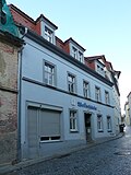 |
Residential house with shop fitting, in closed development | Gerberstrasse 4a (map) |
Around 1850 | Architecturally and urbanistically important, original windows and doors, emphasized on the ground floor by keystone-like crowning |
09250806 |
 |
Residential building in closed development | Gerberstrasse 5 (map) |
Around 1850 | Significant in terms of building history and urban development, symmetrical facade design, original windows, keystone |
09250850 |
 |
Residential building in closed development | Gerberstrasse 6 (map) |
Around 1850 | Architecturally and urbanistically important, original windows and doors, emphasized on the ground floor by keystone-like crowning |
09250807 |
 |
Residential building in closed development | Gerberstrasse 7 (map) |
Around 1890/1895 | In terms of building history and urban planning, it is of importance, plaster design and ornamentation |
09250849 |
 More pictures |
Residential building in closed development | Gerberstrasse 7a (map) |
Around 1890/1895 | Of importance in terms of building history and urban development, symmetrical facade design, plaster design and ornamentation |
09250848 |
 |
Residential building in closed development | Gerberstrasse 7b (map) |
Around 1850 | Architecturally and urbanistically important, symmetrical facade design, original entrance door with portal, keystone, skylight |
09250847 |
 More pictures |
Residential building in closed development | Gerberstrasse 12 (map) |
1st half of the 19th century | Significant in terms of building history and urban development. Façade image in the 2nd half of the 19th century, certainly during this time also an increase in the second floor, otherwise a high degree of authenticity, important for urban planning in connection with neighboring buildings. Roof extensions, original windows on both upper floors. |
09250757 |
 |
Vaulted room of the former auction hall and the former Alt-Bautzen inn | Gerberstrasse 13 (map) |
Around 1850 | In terms of architectural history, the large vault on the ground floor, the original auction hall and inn was demolished and the vault was integrated into the new building |
09250846 |
 More pictures |
Residential house in closed development (cloth maker house) | Gerberstrasse 14 (map) |
Marked 1791 in the keystone | Architecturally and socially important, symmetrical facade design, base made of rubble stones, elongated dormer window, original windows and doors |
09250808 |
 More pictures |
Residential house with shop fitting in closed development | Gerberstrasse 15 (map) |
Around 1800 | Significant in terms of building history and urban development, with later changes to the structure, elongated dormer window, original entrance door |
09250845 |
 |
Residential building in closed development | Gerberstrasse 16 (map) |
Around 1850 | Significant in terms of building history and urban development, simple facade design, keystone-like window crowning on the second floor |
09250809 |
 More pictures |
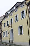
Residential house in closed development, with memorial plaque (birthplace of Karl Friedrich Gottlob Wetzel ) | Gerberstrasse 17 (map) |
1800 | Structurally and historically important, original door |
09250844 |
 |
Residential building in closed development | Gerberstrasse 18 (map) |
Around 1850 | Significant in terms of building history and urban development, emphasis on the middle through the roof design, emphasis on the sides on the ground floor through the door, original windows and door |
09250810 |
 More pictures |
Residential building in closed development | Gerberstrasse 20 (map) |
Around 1820 | Significant in terms of building history and urban development, two-storey, simple plaster design, side accentuated by the door on the ground floor |
09250811 |
 More pictures |
Residential building in closed development | Gerberstrasse 22 (map) |
Around 1820 | Architecturally and urbanistically important, side emphasis on the ground floor through a door, with loft extension |
09250812 |
 |
Residential house with shop fitting in closed development | Gerberstrasse 23 (map) |
Around 1885/1890 | Significant in terms of building history and urban development, original entrance door, groin vault in the entrance area, emphasis on the second floor with the ledge below |
09250842 |
 More pictures |
Residential house (former Goldener Anker guesthouse) in closed development | Gerberstrasse 24 (map) |
1820 | Structurally and historically important, original door |
09250813 |
 |
Residential house in closed development (Kolping House) | Gerberstrasse 26 (map) |
Marked 1796 in the keystone | Kolping House, of architectural and local significance, marked 1796 - P. Gude (in the keystone), symmetrical facade design, protruding middle section, original door |
09250814 |
 |
Residential house in semi-open development | Gerberstrasse 28 (map) |
Around 1800 | Significant in terms of building history and urban development, elongated dormer windows, original door and shutters on the ground floor |
09250815 |
 |
Remnants of the masonry of the former Gerber Gate (foundation wall, ground floor) in the form of a vaulted hall with arches (individual monument to ID No. 09301008) | Gerberstrasse 34 (map) |
Around 1800 | Individual monument of the urban fortifications as a whole; Significant in terms of local history and building history, earlier building and safe locksmith shop in Strasbourg in a large, vaulted ground floor hall (cross vault), this hall was the remains of the former tanner's gate, natural stone and brick, vault has meanwhile been demolished |
09250818 |
 |
Residential house with shop installation in a formerly closed development | Goschwitzstrasse 6 (map) |
Around 1910 | Architecturally important, two floors, original entrance door, inside vaults, cellar, demolition permit from April 27, 2012 (Bautzen District Office) |
09250654 |
 |
Residential building with a large gateway, in a closed area | Goschwitzstrasse 8 (map) |
Around 1870/1890 | Architecturally important, remains of original wall painting, inner courtyard |
09250653 |
 |
House and gate entrance in closed development | Goschwitzstrasse 9 (map) |
Marked 1759 | Significant in terms of building history and the appearance of the street, inscribed in the medallion above the archway: Built in 1759, burned down in 1823, renovated in 1922, two floors, dormer windows |
09250657 |
 |
Residential house in closed development with original entrance gate | Goschwitzstrasse 10 (map) |
Around 1870/1890 | Architecturally important, horizontal emphasis by the ledge above the ground floor, roof extension |
09250652 |
 |
Residential building in closed development | Goschwitzstrasse 16 (map) |
Around 1900 | Significant in terms of building history and urban development, emphasis on the center, window crowning, plaster structure (neoclassicism) |
09250649 |
 |
Residential house with shop in a corner and in a closed development | Goschwitzstrasse 17 (map) |
Around 1900 | In terms of building history, the corner is emphasized by the slightly protruding structure and roof extension and window crowning |
09250943 |
 |
Residential building in closed development | Goschwitzstrasse 19 (map) |
Around 1895 | Significant in terms of building history and urban development, side emphasis, window crowning, skylight, plaster structure |
09250658 |
 |
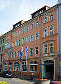
Administration building (Allgemeine Ortskrankenkasse) | Goschwitzstrasse 21 (map) |
1928 | Health insurance building, of importance in terms of building history and local history. Horizontal structure through the design of the first floor, emphasis on the middle with plaster relief (Aesculapian staff with snake), passage on the left (lattice gate, right and left depictions of snake and child), formerly built for the health insurance company, today AOK, on the floor above there is a doctor's office. Rear house villa, a typical architectural example for the construction period, which is eligible as a monument due to its largely unchanged condition, but cannot be justified in detail as a monument. |
09250659 |
 |
Residential house with gate entrance, in closed development | Goschwitzstrasse 23 (map) |
Around 1895 | Significant in terms of building history and urban development, emphasis on the sides, plaster structure below the roof, original skylight |
09250660 |
 |
Residential and commercial building in closed development | Goschwitzstrasse 25 (map) |
Around 1905 | Significant in terms of building history and urban development, side emphasis by curved gable and ball as crowning, horizontal accentuation by ledge above ground floor, round arch above shops (banks), two ear-shaped windows, quadruple windows in the gable |
09250661 |
 |
Residential building with Goethe pharmacy including historical furnishings and lettering above the entrance, coat of arms and the original entrance door | Goschwitzstrasse 27 (map) |
1903 | Architecturally and urbanistically important, side emphasis by curved gable, original windows partially preserved, two portals (one original preserved), coat of arms, above old copper lamp, in the hallway ceiling painting, rear building (since 1900), equipment of the pharmacy: original stucco ceiling, existing furniture from the period shelving system with drawers, mirror fields and decorative decorative elements (in shelves, a collection of historical pharmacy bottles) as well as a separate shelf and counter, original inner door |
09250662 |
 |
Rectory of the St. Petri Congregation (Lutherhaus) | Goschwitzstrasse 28 (map) |
Around 1935 | Structurally, historically and artistically of importance, side emphasis by colored glass windows (glass art R. Süssmuth, Penzig, 1935), entrance door with colored glass windows, stone plinth |
09250648 |
 |
Apartment building with a corner shop area and in closed development, with a memorial plaque for the 13th Guards Regiment | Goschwitzstrasse 33 (map) |
Around 1910 | Significant in terms of building history and shaping the street scene, asymmetrical construction with triangular gables and corner bay windows, marked KP (in medallion), Art Nouveau railing in the stairwell |
09250626 |
 |
Residential building in closed development | Goschwitzstrasse 34 (map) |
Around 1870/1880 | Significant in terms of building history and urban development, simple plaster structure, some original windows (winter windows) |
09250646 |
 |
Residential building with shop in closed development | Goschwitzstrasse 38 (map) |
Around 1895 | In terms of building history, emphasis on the middle through the balcony on the second floor, plaster relief and clinker construction from the second floor, first floor plaster, loft conversion |
09250645 |
 |
Residential building with shop in closed development | Goschwitzstrasse 40 (map) |
Around 1895 | Architecturally important, yellow clinker brick building, plaster relief on the window crowning, roof extension |
09250644 |
 More pictures |
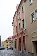
Residential building and former inner courtyard with colonnades, in closed development | Große Brüdergasse 1 (map) |
Around 1720 | Significant in terms of the building history and the street scene, with a slight central projectile, plaster ashlar on the ground floor, triumphal arch-like portal with keystone, emphasis on the first floor with window crowning with coat of arms, metal door, remains of the original staircase, vault |
09251069 |
 |
Residential building with shop in closed development | Große Brüdergasse 6 (map) |
Around 1750 | Significant in terms of architectural history, the central projection is emphasized by staggering, the first floor is emphasized by the crowning of windows, colossal pilaster, vault, door marked with AR |
09251068 |
 More pictures |
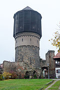
Water tower | Große Brüdergasse 7 (map) |
1877 | Significant in terms of building history and technology. Water tower with a cylindrical flat-bottom container and an Intze I container on top. Built in 1877 in the ruins of the Franciscan monastery church of St. Marien, which burned down at the end of the 16th century. Installation of a 320 m³ flat bottom container. Diameter 9 m, height 5 m. Around 1905 heightened the tower with a 1000 m³ container of the Intze I type. Diameter 13 m, height 8.75 m. A hanging truncated cone and an inner spherical segment form the support base of the Intze I container. The tower reaches a height of around 39 m. In 1936, the tank was clad with horizontal wooden boards, presumably due to corrosion of the reinforcement on the outer Monier cladding, and received its current appearance. Until it was closed in 1977, Alte Wasserkunst pumped spring water into the elevated tank. The water supply of Bautzen was then taken over by the Sdier waterworks. The cylindrical tower shaft consists of quarry stone masonry made of Lusatian granite. Above it is a smoothly plastered and protruding floor, which is limited at the bottom by a circular arched frieze and at the top by regularly arranged consoles and indicates the location of the flat-bottom container. Then the wooden cladding of the Intze container, which is polygonal in plan. With its height and the distinctive conical roof dome, the tower has a significant impact on the cityscape. Due to its capacity, the water tower is one of the largest Intze I water towers in Saxony. |
09251155 |
 More pictures |
Ruins of the monk's church and the remains of the Franciscan monastery with enclosure wall | Große Brüdergasse 7 (Hohengasse 2) (map) |
1441 (monastery church); around 1240 (monastery) | Historically and structurally significant.
Gothic ruin, the effect of which is particularly impaired in the western part by the water tower from 1878/93. Franciscan monastery founded around 1240, building indulgences in 1248. 1401 Destroyed by fire. In the following period restoration of the church and extensive renewal of the enclosure. The extended and vaulted church was consecrated in 1520. The church and monastery burned down in 1598 and have been in ruins since then. From the two-aisled, eight-bay monastery church with a straight choir closure, remnants of the north wall with buttresses, pointed arched windows and vault beginnings inside. The wall parts of the older western yokes made of quarry stone with brick structures from an initially smaller, single-nave building, probably from the 13th century, the eastern yokes made of brick from an extension of the church in the 15th century. The large pointed arch portal with rich profiling and eyelashes is remarkable. Smaller components such as B. a mask capital, 1st half of the 14th century, in the city museum, Bautzen. |
09251032 |
 |
Residential building in closed development | Große Brüdergasse 8 (map) |
Around 1800 | Significant in terms of building history and urban development, elongated dormer window, requirement to do justice to the style of the street in the case of new construction |
09251067 |
 More pictures |
Residential building in closed development | Große Brüdergasse 12 (map) |
Around 1480 | Architecturally and historically important, with late Gothic vaults |
09251065 |
 More pictures |
Residential building in closed development | Große Brüdergasse 14 (map) |
Around 1600 | Architecturally important, with arched portal, vault |
09251064 |
 More pictures |
House in a corner and in a semi-open development | Große Brüdergasse 16 (map) |
1957 | Architecturally important, construction method adapted to the street, emphasis on the ground floor with rounded window portals |
09251063 |
 |
Residential building in closed development | Große Brüdergasse 18 (map) |
Around 1780/1800 | Significant in terms of the building history and the appearance of the square, simple portal with keystone |
09251037 |
 More pictures |
Residential building in closed development | Große Brüdergasse 20 (map) |
Around 1800/1820 | Significant in terms of building history and the appearance of the square, with twin windows |
09251036 |
 More pictures |
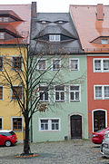
Residential building in closed development | Große Brüdergasse 22 (map) |
Around 1780 | Architecturally important, portal with keystone |
09251035 |
 More pictures |
Residential building in closed development | Große Brüdergasse 24 (map) |
Around 1720 | Significant in terms of building history and the appearance of the square, with sloping pillars at the corner of the house, portal with keystone |
09251034 |
 |
House in a corner and in a semi-open development | Große Brüdergasse 26 (map) |
17th century | Significant in terms of building history and the appearance of the square, the half-hip roof |
09251033 |
 |
Residential house in corner location and in closed development | Hauensteingasse 2 (map) |
After 1720 | Formerly Conditorei / Café Lehmann, historically and urbanistically important, simple plastered structure facing Hauensteingasse, rich plastered structure facing Wendische Strasse, central emphasis through the entrance portal and crowning of windows on the first floor, vaults |
09250885 |
 |
House with shop in a corner | Hauensteingasse 5 (map) |
Marked 1894 | Structurally and in terms of town planning, it is of importance, clinker brick construction, sandstone window frames |
09250615 |
 |
Residential building with a shop area, in a corner | Hauensteingasse 6 (map) |
Around 1890 | Neo-Baroque facade, of importance in terms of building history and urban development |
09250614 |
 More pictures |
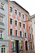
Residential building with a shop area, in a corner |
Hauptmarkt 1 (map) |
Around 1850/1860 | Significant in terms of building history and the appearance of the street |
09250605 |
 |
Residential house in closed development (Golden Book) | Hauptmarkt 2 (map) |
After 1709; 1785 (rebuilt) | Baroque house of historical importance, building was an inn |
09250604 |
 More pictures |
Goldener Adler inn | Hauptmarkt 4 (map) |
1504 and later | Structurally, historically and in terms of the plaza, the building was an inn at the end of the 18th century |
09250603 |
 |
House (The Towel ) | Hauptmarkt 5 (map) |
1408 (in the core) | Architecturally and historically important, inside Gothic remains, inscription: "This house, called Das Handtuch, was built around 1480" |
09250602 |
 More pictures |
Residential building with city pharmacy | Hauptmarkt 6 (map) |
1542 | Renaissance building with a baroque facade, of architectural and local significance |
09250601 |
 |
Residential building with a shop area | Hauptmarkt 7 (map) |
Around 1730 | Baroque town house, of importance in terms of architectural history, artistry and the appearance of the square |
09250600 |
 More pictures |
House in a corner | Hauptmarkt 8 (map) |
Around 1720 | Baroque town house, of importance in terms of building history and character of the square |
09250599 |
 |
Residential building with a shop area | Hauptmarkt 9 (map) |
1760 | Baroque town house, of importance in terms of building history and the appearance of the streets |
09250598 |
 |
Residential house with two shop fittings, in closed development | Heringstrasse 3 (map) |
Before 1636 | Significant in terms of architectural history and urban development, early baroque building, emphasis on the center with plaster relief and portal, vault with keystone |
09250991 |
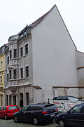 |
Residential house in semi-open development | Heringstrasse 4 (map) |
Around 1750 | Architecturally important, central emphasis by bay windows, above balcony, vault |
09251051 |
 |
Residential building in closed development | Heringstrasse 5 (map) |
1600/1630 | Architecturally and urbanistically important, with vaults on the ground floor |
09250992 |
 |
Residential building with café and restaurant Zur Altstadt, in a closed area | Heringstrasse 6 (map) |
Around 1750 | Structurally and in terms of urban development, it is of importance, on the ground floor plastering ashlars, emphasis on the first floor with window crowning and vaults |
09251052 |
 |
Residential building in closed development | Heringstrasse 7 (map) |
Around 1750 | Significant in terms of building history and urban development, emphasis on the center through twin windows and triangular gables on the first floor, vaults |
09250993 |
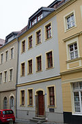 |
Residential building in closed development | Heringstrasse 8 (map) |
Around 1720 | Former shoe repairer E. Wenk, of architectural and urban significance, portal, old door, ledge above the ground floor, vault |
09251053 |
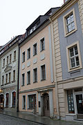 |
Residential building in closed development | Heringstrasse 9 (map) |
Around 1720 | Architecturally and urbanistically important, with original portal, vault |
09250994 |
 |
Residential house in corner location and in closed development | Heringstrasse 10 (map) |
Around 1710 | Significant in terms of architectural history and the appearance of the street, with mighty corner pillars (because of the hillside location), door portal with keystone, vault |
09251054 |
 |
Residential building in closed development | Heringstrasse 11 (map) |
Around 1720 | Significant in terms of building history and urban development, with plastered cuboids on the ground floor, arched portal with keystone, original grille in front of the skylight, central accentuation by means of a central projectile and plastered cuboids, above balcony with original railing, keystone over windows in the central part, vault |
09250995 |
 |
Residential house (formerly Gasthaus Goldenes Lamm) in a corner location as well as a former sheepfold and parts of the enclosure in the rear part of the parcel | Heringstraße 12 (main address: Hohengasse 16) (map) |
Marked with 1726 (house); 1st half of the 19th century (sheepfold) | Representative building, of architectural and local significance. Former sheepfold (Heringstraße 12): one-storey building made of quarry stone, partly plastered, mansard roof with forelock, five oculi on the back of the building, today a restaurant. |
09251025 |
 |
Residential building with later shop installation, in closed development | Heringstrasse 13 (map) |
Around 1720 | Significant in terms of building history and urban development, emphasis on the center through bay windows and entrance door, vaults |
09250996 |
 |
Residential building in closed development | Heringstrasse 15 (map) |
1723 (?) | Then to the south the monk's bastion, historically significant, with side emphasis through the entrance door |
09250997 |
 More pictures |
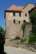
Mönchsbastei : tower-like building adjoining No. 15 to the south, reaching as far as Mühltorgasse (individual monument to ID No. 09301008) | Heringstrasse 15 (map) |
14th Century | Individual monument of the urban fortifications as a whole; of importance in terms of local history and building history |
09250507 |
 |
Residential building in closed development | Heringstrasse 17 (map) |
Around 1750 | Significant in terms of building history and urban development |
09250998 |
 |
Residential house in semi-open development | Heringstrasse 19 (map) |
Around 1750 | Architecturally and in terms of town planning, it is of importance, with a central projection and vault |
09250999 |
 |
Residential building in closed development | Hintere Brüdergasse 4 (map) |
Early 19th century | Architecturally important, portal with keystone |
09251074 |
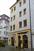 |
Residential house with restaurant Zum Karasek, in a corner | Hintere Reichenstrasse 2 (map) |
Before 1634 | Structurally and historically of importance, plaster structure, ledge above ground floor, corner accentuated by plaster ashlar |
09250891 |
 |
Residential building in closed development | Hintere Reichenstrasse 4 (map) |
After 1720 | See also Reichenstrasse 5, object 09250609, of architectural and urban significance, plaster structure, keystone above windows and door, vaults |
09250892 |
 |
Residential building in closed development | Hintere Reichenstrasse 6 (map) |
After 1709 | Architecturally important, simple facade design |
09250893 |
 |
Residential house with three entrances, in closed development | Hintere Reichenstrasse 8 (map) |
After 1709 | Architecturally important, simple facade design |
09250894 |
 |
Residential building in closed development | Hintere Reichenstrasse 10 (map) |
After 1720 | Architecturally important, shutters on the ground floor |
09250895 |
 |
Residential house with a former shop fitting in a closed development | Hintere Reichenstrasse 11 (map) |
After 1800 | Architecturally and urbanistically important, baroque town house with a simple plaster structure |
09250905 |
 |
Residential house with a former restaurant Kleiner Fuchs in closed development | Hintere Reichenstrasse 12 (map) |
18th century | Architecturally important |
09250896 |
 |
Residential building in closed development | Hintere Reichenstrasse 14 (map) |
2nd half of the 18th century | Architecturally important |
09250897 |
 |
Residential house with shop fitting and former workshop, in closed development | Hintere Reichenstrasse 15 (map) |
Around 1880 | Significant in terms of building history and urban development, plaster structure, window crowning, tooth frieze, original door, workshop (Müller plumber) |
09250904 |
 |
Residential building in closed development | Hintere Reichenstrasse 16 (map) |
Around 1850 | Significant urban development, with former loading ramp (Helwig & Schönborn) |
09250898 |
| Residential house in corner location and in closed development | Hintere Reichenstrasse 17 (map) |
Around 1885 | Significant in terms of building history and the appearance of the street, plaster structure |
09250903 |
|
 |
Residential building in closed development | Hintere Reichenstrasse 18 (map) |
Around 1870 | Architecturally important |
09250899 |
 |
Residential building in closed development, with a Kester hall on the ground floor | Hintere Reichenstrasse 22 (map) |
Around 1900 | Architecturally important, simple facade design |
09250900 |
 |
Residential house with three entrances, in closed development | Hintere Reichenstrasse 24 (map) |
After 1740 | Significant in terms of building history and urban development |
09250901 |
 More pictures |
Ruins of the monk's church and the remains of the Franciscan monastery with enclosure wall | Hohengasse 2 (main address: Große Brüdergasse 7) (map) |
1441 (monastery church); around 1240 (monastery) | Historically and structurally important, see Große Brüdergasse 7 |
09251032 |
 |
House in a corner and in a semi-open development | Hohengasse 4 (map) |
Around 1890 | Significant in terms of building history and urban development, slightly arched structure |
09251031 |
 |
Residential building in closed development | Hohengasse 5 (map) |
1770/1780 | Architecturally important |
09251061 |
 |
Residential building in closed development | Hohengasse 6 (map) |
Around 1890 | Architecturally and urbanistically important, ledge above ground floor |
09251030 |
 |
Residential house with shop fitting, in closed development | Hohengasse 7 (map) |
Around 1750 | Significant in terms of building history and urban development |
09251060 |
 |
Residential building in closed development | Hohengasse 8 (map) |
Around 1890 | Significant in terms of building history and urban development, with a slight emphasis on the middle |
09251029 |
 |
Residential building in closed development | Hohengasse 9 (map) |
Around 1720 | Architecturally important, with pilasters, portal, windows on the ground floor with bars or arched shutters, ledge above the first floor, loft extension, vault |
09251059 |
 |
Residential building in closed development | Hohengasse 10 (map) |
1st half of the 18th century | Architecturally important, central emphasis by portal with keystone, emphasis of the first floor by donkey back above windows, vaults |
09251028 |
 |
Residential building in closed development | Hohengasse 11 (map) |
Around 1750 | Architecturally important, central emphasis by portal and door, skylight with wooden gables, vault |
09251058 |
 |
Residential building in closed development | Hohengasse 12 (map) |
1st half of the 18th century | Architecturally and artistically of importance, side emphasis by entrance door with portal, above crowns with medallion relief (with initials IH and HR), sandstone walls with relief |
09251027 |
 |
Residential building in closed development | Hohengasse 13 (map) |
Around 1750 | Architecturally important, original portal, old door, ledge above the first floor, vault |
09251057 |
 |
Residential building in closed development | Hohengasse 14 (map) |
Around 1750 | Architecturally important, side emphasis by entrance door with arched portal and keystone, vault |
09251026 |
 |
Residential building in closed development | Hohengasse 15 (map) |
Around 1720 | Architecturally important, stucco on the first floor, old door, vault |
09251056 |
 More pictures |
Residential house (formerly Gasthaus Goldenes Lamm) in a corner location as well as a former sheepfold and parts of the enclosure in the rear part of the parcel | Hohengasse 16 (Heringstrasse 12) (map) |
Marked with 1726 (house); 1st half of the 19th century (sheepfold) | Representative building, of architectural and local significance. Residential building Hohengasse 16 with portal, coat of arms, pilasters, keystones above windows on the ground floor and above entrances, vaults. |
09251025 |
 |
Residential building in closed development | Hohengasse 17 (map) |
Around 1720 | Architecturally important, vaults |
09251055 |
 |
Apartment house in a corner | Holzmarkt 1 (map) |
Around 1900 | Significant in terms of building history and urban development, symmetrical structure, emphasis on the corner with two differently shaped corner bay windows and gable, entrance door on the corner and side. Deletion in 2007 (partial renovation with plastic windows, simple construction with insufficient monument value). After a renewed inspection of the property, the view of the value of the building changed, as the interior was still largely original (in the stairwell: historic floors with colored tiles and large-format rectangular granite slabs in the entrance area, original apartment doors on all floors, banisters from the period with wooden handrails, granite steps). External facade with vertical structure and consistently preserved conventional proportions, corner emphasis (only the tower attachment is missing), original house entrance door, unsuitable shop fitting on the ground floor. |
09250770 |
 |
Apartment building in closed development | Holzmarkt 3 (map) |
Late 19th century | Architecturally and historically important in terms of urban development, nine-axis building, structured on the upper floor by pilasters |
09250771 |
 |
Residential house in semi-open development | Holzmarkt 4 (map) |
2nd half of the 19th century | Significant in terms of building history and urban development, symmetrical structure, emphasis on the middle, emphasis on the windows on the first floor through crowning, column-like design on the ground floor |
09250731 |
 |
Tenement house with a shop area, in a closed area | Holzmarkt 5 (map) |
Late 19th century | Significant in terms of building history and urban development, asymmetrical structure, bay window above large, arched entrance gate, above small entrance triangular gable with dating, below plaster relief (mural with Bautzen motif) |
09250772 |
 |
Residential building in closed development | Holzmarkt 6 (map) |
Around 1895 | Structurally and historically important, symmetrical facade design from the first floor, plaster ashlar on the ground floor, plaster relief (wreaths), original door |
09250732 |
 |
Residential building with shop fittings | Holzmarkt 8 (map) |
Around 1885 | Significant in terms of building history and urban development, simple plaster structure, winter windows, plaster ashlar on the ground floor |
09250733 |
 |
Apartment building in a corner and in a closed development | Holzmarkt 13 (map) |
Around 1895 | Significant in terms of building history and urban development, the corner is emphasized by the original balcony railing and the window crowning |
09250740 |
 |
Rear building with gate and gate entrance, in closed development | Holzmarkt 15 (map) |
Around 1890 | Architecturally important, former Hermann Franke office, gate entrance with saying: “Theory is part of practice, knowledge is part of action”, ceiling and wall painting, “For cattle trade”, gate |
09250739 |
 |
Tenement house with three entrances, in closed development | Holzmarkt 21, 23, 25 (map) |
1895/1896 | Significant in terms of building history and urban development history. Central emphasis by stepped gables, balconies with original railings, remains of a continuous balcony on the first floor, fluted supports, side emphasis by small pointed gables, spiral staircase (original iron construction, wooden steps), plus a table: “This staircase was conceived by Hermann Puy, engineer Wilk in Eisenach did it. Bautzen, in 1896. Xaver Mauerer “, original apartment doors, winter windows on staircase windows, metal shutters inside. |
09250736 |
 |
Residential house in closed development with gate entrance, back building (horse stables), barn in the back yard (today workshop) | Holzmarkt 27, 29 (map) |
Around 1880/1890 | Residential house with gate entrance, of architectural and urban development historical importance, interesting facade design, triangular window crowning with relief on the second floor, seven-axis, emphasis on the central axis, mansard roof, side emphasis by gable, saying in the weathered plaster relief of the front facade: "Only through work, to work is no one surplus ”, house partly used by driving school, changes in the 30s, the back buildings belong to Holzmarkt 29 according to ALK data |
09250735 |
 More pictures |
Administration building (formerly Gewandhaus ) with Gasthof Ratskeller, in a corner and in closed development | Innere Lauenstrasse 1 (map) |
1476, originally late Gothic | Architecturally and historically important, with corner core, emphasis on the middle due to the slightly protruding structure, emphasis on the second floor with high windows with arched portal, pilaster and balcony, triangular gable, ashlar on the ground floor |
09251092 |
 More pictures |
Residential house in corner location and in closed development | Innere Lauenstrasse 2 (map) |
1720/1724 | Significant in terms of architectural history and the appearance of the street, portal with Corinthian pilasters |
09250987 |
 |
Residential house with shop fitting, in a corner location and in closed development | Innere Lauenstrasse 3 (map) |
1709-1720 | Architecturally important, simple facade design, opulent door frames (portal), original components in the stairwell, various vaults, stone floor |
09250925 |
 More pictures |
Residential house with shop fitting, in closed development | Innere Lauenstrasse 4 (map) |
1720/1740 | Significant in terms of building history and the appearance of the street, on the ground floor lateral emphasis, central emphasis through window crowning, pilasters, portal with triangular gable, Gothic spiral staircase |
09250986 |
 |
Residential and commercial building in closed development | Innere Lauenstrasse 5 (map) |
19th century, older in essence | Architecturally important, simple facade design, ground floor with mezzanine, both emphasized by cast-iron pillars with rich reliefs |
09250926 |
 More pictures |
Residential house with shop fitting, in closed development | Innere Lauenstrasse 6 (map) |
1709/1720 | Baroque town house with a very elaborately designed facade, of importance in terms of building history, architecture and the street scene, with rich plaster relief, central accentuation by triangular gables as crowning of windows on the second floor, with false parapets in the plaster, interior stucco ceilings |
09250985 |
 |
Residential house with shop fitting, in closed development | Innere Lauenstrasse 8 (map) |
1720/1740 | Baroque town house, of importance in terms of building history, architecture and street scene, emphasis on the center, structure of the pilasters, very rich plaster relief with two busts (Mars and Mercury) |
09250984 |
 |
Residential house with shop fitting, in closed development | Innere Lauenstrasse 10 (map) |
Around 1720 | Architecturally important, central projecting, plaster ashlar, portal with beehive, crowning of windows |
09250983 |
 |
Residential house with shop fitting, in closed development | Innere Lauenstrasse 12 (map) |
1750 | Architecturally important, installation of the former dairy shop |
09250982 |
 More pictures |
Lauenturm with relief (individual monument for ID no.09301008) | Innere Lauenstrasse 14 (map) |
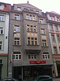
1400/1403 (tower); 1739 (hood); 1912 (relief) | Individual monument of the urban fortifications as a whole; shaping the townscape, of local and architectural importance, gate tower with baroque hood, relief by Hauschild (inscription: "To King Albert of Saxony. The grateful Bautzen") |
09250981 |
 |
Residential and commercial building in closed development | Karl-Marx-Strasse 1 (map) |
1926 | Significant in terms of building history and urban development, central emphasis by bay windows with plaster relief (expressionistic), triangular gable with owl on top, ceiling painting in the hallway (new) |
09250637 |
 |
Residential and commercial building in closed development | Karl-Marx-Strasse 3 (map) |
1911 | Significant in terms of building history and urban development, emphasis on the center with arched bay windows, rich plaster relief on it, above a balcony with original railing, loft extension, plaster ornamentation, structure of the facade by pillars |
09250638 |
 |
Residential and commercial building in closed development | Karl-Marx-Strasse 5 (map) |
1911/1912 | Significant in terms of building history and urban development, to the side: arched bay window on rich plaster relief, curved gable (neo-baroque) |
09250639 |
 |
Semi-open residential and commercial building | Karl-Marx-Strasse 6 (map) |
1911/1912 | Significant in terms of building history and urban development, central emphasis by bay windows with rich plaster ornamentation, above bay windows with columns, side emphasis by balconies, above the second floor emphasis by small attached roof, rich plaster relief on the loft, roof windows set back on both sides, roof closure by three arched roof windows, original stair railing, marked with R (in grid above portal) |
09250635 |
 |
Residential and commercial building in closed development | Karl-Marx-Strasse 7 (map) |
1911/1912 | Significant in terms of building history and urban development, emphasis on the center through the structure of the plaster, gable, side emphasis through bay windows, above balcony, plaster relief on the third floor and in the gable |
09250640 |
 |
Residential and commercial building in closed development | Karl-Marx-Strasse 8 (map) |
1911 | Significant in terms of architectural history and urban development, central emphasis by bay windows on the first floor and balconies above, side emphasis by bay windows on the second and third floors, loft extension and triangular gable, horizontal plaster relief over the first floor, vertical plaster relief on the second and third floors (bay window) and in the attic extension, original Balcony railing, original entrance door, with skylights made of colored glass (depicting motifs from the music), ceiling painting, original shop entrance (owner: Jeremias) |
09250634 |
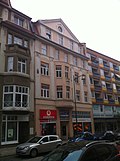 |
Residential and commercial building in closed development | Karl-Marx-Strasse 9 (map) |
1911/1912 | Significant in terms of building history and urban development, lateral emphasis by arched bay windows with plaster relief, triangular gable (on the side), round window with plaster relief |
09250641 |
| Residential and commercial building in closed development | Karl-Marx-Strasse 10 (map) |
Around 1910 | Significant in terms of building history and urban development, side emphasis by bay windows, two-tone plaster structure, rich plaster relief on the third floor and in the curved gable, with original door and wall painting in the stairwell |
09250633 |
|
 |
Residential and commercial building in closed development | Karl-Marx-Strasse 12 (map) |
Around 1910 | Significant in terms of building history and urban development, two-tone plaster structure, plaster relief, pillars on the first floor, side accentuated by bay windows, loft extension, above small tower, labeled AK (in the window frames) |
09250632 |
 |
Residential and commercial building in closed development | Karl-Marx-Strasse 14 (map) |
Around 1910 | Significant in terms of building history and urban development, two-tone plaster structure, plaster relief, side accentuation by bay windows, large triangular gable |
09250631 |
 |
Residential and commercial building in closed development | Karl-Marx-Strasse 15 (map) |
1910/1912 | Significant in terms of building history and urban development, central emphasis by bay windows, above pointed gable (central emphasis by columns between windows), ten-axis facade, plaster ornaments between the first and second floors in the bay window, on the third floor on the side |
09250642 |
 |
Residential and commercial building in closed development | Karl-Marx-Strasse 16 (map) |
Around 1910 | Significant in terms of building history and urban development, two-tone plaster structure, plaster relief between the third and fourth floors, loft conversion, roof end with small pointed skylight |
09250630 |
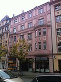 |
Residential and commercial building in closed development | Karl-Marx-Strasse 18 (map) |
Around 1910 | With an elaborate façade, of architectural and urban significance, symmetrical construction with side accentuation by arched bay windows, above balconies, plaster relief |
09250629 |
 |
Residential and commercial building in closed development | Karl-Marx-Strasse 20 (map) |
1910/1915 | With an elaborate facade, of architectural and urban significance, symmetrical construction, sides with protruding oriels emphasized, atlantic figures, original railings, plaster reliefs and ornaments |
09250628 |
 |
Residential and commercial building in closed development | Karl-Marx-Strasse 22 (map) |
Around 1910 | Significant in terms of building history and urban development, the floor plan is slightly rounded, the sides are emphasized by the balconies and plaster blocks, the entrance with the original door, the side tile design (tile painting and tile art nouveau ornamentation) |
09250627 |
| Stone fountain on the ground floor of the apartment building (apartment building not a monument) | Kesselstrasse 3 (map) |
Around 1890 | Architecturally important, the floors are subdivided by ledges, original window frames.
|
09250924 |
|
 |
Residential building with gate and passage (with vault) | Kesselstrasse 5 (map) |
Mid 17th century | Architecturally important, middle of the 19th century, core older, ground floor partly with original late Gothic vault, today renovated with the move of an underground car park |
09250912 |
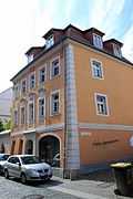 |
Residential house with built-in shop, in corner location and in half-open development | Kesselstrasse 11 (map) |
1701 | Significant in terms of architectural history and the appearance of the street, baroque town house with slightly arched facade, baroque plaster reliefs (mid-17th century) |
09250914 |
 |
Residential building with shop fittings and gate | Kesselstrasse 15 (map) |
Around 1800 | Architecturally important, two elongated dormers lying one above the other on the roof |
09250917 |
 |
Residential building with shop fitting, in closed development (Musikhaus FG Löbner) | Kesselstrasse 16 (map) |
Around 1870 | With built-in shop, historically important, two-story town house, windows with round arches on the ground floor, horizontal emphasis by two ledges between the ground floor and the first floor |
09250922 |
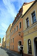 |
Residential building in closed development | Kesselstrasse 18 (map) |
17th century | In terms of building history, house history and urban development, it is of importance, Renaissance town house with simple facade design, wooden roof extension |
09250921 |
 |
Residential house with gate and supporting pillars, in corner position and in half-open development | Kesselstrasse 32 (map) |
After 1700 | Architecturally important, baroque warehouse |
09250919 |
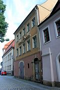 |
Residential house with gate in a semi-open development | Kesselstrasse 34 (map) |
After 1720 | Architecturally significant, baroque town house with emphasis on the middle: crowning of the middle windows with a halo (second floor), first floor with arched gable and medallion “M”, large portal on the first floor, entrance door with keystone |
09250918 |
| Residential house in corner location and in closed development | Kirchgasse 1 (map) |
Mid 18th century | Of architectural significance, asymmetrical roof shape, oculus, until 2008 erroneously listed under number 2 in the list of monuments |
09250790 |
|
 More pictures |
Guest house in semi-open development | Kirchplatz 1 (map) |
1709 | Significant in terms of building history and local history and shaping the square, symmetrical building with a protruding central section, there on the sides entrance portals, on the right with keystone, groin vault |
09250789 |
 |
Residential building in closed development | Kirchplatz 2 (map) |
Around 1820 | Significant in terms of architectural history and the appearance of the square, symmetrical construction, entrance portal in the middle (with keystone), stairs in front of it |
09250791 |
 |
Residential building in closed development | Kirchplatz 3 (map) |
Around 1780/1790 | Significant in terms of building history and the appearance of the square, symmetrical construction, central entrance portal, frontal staircase, symmetrical support pillars |
09250792 |
 |
Residential house with restaurant “Am Kornmarkt”, in half-open development | Kirchplatz 5 (map) |
Early 19th century | Significant in terms of building history and character of the square, symmetrical floor plan, hipped roof, dormers |
09250793 |
 More pictures |
Catholic Church of Our Lady | Kirchplatz 6 (map) |
Remains probably 13th century (church); 1443 (new consecration); 1455 (altar consecration) | Structurally, historically and locally of importance, four-bay nave with 3/8 choir closure, plastered, surrounded by buttresses, three-storey tower with attached staircase on the north side, curved hood with onion lantern, porch on the south side, entrance hall on the west side, pointed arched windows on the ship with tracery, neo-Gothic rose window in the west
|
09250029 |
 |
Residential house and back building, in closed development | Kleine Brüdergasse 5 (map) |
Marked 1789 in the keystone | Architecturally important, town house with large portals, keystones above entrance door and gate as well as portal added later, ledge above ground floor, original entrance door and gate, vault |
09251070 |
 |
Residential house and back building, in closed development | Kleine Brüdergasse 6 (map) |
Around 1720 | Architecturally important, slightly convex facade, narrow portal, original staircase, vault |
09251071 |
 More pictures |
Saxon post mile pillars (totality); Post mileage |
Kornmarkt (opposite the museum entrance) (map) |
1725 | Remnants of a full-mile column, of importance for traffic and local history, granite obelisk, marked 1725, torso without base and top, inscriptions "AR / Budis / sin ½ M 1725" with post horn, "Schwein / erden 3 ¼ M 1725" with post horn and row number 76 , Tip incorrectly restored. Remnants of a Saxon full-mile column made of Upper Lusatian granite, row number 76, originally set up on "Hohen Straße" (section Kamenz-Bautzen). It reads "AR / Budis / sin ½ M 1725" with post horn, "Schwein / erden 3 ¼ M 1725" with post horn. The units of measurement were falsified during an earlier restoration, they should be "St.". The base and top section are improperly added. The remnant was discovered in 1936 in the eastern border wall of the Nikolaistufen. Carved out of the wall in 1937/39, built into the wall again in 1945 and finally removed from the wall in 1957 and incorrectly restored and re-erected by the sculptor Thieme. |
09250250 |
 More pictures |
Museum building in a corner location and half-open development with a savings bank extension (Schulstrasse) as well as six sandstone tombs of Baroque and late Baroque origin in front of the eastern gable wall of the house at Kesselstrasse 34 ( City Museum ) | Kornmarkt 1, 1a (map) |
Inscribed 1910–1912 (museum); 1930–1932, marked with in the stairwell (Sparkasse) | Architecturally, historically and artistically of importance, museum built according to the designs of City Planning Officer Göhre and City Planning Director Richard Görling, horseshoe-shaped floor plan, four-story building with asymmetrical structure, ground floor and first floor with ledges from the second floor continuously closed, second floor mezzanine-like, above mansard floor, building interrupted by a protruding structure above the entrance, accentuated by window frames extending over two floors, above round gable end, side accentuation by risalit (stepped on the ground floor, on the first and second floors continuous window walls and overlying round gable end), on the corner balcony with woman sculpture, savings bank attached to the museum along the Schulstraße, 1930–32, three-storey massive building with loft extension and clock tower, facade especially on the ground floor subdivided by profiled frames of the windows to the base, entrance portal in the clock tower, inside the original staircase with handrails and doors preserved from the construction period, as well as a hall with wall and ceiling cassette on the second floor and a skylight hall |
09250583 |
| Residential building with shop fittings in a corner and closed development | Kornmarkt 2 (map) |
1830 | Of architectural and urban significance, classicist town house, double ledge above the ground floor, pilasters between the first and second floors, triumphal arch-like windows on the first floor, arched windows on the second floor, crenellated frieze with relief flowers in between under the eaves |
09250934 |
|
 |
"Weintraube" house and restaurant in a corner | Kornmarkt 3 (map) |
Marked 1762 | Example of reform architecture around 1910, enlivened by stylized neo-baroque design elements, well-known Bautzner restaurant, of architectural and local significance, mansard roof, crowned portals with relief including inscription, emphasized corner window on the first floor, relief inscription: "This house was built in 1762 by ... It was removed u. rebuilt in the war years 1915–1916 by Arthur Schreiber (architect or client?) " |
09250584 |
 |
Residential house with shop fitting, in semi-open development | Kornmarkt 9 (map) |
Around 1885 | Significant in terms of building history and urban development, emphasis on the center by portal and ornate round gable, bat dormers |
09251492 |
 |
Residential building with a shop area, in a corner | Kornstrasse 1 (map) |
Around 1860 | Classicist town house with a shop area, of importance in terms of building history and urban planning |
09250606 |
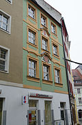 |
Residential building in closed development | Kornstrasse 2 (map) |
After 1720 | In terms of building history and urban development, it is of importance, central projection, further emphasis on the center through curved window gables and plaster reliefs |
09250911 |
 |
Residential house with shop fitting, in closed development | Kornstrasse 3 (map) |
Around 1880/1890 | Significant in terms of building history and urban development, simple facade design, emphasis on the ground floor through horizontal structure |
09250890 |
| Residential house with shop fitting, in closed development | Kornstrasse 5 (map) |
Around 1850/1880 | Significant in terms of building history and urban development, simple facade design |
09250888 |
|
| Residential house with shop fitting, in closed development | Kornstrasse 5a (map) |
1880/1890 | Architecturally and urbanistically important, seven-axis residential building, horizontal structure through a protruding roof over the first floor, vaulted, straight gable with a mansard roof and crenellated frieze, structure of pilasters |
09250889 |
|
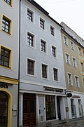 |
Residential house with shop fitting, in closed development | Kornstrasse 6 (map) |
18th century | Architecturally and urbanistically important, Renaissance town house with a simple facade design, remains of a late Gothic vault in the hallway |
09250909 |
 |
Apartment building in a corner location and in a closed development with a memorial plaque for Kurt Pchalek | Kurt-Pchalek-Strasse 1 (map) |
Around 1895 | Architecturally and locally of importance, corner bay with tower, plastered window frames |
09250682 |
 |
Apartment building in a corner and in a closed development | Kurt-Pchalek-Strasse 2 (map) |
Around 1885/1890 | Architecturally and urbanistically important, with a balcony, plaster structure, plastered window frames, original door |
09250683 |
 |
Apartment building in closed development | Kurt-Pchalek-Strasse 4 (map) |
Around 1890 | Architecturally important, simple plaster structure, original front door |
09250684 |
 |
Apartment building in a corner and in a closed development | Kurt-Pchalek-Strasse 5 (map) |
Around 1905 | Architecturally and urbanistically important, plaster structure, offset ledge above the ground floor, rounded corner with a curved ledge, skylight, strongly curved throat |
09250680 |
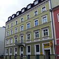 |
Apartment building in closed development | Kurt-Pchalek-Strasse 8 (map) |
Around 1880 | Significant in terms of building history and urban development, emphasis on the center through the balcony on the first floor, plaster ashlar on the ground floor, acroterion, frieze below the roof |
09250686 |
 |
Apartment building with a shop area in closed development | Kurt-Pchalek-Strasse 14 (map) |
Around 1895 | Significant in terms of architectural history and urban development, red brick building, emphasis on the middle with stacked balconies on top of each other, first floor with plastered structure, original door |
09250688 |
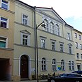 |
school | Kurt-Pchalek-Strasse 15 (map) |
1856 | Former commercial school, of architectural and local significance, symmetrical facade design, central projectile with triangular gable, stucco decoration |
09250678 |
 |
Apartment building in closed development | Kurt-Pchalek-Strasse 16 (map) |
Around 1885/1890 | Significant in terms of building history and urban development, plaster structure, original window coverings on the third floor |
09250689 |
 |
Apartment building in closed development | Kurt-Pchalek-Strasse 18 (map) |
Around 1885/1890 | In terms of building history and urban development, it is of importance, plaster structure, formerly Georg Schuster, decorative painting and paint shop |
09250690 |
 |
Tenement house with a shop area, in a closed area | Kurt-Pchalek-Strasse 21 (map) |
Marked in the weather vane with 1896 | From an architectural and urban point of view of importance, corner bay window with turret |
09250691 |
 |
Apartment building in closed development | Kurt-Pchalek-Strasse 25 (map) |
Around 1885 | Significant in terms of building history and urban development, simple facade design, original door, some original windows |
09250692 |
 |
Residential and commercial building in closed development | Kurt-Pchalek-Strasse 29 (map) |
Around 1910 | Significant in terms of building history and urban development, emphasis on the center with curved gables, segmental arched bay windows on the first and second floors, original plastering ashlar on the ground floor, portal with slipway, original door and gate, remnants of floral elements on the facade |
09250693 |
Deletions from the list of monuments
| image | designation | location | Dating | description | ID |
|---|---|---|---|---|---|
 |
Residential building in closed development | Gerberstrasse 8 (map) |
Facade painting in the 2nd half of the 19th century, older in the core | Of importance in terms of building history and urban planning; Removed from the list of monuments after 2014 |
09253073 |
| Residential house in open development | Hintergasse 1 (map) |
18th century | Structurally important; Removed from the list of monuments after 2014 |
09250974 |
|
 |
Residential house in open development | Back alley 3 (map) |
18th century | Structurally important; Removed from the list of monuments after 2014 |
09250973 |
| Garden shed | Hintergasse 6 (map) |
Late 19th century | Converted house, historically important; Removed from the list of monuments after 2014 |
09250533 |
|
 More pictures |
Domstiftliches Vorwerk: Ancillary building in closed development, later workshop installation (possibly forge) | Holzmarkt 7 (map) |
Around 1750 | The building once belonged to the Domstiftlichen Vorwerk (see also Töpferstrasse 40, Obj. 09250774 and Töpferstrasse 38, Obj. 09250004), of architectural and local significance, hipped roof with towers, workshop installation (2nd half of the 19th century), demolition permit for former blacksmiths from September 15, 2009; demolished between 2009 and 2014 |
09250773 |
| Residential house with built-in shop, in corner location and in half-open development | Kornmarkt 4 (map) |
Around 1850/1870 | Of importance in terms of building history and urban planning; Removed from the list of monuments after 2014 |
09250933 |
|
| Residential house with shop fitting, in semi-open development | Kurt-Pchalek-Strasse 1a (map) |
1st quarter of the 19th century | Architecturally important, two-story, half-hipped roof, crowning of windows, horizontal structure over the first floor by a ledge; demolished before 2008 |
09250681 |
Remarks
- This list is not suitable for deriving binding statements on the monument status of an object. As far as a legally binding determination of the listed property of an object is desired, the owner can apply to the responsible lower monument protection authority for a notice.
- The official list of cultural monuments is never closed. It is permanently changed through clarifications, new additions or deletions. A transfer of such changes to this list is not guaranteed at the moment.
- The monument quality of an object does not depend on its entry in this or the official list. Objects that are not listed can also be monuments.
- Basically, the property of a monument extends to the substance and appearance as a whole, including the interior. Deviating applies if only parts are expressly protected (e.g. the facade).
Detailed memorial texts
-
↑ city fortifications (totality); Outer city wall:
- Inner city fortifications: At the beginning of the 14th century, the inner city fortifications were completed, city wall approx. 2 m thick and 10 m high, 7–9 m wide kennel, two ditches and a wall between them, defensive towers, bastions and roundels
- Seven gates: Nicolaitor, Schülertor, Wendisches Tor, Inneres Reichentor, Inneres Lauentor, Fischerpforte, Mühltor
- Outer city fortifications: city wall approx. 5 m high and only partially provided with battlements or battlements, no kennel, two ditches and a wall in between. Eight gates: Gerbertor, Taschenpforte, Brick Gate, Outer Reichentor, Rosentor, Goschwitztor, Hortentor, Outer Lauentor with New Gate.
- History (source: Lorenz, Falk, Zetsch, Susanne: Die Wallanlagen in Bautzen. Unpublished seminar paper in the field of history of landscape architecture and garden monument preservation, TU Dresden 1998/99): 1002 first mention of the city fortifications, 1763 demolition of the bridges to the city gates and backfilling of the one in front lying ditch sections, from 1796–1801 the ditches from the Lauentor to the school bastion, demolition of the ramparts between the school bastion and the Reichentor, 1825 demolition of the outer Reichentor and the outer Lauentor, from 1830 demolition of the roundel of the inner city gates, 1852 breakthrough of the outer city wall, 1859-1861 Leveling of the northern part of the Lauenwall, 1868 demolition of the school bastion, from 1873 demolition of the rest of the Lauenwall, 1890–1892 demolition of the Königswall, 1894 demolition of the northern brick wall.
- Horticultural design: 1732 planting of the outer ramparts with linden and chestnut trees and setting up stone benches, 1859–1861 horticultural design of the northern part of the Lauenwall, from 1873 horticultural design of the rest of the Lauenwall according to plans by court gardener G. Krause from Dresden, in 1876 the facilities were retained the name "Promenaden", 1890-1892 horticultural design of the Königswall by the city gardener Karl Johann Friedrich Stolp, from 1945 severe destruction by the war, redesign of smaller parts.
-
↑ The entire Soviet-Polish military cemetery: the
aggregate of three military cemeteries with honorary groves and monuments, divided into three areas:- Area 1: Collective grave for 92 war dead (Russian-Polish grove of honor), place with memorial stone and slabs set into the floor, in front of the staircase
- Area 2: green area with small side staircases and memorial stone (no burials)
- Area 3: Collective grave for 3,053 war dead and 32 individual graves, Soviet grove of honor (see also individual monument 09250082, same address), of local history, cemetery with evenly arranged 32 tombstones for individually buried there, 515 m² collective grave with 15 tombstones and one in the middle standing monument, framed by brick pillars with simple iron railing, the entire system refers to the height of the ramparts (stairs)
-
^ Friedensbrücke: built
1908–1909 by the company Liebold & Co. Langebrück branch near Dresden according to plans by the Royal Road and Water Authority in Bautzen. Height 24 m above the floor of the Spree. The clear widths of the four cage arches are 27, 35, 35 and 27 m, the pillar widths are only 2.50 m. Over the arches, weight-minimizing relief arches were arranged, which could be read from the outside through a recessed profile of the front wall. The pillars are emphasized by the tapered substructures at the front and back, as well as rectangular pillar templates that originally ran through to the granite balustrade of the exit pulpit. Two coats of arms of the royal court sculptor Wilhelm Schreiber from Dresden adorn the apex of the eastern central arch: downstream the Bautzen coat of arms , upstream the Saxon coat of arms .
On April 20, 1945 the two western arches were blown up. Although the pillars were not wide enough for one-sided arch thrust, the eastern central arch remained. 1946-49 Reconstruction using the same construction method, widening the carriageway from 11.00 to 15.10 m between the railings with the help of a reinforced concrete girder grating, but dispensing with the relief arches and a corresponding profile of the front walls, so that the original arches are still used today are recognizable. 1998/99 Installation of a new, 20 cm thick reinforced concrete deck over the girder grating as a sealing girder.
The construction of the bridge significantly improved the road layout across the Spreetal, so the existing, very steep Spreetal crossings (Heilig-Geist-Brücke and Gerberstrasse / Seidauer Brücke) could now be avoided. It also allowed the city to grow westward. Within six years, around 2000 people have settled here in the “Neustadt”. Thanks to the successful architectural design, the most important bridge in Bautzen in terms of traffic technology blends in perfectly with the historic cityscape and shapes it at the same time. In addition, it is of importance in terms of technology and urban history.
July 3, 2000: The Friedensbrücke consists of four arched vaults and has a total length of 181 m. The western central arch spans the Spree, the eastern one the Fischergasse with clear widths of 35 m each. Arches 1 and 4 form the connection to the Spreetal slopes on both sides and each have a clear width of 27 m. The traffic width of the structure was originally 11 m, 7.5 m on the paved road and 1.75 m on the two raised walkways. When the two western arches were rebuilt in 1947-49, the bridge was widened so that it now cantilevers 2.18 m on both sides. This means that there is now a width of 15.1 m between the railings. The apex of the eastern central arch has decorative heraldic stones with a height of 2.75 m and a width of 1.75 m. The Bautzen coat of arms is located in the apex of the arch downstream and the coat of arms of Saxony in the upstream vertex. Originally, the same coat of arms was on the second central arch. The pillars carry natural stone parapets that are designed as pulpits. The visible surfaces of the structural parts from 1909 - the west abutment, the pillars 1 and 2 below the transom, the complete pillar 3 and arch 3 with the eastern front wall from approx. Apex, arch 4 and the east abutment - were Facing made of colored granite layered masonry, partly embossed. Pure blue-gray stone from the Demitz granite quarries was used for the base cornices, pillar covers, keystones and corbels and parapets. The bridge crosses Bundesstraße 6 and passes under the Spree and a municipal road. -
↑ St. Petri Cathedral (Dehio - Handbook of German Art Monuments / Saxony Volume 1):
Bishop's Church since 1921, co-cathedral since 1980. On the north side of the meat market, at the highest point in town, the Gothic hall church with baroque elements and a striking west tower. The oldest parish church in the city. Nothing has survived from the church built around 1000 under Bishop Eido (992-1015). Construction of the choir probably started in 1213, consecration in 1221. Construction of a square west tower began in the 2nd quarter of the 13th century in the transition style from Romanesque to Gothic, towards the end of the 13th century the plan was changed in favor of a double-tower facade, to which a three-aisled hall church presumably extends over three bays adjoined, the second and third floors of the south tower in the middle of the 14th century. Damage from fires and the Hussite War in the 15th century, extension to the east in 1456–63 and a fourth nave built on the south side. Probably in the second half of the 15th century, the choir was converted into a hall choir. At the end of the 15th century, the surrounding walls were raised; 1492–97 vaulting.
Used by Protestant and Catholic Christians since 1530, the rood screen is now dividing the denominations. Reconstruction after a fire in 1634. After another change of plan, only the south tower with polygonal storeys continued and completed in 1664 by Martin Pötzsch with a baroque spire. Modifications in 1786 and 1814. 1883–87 neo-Gothic design of the interior by Hermann Knothe-Seeck as well as construction of the Protestant sacristy and renovation of the western south portal according to plans by Konstantin Lipsius. Restorations 1950–55, 1986–89 (tower), 1994–95 (Protestant sacristy).
Ground plan: four-aisled hall church that bends south between the fourth and fifth yoke. The three original aisles flow into the hall ambulatory choir, the inner choir with a three-sided polygon, the ambulatory with a five-sided polygon. A second south aisle extends from the west over four bays, then to the east the Catholic vestibule and the two-bay Catholic sacristy. The tower complex to the west in front of the three original naves, the Protestant sacristy added to the south. Two lobbies on the north side of the church.
Outside: Mighty quarry stone building with ashlar elements, surrounded by buttresses. Very high gable roof with dormers, hipped over the polygonal choir. On the west side, the double tower facade was laid out in the basement, above only the six-storey south tower with Welscher dome, polygonal bay windows, lantern and pyramid point completely executed. A gable with baroque volute and vase attachments above the northern stump of the tower and central section. The protruding part in the basement is a fragment of the original single-tower facade, the simple pointed arched west portal with simple archivolts and gable, above which a pointed arch frieze delimits the floor. On the north side of the church two porches with a portal, on the roof of the western baroque half-gable with lion heads, volutes and pyramidal attachments. High, narrow tracery windows, which are particularly large on the younger south nave. Various epitaphs, some of which are figurative, on the outer walls, especially noteworthy is that for Heinrich Ernst von Nostitz († 1639), a full-length male figure whose right hand holds a sword.
Inside the narrow western tower hall with ribbed vaults and the tower stairs. The church interior is a bright, spacious hall with a surrounding choir, only divided by the low rood screen into the catholic east part in the elongated choir and the evangelical west part. The net vault of the three main naves, supported by slender octagonal pillars, with colored keystones, the evangelist John, Mary with Child, Peter and Paul as a relief in the choir, and the coats of arms of various cities that financed the reconstruction in the 17th century. The second south aisle, added later, has four bays and a powerful star vault. The evangelical sacristy with ribbed vault and two-sided end to the south. The catholic vestibule with star net vault, the catholic sacristy vaulted with cross ribs, above it three-bay singing gallery open to the choir, cross-vaulted, in the western yoke rich star vault. On the west side of the hall there are two-storey wooden galleries that extend into the side aisles, by Fritz Schumacher, 1908, the parapets with Art Nouveau motifs, the notable angel on the north side and the figure of Paul on the spindle of the spiral staircase. In the southwest the lavishly designed royal box, designed by Friedrich Hornuff, made by Christian Neumann in 1673/74, above the parapet adorned with cartouches, fruit cords, putti and masks, arched box openings with twisted columns in between that support a strong cornice. A crypt from 1657 is included in the vestibule on the north side of the nave, in front of the western yoke.
Furnishing:- Catholic part, choir: Baroque high altar with lateral columns and blown gable structure in Saxon marble after a design by Johann Benjamin Thomae, by Giovanni Maria Fossati, 1722. The excellently crafted sandstone figures by Johann Benjamin Thomae: in the basement Johannes the Baptist and Johannes the Evangelist, im Essay Bishop Benno, Archangel Michael, Bishop Donatus and four angels. The main panel depicting the handover of the keys and the gable painting, God the Father pressing the globe to his heart, by Giovanni Antonio Pellegrini. In front of the altar structure there is a sarcophagus-like altar table, in the cartouche the representation of the Trinity and the coat of arms of the dean Joh. Jak. Jos. Wosky von Bärenstamm, marked 1772. Elaborately carved choir stalls with particularly splendid flower and tendril motifs on the back walls, end of the 18th century. In the ambulatory on the north side a sacraments altar, originally in the sacristy, in its rococo shape looking like a jewel, with light arched architecture by Johann Hajek, 1783, wood, colored, the figures partially gilded. A sarcophagus-like altar table with a tabernacle and the Lamb of God, flanked by richly ornamented cartouches with reliquary containers. Pilasters and arches with angels, cross and anchor as symbols of faith and hope. On each side a confessional, on the left for men, marked by Peter and the rooster, on the right for women, with Magdalena and an ointment vessel. Neo-Gothic sandstone baptism with a high wooden lid. Painting depicting the handover of the keys in the style of the Narcarenes, originally intended for the high altar, by Wenzel Schwarz, inscribed 1885. On the south side of the ambulatory is the middle shrine of a late Gothic Marian altar and the cross altar, the former colored with gilding, in the middle Mary with the Christ child , left St. Nikolaus, on the right St. Bartholomew. The cross altar with beautifully structured, larger than life crucifix, linden wood, painted in color, by Balthasar Permoser, 1713/14. On the singing gallery Kohl organ, 1866, with a neo-Gothic, clearly outlined prospect. In the Catholic vestibule there are several elaborately crafted sandstone tombs: Martin Katmann von Mauruck († 1630), life-size relief of the cathedral chapter secretary with ruff, coat and breeches, from the workshop of Michael Schwenke from Pirna. Anna von Nostitz († 1642), colored, full-length relief of the deceased with clasped hands and open hair, the robe with a painted flower pattern. Achilles Praecipian von Soie († 1642), full-length representation of a knight in armor with armband, sword and command staff. Gregorius Katmann von Mauruk († 1644), the deceased kneels in prayer in front of a crucifix, including a large cartouche with an inscription. The tombs of the cathedral deans Johannes Basilius von Lichtenfeld († 1650) and Christoph Johann Reinhold von Reichenau († 1665), each with a full-length relief of the deceased in the priest's robe, the latter also with a bishop's staff and miter. Tomb of Petrus Franc. Langinus von Küfferberg († 1675) with a portrait relief of the dean in the priest's robe with Bible and crucifix in an oval frame with writing tape, above two angels holding a chalice.
- Evangelical part: In front of the bars from 1952, a simple modern altar. The wooden pulpit on a pillar on the north side, painted in white and gold, 1817, by Joh. Bernhard Voigt and Wilke. Baptism, iron art casting from Lauchhammer, 1850. In the south aisle on the east side of the soaring, three-storey epitaph altar by a sculptor from Zittau, the central fields framed by columns over angel consoles, side tendrils and cheeks with figurative and ornamental decorations, numerous Bible verses, wood, 1644, in the 19th century Century stone colored. In the lower field representation of the Last Supper, on the left flanked by Christ as a gardener, on the right Maria Magdalena. The main relief with figurative depiction of the crucifixion, the cheek on the left with Christ in Gethsemane, on the right the Entombment. On the third floor the resurrection, to the side angels with Christ's instruments of torture. The semicircular crown shows Christ as ruler of the world on the rainbow. On the north wall the Last Supper painting in the style of the Narcarenes by Wenzel Schwarz, 1887. In the south aisle there is a three-storey epitaph for Georg Mättig († 1650) made of wood, painted in color. The main relief is the resurrection of Christ, surrounded by decorative columns on angel consoles and inscription cartouches. The gable relief depicting the Last Judgment, framed by pilasters and ornament, crowned by an angel with a trumpet and a laurel wreath. Richly carved epitaph for Christoph Vitzthum von Eckstädt († 1688), painted in color. In the middle, two angels hold a laurel wreath with the Vitzthum coat of arms, framed by magnificent baroque tendril decorations and the sixteen ancestral coats of arms, a kneeling female figure below. Owl organ on the west gallery, 1909, Art Nouveau brochure by Fritz Schumacher, 1908. The crypt in the northern vestibule, presumably based on a design by Martin Pötzsch, the broad arch with an elaborately wrought iron grille in Baroque shapes. The wall above the arch is decorated by cornices and pilasters with lion heads. In the crypt two simple groin vaults, as keystones the coats of arms of the Bernauer and Henrici family, both marked 1657. Two sandstone grave slabs for council builder Martin Pötzsch († 1697) and his wife Dorothea nee. Sohr († 1697), formerly in the e diving cemetery, with a writing cartouche framed by scrollwork, acanthus and grapes, in the upper part of the left panel two hands made of clouds with a straight edge and angle, another hand measures a disc with a framed inscription with a compass. In the upper part of the second plate, two hands with flaming hearts coming out of clouds, with a tape above them.
-
↑ Strumpfwalke Fischergasse 22:
First mentioned in 1360 Tuchmacherwalke in the area of the Werkhaus der Neuen Wasserkunst (see Fischergasse 20) mentioned: Millworks that beats ("mills") finished fabric with hammers under running water, created by the felting of the fibers in the fabric named fulling fabrics. Around 1500 new construction or renovation. 1606 Compulsory withdrawal of the drapery mill belonging to a guild by the city council. (Partial) demolition for the construction of the New Water Art and a workshop for this. 1621 New construction of a canvas whale by a merchant on the property south of the Werkhaus. Reopened in 1686 as a hosiery after bad business. At the beginning of the 18th century it was owned by the city, it was verifiably leased to stocking and beret makers from 1702 to 1820, then sold to the same guild - it remained the owner and operator of the “Walk-Anstalt (...) for the manufacture of goods of the hosiery and beret-making trade ”into the 20th century. From 1847 onwards it was set up as a wool spinning mill on a lease basis for a few years, in 1887 after the sale and demolition of the second guild fulling mill on the Weinberg (near Kupferhammer), stocking mill in Fischergasse, the only one of its kind in Bautzen until 1907, afterwards contract laundry for “men’s and women’s wardrobe”, private evidence Managed from 1939 to 1991, today a residential building. Whale building from the early 17th century, probably a timber frame construction, rebuilt in 1729 as a solid structure by the city council. From the Spree, an artificial trench leads directly to the house, which was filled in in the 20th century. 1847 by the merchant Johann Gottfried Fabian conversion and extension of the fulling building for the establishment of a wool spinning mill above the fulling. After 1900 a free-standing brick chimney (broken off) on the southern front of the building, indicating a boiler system for the laundry. Two-storey solid building with a northern annex, plastered, wooden beam ceilings, gable roof with standing chair. Simple axes with upright rectangular windows. 1963 Extension of the attic for an apartment, caterpillars. Of economic significance. -
↑ Johann Georg Monument with Market Fountain:
The monument for which the Dresden professor Gustav Heine (1802–1880) provided the design, commemorates the end of negotiations between Bohemia and Saxony from 1635 to 1637 (date attached to the monument). The design was carried out by the Dresden sculptor Wilhelm Schwenk (1830–1871), who, in addition to the Bautzen monument, had already created the statue of Johann Georg I (1863) for Johanngeorgenstadt. The market fountain including the fountain figure is worthy of protection due to its artistic importance, which results from the high quality of the late classicist sculpture. At the same time, it is also significant in terms of urban history. On the one hand, it reminds of the fact that Lusatia belonged to Saxony in the form of a monument in the 19th century and, on the other hand, of the commissioning of the water pipe as an early modern engineering achievement by Wenzel Röhrscheidt in 1610. Since the old town of Bautzen was built on rock and so no spring - and groundwater was available, great importance has always been attached to the wells, which are rare in the cityscape. -
↑ Catholic Church of Our Lady (Dehio - Handbook of German Art Monuments / Saxony Volume 1):
The simple church stands on a small square outside the old town ring, east of the Reichenturm. Re-consecrated after damage in the Hussite War in 1443, tower hood attached in 1581, destroyed several times in the 17th century. 1864 conversion with extension by a yoke to the west, addition of the entrance hall, installation of the galleries, 1879/80 redesign of the outside in neo-Gothic forms by master builder Kaup, 1897, 1912 and 1936 restoration inside, after 1945 removal of war damage, 1970–73 extensive redesign of the interior by J. Biesold and Gottfried Zawadski, extension of the new sacristy, 1983 restoration of the old sacristy.
Four-bay rectangular hall with 3/8 choir closure, plastered, surrounded by buttresses. The gable roof hipped over the choir. On the north side there is a three-storey tower with an attached staircase, curved hood with an onion lantern. Porch on the south side, entrance hall on the west side. On the nave there are pointed arched windows, some with tracery, in the west a neo-Gothic rose window, on the tower there are also round arched windows and ox eyes. Light, elongated interior with simple groin vaults that rest on the shield arches in front of the wall and the pillars with a half-octagonal cross-section. In the Westjoch gallery with modern wooden balustrade. To the north of the choir, in the tower, the old sacristy with two star vaults, 1443, with ribs designed in red and black. Above that, the so-called Michaelis choir opening to the church with two pointed arches.
Equipment: On the north wall monumental crucifixion group with Mary and John, painted in color, 17th century. On the right in the choir room a copy of the miraculous image of the Mother of God from the Good Council in Genazzano (Italy), with Sorbian inscription, 18th century, from the former Altar of Mary. On the south wall there is a figure of St. Benno, whose attributes (fish and key) is holding an angel figure, wood, white and gold, 1700, from the former Benno altar. On the north wall there is a picture of the Holy Trinity, early 18th century, from the former main altar. Colored choir windows depicting the heavenly Jerusalem, 1972, by Gottfried Zawadski In the new sacristy a crucifix made of Meissen porcelain, early 19th century. Organ by Kohl, 1864, with a simple, high-swinging prospectus. Under the gallery a stone epitaph for the Sorbian priest Magister Georg Bernhard Russ († 1644), half-figure above a parapet, a cartouche with an inscription forms a kind of pulpit. On the outside of the northern tower wall, a simple memorial plaque for Jakob Behrnauer († 1553).
swell
- List of listed monuments of the State Office for the Preservation of Monuments in Saxony, as of April 15, 2014
- Monument map of Saxony , accessed on March 3, 2018
Individual evidence
- ↑ Barbara Bechter (edited by), Wiebke Fastenrath (edited by), Georg Dehio (author), Dehio Vereinigung (edited by): Dehio - Handbuch der deutschen Kunstdenkmäler / Sachsen Volume 1 . Deutscher Kunstverlag, Berlin 1996, ISBN 3-422-03043-3 .
- ↑ Geoportal of the district of Bautzen. In: cardomap.idu.de. Bautzen district office, accessed on March 8, 2018 .
- ↑ Geoportal of the district of Bautzen. In: cardomap.idu.de. Bautzen district office, accessed on March 9, 2018 .
- ↑ Geoportal of the district of Bautzen. In: cardomap.idu.de. Bautzen district office, accessed on March 9, 2018 .
- ↑ Geoportal of the district of Bautzen. In: cardomap.idu.de. Bautzen district office, accessed on March 9, 2018 .
- ↑ Geoportal of the district of Bautzen. In: cardomap.idu.de. Bautzen district office, accessed on March 9, 2018 .
- ↑ Geoportal of the district of Bautzen. In: cardomap.idu.de. Bautzen district office, accessed on March 9, 2018 .
- ↑ Geoportal of the district of Bautzen. In: cardomap.idu.de. District Office Bautzen, accessed on March 10, 2018 .
