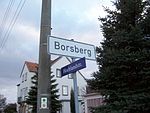
List of streets and squares in Borsberg (Dresden)
The list of streets and squares in Borsberg describes the street system in the Dresden district of Borsberg with the corresponding historical references. Streets in the Borsberg district are listed. Cultural monuments in the Borsberg district are listed in the list of cultural monuments in Borsberg (Dresden) .
Borsberg is part of the statistical district of Schönfeld / Schullwitz , which in turn is in the town of Schönfeld-Weißig in the Saxon capital of Dresden. The most important road in the Borsberger Flur is the highland road, which as the district road K 6213 comes from Pillnitz via Borsberg to Zaschendorf . There are a total of eight named streets in Borsberg, which are listed in the following list.
Legend
The following table gives an overview of the streets and squares in the district as well as some related information. In detail these are:
- Name / Location: Current designation of the street or the place as well as under 'Location' a coordinate link via which the street or the place can be displayed on various map services. The geoposition indicates approximately the middle of the street.
- Length / dimensions in meters: The length information contained in the overview are overview values rounded up or down according to mathematical rules , which were determined in Google Earth with the local scale. They are more for comparison purposes and, if official values are known, are exchanged and marked separately. For squares, the dimensions are shown in the form a × b. The addition “in the district” or “in the district” indicates how long the street is within the city / district, provided it runs through several city / districts.
- Name origin: origin or reference of the name.
- Year of naming: Time at which the street was given its current name (if known).
- Notes: Further information on nearby institutions, the history of the street, historical names, monuments, etc.
- Image: Photo of the street.
Street directory
| Name / location |
Length / dimensions |
Origin of name |
Year of designation |
Remarks | image |
|---|---|---|---|---|---|
| Borsbergblick location |
View of the Borsberg | The 361 meter high Borsberg rises directly to the east of the village. A column has stood on its summit since 1865 and served as a first-order station for the Royal Saxon Triangulation . Up until Schönfeld-Weißig was incorporated into Dresden, the highest point in Dresden was on the southern slope of the Borsberg. | |||
| Brunnenweg location |
Fountain | Two of the Borsberg cultural monuments are located on Brunnenweg. | |||
| Highland road location |
Schönfeld highlands , surrounding landscape | The highland road connects Borsberg with the neighboring towns of Pillnitz and Zaschendorf . Several Borsberg cultural monuments are located on it. Its continuation in Pillnitz is called Wünschendorfer Straße, the further course in Zaschendorf is called Zum Triebenberg. | |||
| Hörnchenweg location |
Field name croissant | The Hörnchen, previously written as "Hörngen", is an inconspicuous elevation southwest of the Borsberg at the end of the Hörnchenweg and, as a protrusion, marks the southern tip of the Schönfeld highlands directly on its steep drop ( Dresden Elbe slopes ) into the Elbe valley basin . | |||
| Krieschendorfer Strasse location |
Krieschendorf , directly neighboring district | The Krieschendorfer Straße connects Krieschendorf with the Meixstraße, but is closed to public motor vehicle traffic as a dirt road. | |||
| Meixstrasse location |
Legendary figure Meix | The Meixstraße leads on the narrow hill between Meix- and bird base along and connects Pillnitz about Borsberger hallway with Reitzendorf and Schonfeld , where each has the same name. It has no direct connection to the rest of the Borsberg road network and was named after the dragon Meix, to whom a legend says that the name of the Meixgrund and the listed Meixmühle go back. | |||
| Meixweg location |
Legendary figure Meix | The Meixweg was named after the dragon Meix, to whom a legend says the name of the Meixgrund and the Meixmühle go back. The fire station on the way is protected as a cultural monument. | |||
| Zum Tiefen Grund Lage |
Field name Deep Ground | The deep bottom is a notch valley in the area of the Dresden Elbe slopes . The stream flowing in it marks the eastern city limits of Dresden in sections and flows into the Graupaer Bach in Oberpoyritz . |
Web links
- Themed city map of Dresden. Retrieved June 13, 2012 .
- Lars Herrmann: Borsberg. Retrieved June 13, 2012 .


