List of street names in Niederstetten
This list of street names of Niederstetten shows the names of the current and historical streets , alleys, paths and squares of the city of Niederstetten and its districts ( Adolzhausen , Herrenzimmern , Niederstetten with the hamlets of Eichhof , Ermershausen and Sichertshausen, the house and castle of Haltebergstetten , the homestead Rehhof and the houses Dreischwingen and Neuweiler, Oberstetten with the hamlet Weilerhof, the homestead Höllhof and the houses Fuggersmühle, Reutalsmühle and Stegmühle, Pfitzingen , Rinderfeld with the hamlets Dunzendorf and Streichental, Rüsselhausen , Vorbachzimmer , Wermutshausen with the hamlet Ebertsbronn and Wildentierbachel with the Heimberg and Wolkersfelden, the Höllhof and Schönhof farms and the Landturm residential area) as well as their origin of name, namesake or meaning, if known. Street names were only introduced in the districts as part of the local land consolidation process.
The article is part of the higher-level list of street names in the Main-Tauber district . The list does not claim to be complete.
| Historical street names - bike and hiking trails - literature - web links |
A.
- Ahornweg
- Akazienstrasse
- Albert-Sammt-Straße - named after Albert Sammt
- Alte Burgsteige - in the Oberstetten district
- Altenbergsteige
- At the old mountain
- At the airport - the site of the Army airfield and airfield Niederstetten, see: niederstetten air base
- On the sunny slope
- Amselweg
- An den Linden - in the Vorbachzimmer district
- Angerweg - in the Oberstetten district
- Äußere Straße - in the Adolzhausen district
- Austraße
B.
- B 290
- Bahnhofstrasse
- Bass-Strasse - named after the BASS tool factory founded by Kurt Bass in Niederstetten in 1947
- Begnizweg - in the Vorbachzimmer district
- Berggasse - in the Oberstetten district
- Beund - in the Adolzhausen district
- Biergässle - in the Oberstetten district
- Birkenstrasse
- Bridge path
- Brunnenberg
- Brunnengasse - in the Vorbachzimmer district
- Burgwiesenweg
C.
- Christian-Bürkert-Straße - Christian Bürkert GmbH & Co. KG is one of the sponsors of a retraining and advanced training center in the Wermutshausen district
D.
- Dreischwingen - the hamlet is a district of Niederstetten without a street name
- Dunzendorf - the hamlet is a district of Rinderfeld without a street name
E.
- Ebertsbronn - the hamlet is a district of Wermutshausen without a street name
- Eckgasse - in the hamlet of Heimberg, a district of Wildentierbach without a street name
- Eichenweg - a forest road in the community forest near Niederstetten
- Eichhof - the hamlet is a district of Niederstetten without a street name
- Eichhofstrasse - in the Adolzhausen district
- Elberweg
- Erbsengasse
- Ermershausen - the hamlet is a district of Niederstetten without a street name
F.
- Fichtenweg
- Finkenweg
- Lilac way
- Flurweg - in the Adolzhausen district
- Frickentalplatz
- Frickentalstrasse
- Frickenwiesenweg
G
- Garden path
- Gerhard-Sturm-Strasse
- Goldammerweg
- Trench cut
- Gutschergasse
H
- Hachtel - the hamlet is a district of Wildentierbach without a street name
- Häckersteige
- Haselweg
- Hatzfeldstrasse
- Main road
- Hauser Tal - in the Vorbachzimmer district
- Folder
- Heimberg - the hamlet is a district of Wildentierbach without a street name
- Hellergrabenweg - a forest road in the community forest near Pfitzingen
- Herrenzimmern - there are no street names in the Herrenzimmern district
- Herrgottsweg - in the Vorbachzimmer district
- Heyerbergstrasse
- Hintere Gasse - in the Oberstetten district
- Hoffelderweg - a forest road in the community forest near Wermutshausen
- Hofwiese - in the Adolzhausen district
- Höllhof - the hamlet is a district of Oberstetten without a street name
- Höllhofsteige - in the Oberstetten district
- High beech
- Hohenbergweg - in the Vorbachzimmer district
- Hohenlohestrasse
- Hohlweg - in the Adolzhausen district
- Hollenbacher Strasse
- Elder path
- Chicken Walk
I.
- Im Anger - in the Oberstetten district
- In Ganswasen
- In the valley - in the Adolzhausen district
- In Vogelsang
- In the stäffelen
J
- Junkerweg
K
- K 2539
- K 2852
- K 2853
- K 2854
- K 2855
- K 2856
- K 2861
- K 2862
- K 2863
- K 2864
- K 2865
- K 2866
- K 2890
- K 2891
- Canal path
- Pine path
- Kirchgasse
- church Square
- Kirchweg - in the Oberstetten district
- Cherry tree avenue
- Klostergasse
- Kraußenklinge - in the Adolzhausen district
- Kühbergweg - in the Oberstetten district
L.
- L 1001
- L 1020
- Long alley
- Laudenbacher Straße - in the Vorbachzimmer district
- Lerchenweg
- Lietenweg - in the Adolzhausen district
- Lindengasse - in the Adolzhausen district
- Lindenstrasse - in the Vorbachzimmer district
- Lüfflingsbergstrasse - in the Vorbachzimmer district
M.
- Marketplace
- Maronenweg
- Maßweg - in the Adolzhausen district
- Titmouse
- Mittelgasse - Until the time of National Socialism , the Mittelgasse was called Synagogengasse , as there were two synagogues in Niederstetten . The first synagogue was in Mittelgasse 2/1 ( ⊙ ) and the second synagogue in Mittelgasse 4 ( ⊙ )
- Mönchshof - a single homestead belonging to the Adolzhausen district
- Mühlgässle - in the Oberstetten district
- Münzgasse
N
- Nightingale Path
- Carnation Path
- Neuweiler
O
- Obere Gasse - in the Oberstetten district
- Oberer Brühlweg - in the Oberstetten district
- Oberer Steinbachweg - in the Vorbachzimmer district
- Oberstetter Strasse
P
- Paradise way
- Pfitzingen - there are no street names in the Pfitzingen district
- Pfitzinger Strasse
- Pfitzinger Weg - in the Adolzhausen district
R.
- Rathausgasse
- Rebenweg
- Rehhofsteige
- Rehhofweg - a forest road in the community forest near Niederstetten
- Reutalweg - in the Oberstetten district
- Rinderfeld - there are no street names in the Rinderfeld district
- Röhrenbrunnengasse
- Römergasse
- Rosenbergstrasse
- Rosenweg
- Rothenburger Steige - in the Vorbachzimmer district
- Rüsselhausen - there are no street names in the Rüsselhausen district
- Rüsselhäuser Weg - a forest road in the community forest near Rüsselhausen
S.
- Schafgasse - in the Oberstetten district
- Schimmelturmgasse
- Schlehenweg
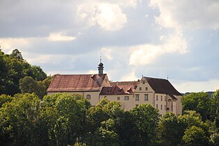
- Keepbergstetten Castle - at the Keepbergstetten Castle
- Schlossberg
- Schönbühler Strasse - in the Adolzhausen district
- Schönhof - the hamlet is a district of Wildentierbach without a street name
- Schöntal mountain
- Schrozberger Strasse - in the Oberstetten district
- Seestrasse
- Sichertshausen - the hamlet is a district of Niederstetten without a street name
- Silvanerweg
- Speierlingweg
- Sperrlohestrasse
- Playground path - a forest road in the community forest near Pfitzingen
- Spitalweg - in the Adolzhausen district
- Steingasse - in the Vorbachzimmer district
- Steinriegelweg - in the Vorbachzimmer district; the stone bars are a defining part of the landscape of the Vorbachtal and Taubertal
- Streichental - the hamlet is a district of Rinderfeld without a street name
T
- Talstrasse - in the Oberstetten district
- Gate alley
- Triensbachstraße - in the Vorbachzimmer district
U
- Untere Gasse - in the Oberstetten district
- Unterer Brühlweg - in the Oberstetten district
- Unterer Spitalweg - in the Adolzhausen district
- Unterer Steinbachweg - in the Vorbachzimmer district
V
- Vorbachstraße - in the Oberstetten district; after the river Vorbach in the valley of which Oberstetten, Niederstetten and Vorbachzimmer lie
- Vorbachzimmerner Strasse
W.
- Weiherweg - a forest road in the community forest near Wildentierbach
- Weilerhof - to the Oberstetten district
- Vineyards
- Hawthorn Trail
- Wermutshausen - there are no street names in the Wermutshausen district
- Vermouths Street
- Wetteweg - in the Adolzhausen district
- Wildentierbach - there are no street names in the Wildentierbach district
- Wildentierbacher Strasse
- Wilhelm-Hachtel-Straße - named after one of the founders of the MHZ Hachtel group
- Winzerweg - in the Vorbachzimmer district
- Wolkersfelden - the hamlet is a district of Wildentierbach without a street name
- Wulzweg - a forest road in the community forest near Wildentierbach
Z
- Zaisenhäuser Weg - in the Adolzhausen district
- Zehntscheuergasse
- Brick mill
Historic street names
- S.
- Synagogengasse - Until the National Socialist era, as there were two synagogues in Niederstetten . Today: Mittelgasse.
Biking and hiking trails
-
Jakobsweg Main-Taubertal
- Stage 7: Markelsheim - Niederstetten
- Stage 8: Niederstetten - Creglingen
- Taubertal Panorama Trail - Supplementary Tour No. 1: Vorbachtal-Hohenlohe. The first extra tour runs on a 27-kilometer circuit from Weikersheim via Laudenbach, Niederstetten, Wermutshausen and Laudenbach back to Weikersheim.
-
Taubertal cycle path , the sporty one:
- Stage 4: Boxberg to Niederstetten
- Stage 5: Niederstetten to Rothenburg ob der Tauber
See also
- List of district roads in the Main-Tauber district
- List of cultural monuments in Niederstetten , with the cultural monuments of the city, sorted by street name
Web links
Individual evidence
- ^ The state of Baden-Württemberg. Official description by district and municipality. Volume IV: Stuttgart district, Franconian and East Württemberg regional associations. Kohlhammer, Stuttgart 1980, ISBN 3-17-005708-1 . Pp. 337-343.
- ↑ a b Niederstetten (Main-Tauber district) - Jewish history / prayer hall / synagogue. In: Alemannia-Judaica.de. April 14, 2018, accessed September 6, 2019 .
- ↑ a b Günther E. Ascher (author): Fascination Jakobsweg “Main-Taubertal”: A pilgrimage in 9 stages from Miltenberg am Main to Rothenburg ob der Tauber . RegioKom publishing house, Großheubach 2013.


