List of street names in Külsheim
This list of street names in Külsheim shows the names of the current and historical streets , alleys, paths and squares of the city of Külsheim and its districts ( Eiersheim , Hundheim , Steinbach , Steinfurt and Uissigheim ) as well as their origins, namesake or meaning, if known. Külsheim is nicknamed Brunnenstadt because there are 18 fountains in the urban area, some of which streets are named after.
The article is part of the higher-level list of street names in the Main-Tauber district . The list does not claim to be complete.
| Cycling and hiking trails - literature - web links |
A.
- Old alley
- At the Bärloch
- At the E-Werk
- At the Kattenberg
- At the playground - in the Steinbach district
B.
- Bachgasse - in the Hundheim district
- Badbrunnenweg
- Badersrain
- Baiersgründlein - in the Steinbach district
- Building land road
- At the stork storm
- Benzstrasse
- Mountain road
- Rush gardens - in the Uissigheim district
- Birkenweg - in the Uissigheim district
- Birkhof - at the Birkhof residential area of the same name near the Hundheim district
- Birnberg - in the Eiersheim district
- Blood count pathway
- Boschstrasse
- Boxtalstrasse
- Bronnbacher Strasse
- Brunnengasse
- Bürgermeister-Heusslein-Strasse
- Mayor-Junghans-Strasse
- Mayor-Kuhn-Strasse
- Bürgermeister-Spengler-Strasse
- Burgstrasse - in the Uissigheim district
D.

Memorial for the soldiers who died in the battle near Hundheim , memorial settlement
- Daimlerstrasse
- Dekan-Werr-Strasse
- Monument settlement - at the residential area of the same name, monument settlement on the perimeter of the Hundheim district
- Dörlesberger Straße - in the Hundheim district in the direction of the Wertheim village Dörlesberg
E.
- Eberhardstrasse - in the Uissigheim district
- Eichendorffweg
- Eichwaldsiedlung - in the Steinfurt district to the Eichwaldsiedlung residential area
- Eiersheimer Straße - in the Uissigheim district in the direction of the Eiersheim district
- Eilschirber way
- Erlenweg
- Eulschirber way - in the district Uissigheim toward the Werbacher living space Eulschirben with Eulschirbenmühle
F.
- Flößlein - in the Eiersheim district
- Frankenstrasse
- Friedhofweg - in the Hundheim district
- Froschgasse - in the Uissigheim district
G
- Gaimühle
- Gamburger road - in the district eggs home toward the Werbacher hamlet Gamburg , then as K 2881
- Gartenweg - in the Steinfurt district
- Nursery Path
- Glockengasse - in the Steinbach district
- Goethestrasse
- Grenzweg
- Grotto path
- Gutentalweg
H

|

|
|
|
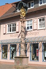
Katharinenkapelle and Mariensäule, Hauptstrasse
|
||
- Haagstrasse
- Hambrechtsweg
- Hans-Weisbach-Strasse
- Hardheimer Strasse
- Main road
- Hebbelstrasse
- Heuweg - in the Steinbach district
- Hinterer Meßhof - at the residential area of the same name, Hinterer Meßhof , near the Steinbach district
- Behind the village - in the Uissigheim district
- High-rise buildings Grund - in the Eiersheim district, as the crow flies in the direction of the Hochhausen district of Tauberbischofsheim
- Hofstrasse - in the Steinbach district in the direction of the Vorderer Meßhof and Hinterer Meßhof residential areas
- high Street
- Hohenloher way
- Höhenstraße - in the Uissigheim district
- Hohlweg - in the Hundheim district
- Hölzlein - in the Steinbach district
I.
- In the small bridge - in the Steinbach district
J
- Jahnstrasse
K

|

|
|
|
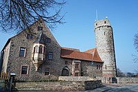
Külsheim Castle ( Kirchbergweg 7 ) and St. Martin ( Kirchbergweg 24 )
|
||
- K 2829
- K 2880
- K 2881
- Kapellenstrasse - in the Eiersheim district
- Kehrlich - in the Uissigheim district
- Celtic way
- Kirchbergweg
- Cherry path
- Little Heidberg
- Kolpingstrasse
- Königheimer Weg - in the Steinfurt district
- Königsgrund
- Körnersweg - in the Hundheim district
- Külsheimer Straße - in the Hundheim district, on the direct route towards Külsheim
L.

Sandstone slab with Chirotherium footprints, L 509
- L 508
- L 509
- Langengewannweg
- Langgasse - in the Eiersheim district
- Lehnfeldweg
- Leimengrubenweg - in the Uissigheim district
- Leimgrubenweg
- Leonhardstrasse - in the Uissigheim district
- Leopoldstrasse
- Lerchenweg - in the Uissigheim district
- Line route
M.
- Mainstrasse
- Manggasse
- Mehleweg
- Miltenberger Straße - in the Hundheim district towards Miltenberg
- Miltner way
- Middle village - in the Eiersheim district
- Dairy way
- Mönchwaldstrasse - in the Steinfurt district
- Mozartstrasse
- Mühlweg
- Münzweg - in the Uissigheim district
O
- Upper Kattenbergweg
- Obertorgasse
- Odenwaldstrasse
P

St. Margareta in Eiersheim, Pfarrgasse 1
- Poplar Avenue
- Pater-Grimm-Strasse
- Pfarrer-Binz-Straße - in the Uissigheim district
- Pfarrer-Hodecker-Strasse - in the Hundheim district
- Pfarrer-Münch-Straße - in the Uissigheim district
- Pfarrer-Uihlein-Strasse
- Pfarrgasse - in the Eiersheim district
- Pioneer Road
- Poststrasse - in the Hundheim district
- Prinz-Eugen-Strasse
R.
- Raiffeisenstrasse - in the Eiersheim district
- Raingartenstrasse - in the Steinbach district
- Rathausstrasse
- Tufts of reeds
- Rhönstrasse
- Richthofenstrasse
- Riedflürlein
- Riemelsweg
- Ringstrasse - in the Uissigheim district
- Ritter-Arnold-Straße - in the Uissigheim district, before and after as K 2880
- Römerbadweg
- Rommelstrasse
- Roter Rain - at the Roter Rain settlement of the same name between Külsheim and Steinbach
- Rüdentaler Straße - in the Steinfurt district in the direction of the Rüdental district of Hardheim in the Neckar-Odenwald district, before and after that as L 508
S.

St. Peter and Paul in Steinbach, Schönertsbachstraße 58
- Schafhausweg
- Schiller Street
- Castle view
- Schlossergasse - in the Uissigheim district
- Schmiedsgasse
- Schneidmühlweg
- Schönertsbachstraße - in the Steinbach district, before and after that as L 508
- Screw travel
- Schulstrasse - in the Eiersheim district
- Schwarzwiesen - in the Steinbach district
- Seestrasse - in the Hundheim district
- Seldernweg
- Siemensstrasse
- Spessartblick - in the Hundheim district
- Spessartstrasse
- Spitalstrasse
- Sportplatzweg - in the Eiersheim district
- Stahlbergstrasse - in the Uissigheim am Stahlberg district
- Stahlbergsweg
- Steige - in the Eiersheim district
- Steinbacher way
- Steingasse - in the Steinbach district
- Steinigsweg - in the Uissigheim district
- Steinwiesen - in the Steinbach district
T
- Valley settlement - in the Hundheim district
- Tannenweg - in the Uissigheim district
- Pigeon tree
- Tauberbischofsheimer Straße - in the Eiersheim district in the direction of the district town of Tauberbischofsheim , then as K 2881
- Tauberstrasse
- Taubertal Cycle Path - a small part of the Taubertal Cycle Path is located in the district of Külsheim
- Tauberweg
- Teichstrasse - in the Steinfurt district
- Tiefentaler Hof - at the residential area of the same name Tiefental (er Hof) near the Hundheim district
- Tiefenweg - in the Eiersheim district
- Triebstraße - in the Hundheim district
- Türkenstrasse - in the Uissigheim district
- Turmstrasse - in the Steinfurt district
U
- Uissigheimer Straße - in Külsheim in the direction of the Uissigheim district
- Under the vineyard
V
- Veitsgasse - in the Uissigheim district
- Vogelsang - in the Uissigheim district
- Vorderer Meßhof - on the residential area of the same name, Vorderer Meßhof , near the Steinbach district
W.
- Wagnerstrasse
- Webereistraße
- Weedgasse
- Weiher - in the Steinbach district
- Wendelin-Scheuermann-Strasse - in the Steinbach district
- Wertheimer Straße - in the Hundheim district, through the village to Steinbach, before and after that as L 508
- Wiesenweg - in the Steinfurt district
- Wilhelm-August-Berberich-Strasse
- Wolferstetter Weg - in Külsheim in the direction of the abandoned hamlet Wolferstetten , which is now part of a military training area of the Bundeswehr
Z
- Zentgraben
- To the Farm
- To the warehouse
- Zwerggasse - in the Steinbach district
Biking and hiking trails
-
Taubertal cycle path , the sporty one:
- Stage 2: Freudenberg - Külsheim
- Stage 3: Külsheim - Boxberg
See also
- List of district roads in the Main-Tauber district
- List of cultural monuments in Külsheim , with the cultural monuments of the city, sorted by street name
literature
- Elmar Weiss, Irmtraut Edelmann, Helmuth Lauf (authors): History of the well town of Külsheim . 2 volumes. City of Külsheim (ed.). Tauberbischofsheim, FN Druck 1992.
- Volume 1 . With contributions by Dieter Frank, Walter Dietz, Pastor Franz Gehrig , Herwig John, Fritz Krug.
- Volume 2 . With contributions from Pastor Gehrig, Herwig John, Günther Kuhn .
Web links
Commons : Streets and alleys in Külsheim - collection of pictures, videos and audio files
Individual evidence
- ^ The state of Baden-Württemberg. Official description by district and municipality. Volume IV: Stuttgart district, Franconian and East Württemberg regional associations. Kohlhammer, Stuttgart 1980, ISBN 3-17-005708-1 , pp. 324-328.
- ^ Main-Tauber-Kreis: Main-Tauber-Kreis: Cities and municipalities. Online at www.main-tauber-kreis.de, accessed on October 25, 2014


