List of street names in Wertheim
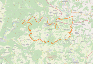
This list of street names of Wertheim shows the names of the current and historical streets , alleys, paths and squares of the city of Wertheim and its districts as well as their origin, namesake or meaning, if known. The town of Wertheim consists of the core town of Wertheim , fifteen localities ( Bettingen , Dertingen , Dietenhan , Dörlesberg with the Ernsthof farmstead and the Ebenmühle residential area, Grünenwört , Höhefeld with the Klosterhöhe hamlet and the Mittelhof and Wagenbuch farms, Kembach , Lindelbach , Mondfeld with the residential area Rosenmühle, Nassig with Ödengesäß, the hamlets Im Loch and Steingasse and the Ödengesäßer Hof residential area, Reicholzheim with the Bronnbach hamlet , the Schafhof farmstead and the Bronnbach railway station, Reicholzheim and Teilbacher Mühle railway station, Sachsenhausen , Sonderriet , Urphar and Waldenhausen ) and six districts ( Besteheid , Eichel / Hofgarten with acorn and Hofgarten , Vockenrot , Reinhardshof with the Besteheider Höhe and Wartberg ). In the course of the regional reform in Baden-Württemberg , numerous streets were renamed, as otherwise they would have occurred twice.
The article is part of the higher-level list of street names in the Main-Tauber district . The list does not claim to be complete.
| Historical street names - bike and hiking trails - literature - web links |
A.

- A 3 - a section of the federal motorway 3 runs through the municipality of Wertheim. In the Bettingen district there is the “Wertheim / Lengfurt” junction (junction no. 66 of the A 3).
- Aalbachstraße - in the village of Dertingen, before and after as L 2310
- Ahornweg - in the village of Dertingen
- Albrecht-Thoma-Straße - in the village of Dertingen
- Alfred-Zippe-Straße - named after the entrepreneur Alfred Zippe. In 1920 he founded a company in Haida in northern Bohemia. In 1951 the company was re-established in Wertheim, which was still managed by the founder Alfred Zippe.
- Almosenberg - in the village of Bettingen
- Alte Heerstraße - in the village of Reicholzheim this street lies on both sides of the Tauber; it leads over a Tauber bridge; After leaving the village, it leads as K 2879 in the direction of the Wertheimer Ortschaft Sachsenhausen (where it is called Teilbachstraße )
- Old Roman Road
- Alte Vockenroter Steige - from Wertheim in the direction of the Vockenrot district.
- Old Schießhausweg
- At the Baumgarten
- On the mountain - in the village of Dertingen
- At the picture field
- At the calibration office
- At the Eicheler Eck
- Am Felder - in the village of Reicholzheim
- At the Feldergraben - in the village of Sachsenhausen
- At the airfield
- At the Freiergraben
- At the cemetery - in the village of Höhefeld, at the local cemetery
- At the ford - in the village of Sachsenhausen
- On the green tree
- Am Haag - in the village of Kembach
- On Heidweg - in the village of Kembach
- At the Junker
- At the Kessler
- On Kirchweg - in the village of Sachsenhausen
- At the kissel
- On the Klosterweg
- At the Kreuzeck
- At the Lindenbächlein - in the village of Lindelbach
- On the Mandelberg - in the village of Dertingen
- Am Mühlacker - in the village of Bettingen
- At the upper gate - in the village of Dertingen
- At the rain
- Am Rauenberg - in the village of Dietenhan
- At the Rechlesgraben
- At the Reinhardshof
- On the Remlinger path - in the village of Bettingen
- At the reed
- On the way to school - in the village of Höhefeld
- At the lake - in the village of Mondfeld, at the Mondfeld bathing lake (also called Mondsee)
- On the sunny slope - in the village of Dietenhan
- On the trunk wood
- On the Tannenberg
- On the drive
- At the Waldeck - in the village of Dörlesberg
- On the Wartberg
- At the hawthorn - in the village of Bettingen
- At the White Stone - in the village of Dertingen
- Amselweg
- At the Christmas meadows
- At the herbaceous meadows
- At the blade - in the village of Dertingen
- On the linden tree - in the village of Lindelbach
- At the school - in the village of Dörlesberg
- Andreas-Fries-Strasse
- Angelstraße - in the village of Sachsenhausen - in the village of Sachsenhausen (see also the Mittlere Angelgasse and the Obere Angelgasse, both in Sachsenhausen); After leaving the village, the Angelstraße leads as K 2829 in the direction of the Wertheim village Dörlesberg
- Junction Wertheim / Lengfurt - Autobahn junction of the A 3 on the boundary of the Wertheim village of Bettingen
- At the height
B.

- Bachstraße - in the village of Urphar, parallel to the Kembach flowing past, which flows into the Main from the left at Urphar
- Bahnhofstrasse - in the area of the Wertheim train station.
- Tree path - in the village of Dörlesberg
- Bergstrasse - in the village of Grünenwört
- Berlin Ring
- Besteheider Höhenweg - between the Besteheid district and the Besteheider Höhe residential area
- Besteheider Landstrasse
- Bettelgasse - in the village of Sachsenhausen
- Bettinger Weg - in the village of Lindelbach
- Bildäcker - in the village of Mondfeld
- Bildweg - in the village of Bettingen
- Birkenweg - in the village of Dertingen
- Bismarckstrasse
- Blättleinsäcker - in the village of Bettingen
- Bleichwiesenweg - in the village of Dertingen
- Blumenstrasse - in the village of Kembach
- Boxtaler way
- Bräunlesweg
- Brehmenweg - in the village of Lindelbach
- Wide way - in the village of Dörlesberg
- Breitgewann - in the village of Mondfeld
- Breslauer Strasse
- Brombergstrasse
- Brüchertsweg
- Brückengasse
- Brummgasse
- Brunneneck - in the village of Mondfeld
- Brunnengasse
- Brunngärtenweg
- Brunngasse
- Brunnweg - in the village of Urphar
- Buschweg - in the village of Urphar
C.
- Carl-Jacob-Kolb-Weg
- Carl-Roth-Strasse
- Carl-Wibel-Strasse
- Caspar-Merian-Strasse - named after the German engraver Caspar Merian .
- Charles-de-Gaulle-Strasse
- Conrad-Wellin-Strasse
D.
- Danziger Strasse
- Dertinger Weg - in the village of Bettingen
- Dietenhaner Straße - in the town of Urphar, after leaving the town as K 2878 in the direction of the Wertheim town of Dietenhan
- Diptamweg - in the village of Dertingen
- Dorfäcker - in the village of Mondfeld
- Dorfgrabenweg - in the village of Dertingen
- Village street
- Dr.-Huebsch-Strasse
- Dr.-Johannes-Löber-Straße - at the residential area Besteheider Höhe
- Dr.-Neuber-Strasse
- Dr.-Wilhelm-Monz-Straße - in the village of Mondfeld
- Throttle path
E.
- Ebenrainstraße - in the village of Lindelbach
- Echterstrasse
- Eicheler Höhenweg
- Eichelgasse
- Acorn set
- Acorn crust
- Eichendorffstrasse
- Eichsgrundsiedlung
- Entrance for rescue vehicles
- Engelsgasse - in the village of Sachsenhausen
- Erlenstrasse
- Ernst-Abbe-Strasse
- Ernsthof
- Ernsthofsiedlung
- Europaweg - in the village of Mondfeld
F.
- Fährgasse
- Falkenstrasse - in the village of Dörlesberg
- Felderstrasse - in the village of Dörlesberg
- Felsenweg - in the village of Urphar
- Ferdinand-Friedrich-Strasse
- Ferdinand-Hotz-Strasse
- Finkenweg
- Fischergasse
- Föhlischstrasse
- Forrest E. Peden Ring
- Frankenplatz
- Frankensteiner Strasse
- Frauenschuhweg - in the village of Dertingen
- Peace way
- Friedhofweg - in the village of Reicholzheim, to the local cemetery
- Friedleinsgasse
- Friedrichstrasse
- Frohnhofweg
- Futtererstrasse - in the village of Mondfeld
G
- Gamburger Weg - in the village of Höhefeld, in the direction of the Werbach district of Gamburg
- Alley houses
- Geiergasse
- Geiselbrunnweg - in the village of Bettingen
- Geißbergstraße - in the village of Reicholzheim
- Georg-Feuerstein-Strasse
- Gerbergasse
- Gereutweg - in the village of Urphar
- Gerhart-Hauptmann-Strasse
- Gerlesgasse - in the village of Reicholzheim
- Gleiwitzer Strasse
- Godmanchesterring - at the Besteheider Höhe residential area. It has been twinned with Godmanchester ( United Kingdom ) since 1981.
- Götzenberg - in the village of Höhefeld
- Grabenstrasse
- Grübenweg - in the village of Bettingen
- Basic way
- Gubbiostraße - at the Besteheider Höhe residential area. A town partnership has existed with Gubbio ( Italy ) since 2006. Before that there was already a friendship between 1980 and 2006.
- Gustav-Freytag-Strasse
- Gustav-Rommel-Straße - in the village of Urphar
- Gyula Horn Street
H
- Haagzaun - in the village of Mondfeld
- Hafenstrasse
- Haidhof
- Half Well Walk
- Hammelsgasse
- Hannes-Greiner-Strasse
- Hans-Bardon-Strasse
- Hasloch way
- Main ring - in the village of Höhefeld
- Main street - in the village of Bettingen
- Heegstraße - in the village of Dörlesberg
- Heinrich-Geissler-Strasse
- Rear village street - in the village of Bettingen
- Shepherd's house - in the village of Bettingen
- Shepherd's Path - in the village of Mondfeld
- Hofäckerstrasse
- Hofgartenstrasse
- Höfleinsweg
- Hofstrasse
- Höhefelder Straße - in the village of Kembach, after leaving the village as K 2825 in the direction of the Wertheim village of Höhefeld
- Höhenweg - in the village of Grünenwört
- Elderberry Trail - in the village of Bettingen
- Holzkirchhäuser Straße - in the village of Kembach, in the direction of Holzkirchhausen (a district of the municipality of Helmstadt in the Lower Franconian district of Würzburg)
- Hölzleinweg - in the village of Dietenhan
- Homburger Weg - in the village of Bettingen
- Hospitalstrasse
- Hotelstrasse - in the village of Bettingen
- Hundheimer Straße - in the village of Dörlesberg; after leaving the town as K 2829 in the direction of the Külsheim district of Hundheim
- Huntingdonring - at the Besteheider Höhe residential area. It has been twinned with Huntingdon ( United Kingdom ) since 1981.
- Hüttenweg
- Hymerring - in the village of Bettingen
I.
- In the corner - in the village of Reicholzheim
- In the field gate - in the village of Lindelbach
- In Rainfeld - in the village of Grünenwört
- Im Roth - in the village of Urphar
- Im Steinig - in the village of Dörlesberg
- In Steppbach - in the village of Reicholzheim, in Steppbachtal, a right tributary of the Tauber
- In the valley
- In the wet - in the village of Grünenwört
- In the Hofstatt - in the village of Reicholzheim
J
- Jägerstrasse - in the village of Mondfeld
- Jahnstraße - in the village of Mondfeld
- Johannes-Kerer-Straße - named after Johannes Kerer , a university teacher, minster pastor in Freiburg and auxiliary bishop in Augsburg.
- Johannes-Rau-Straße - named after Johannes Rau , the 8th Federal President of the Federal Republic of Germany.
- John F. Kennedy Street - named after John F. Kennedy , 35th President of the United States of America.
K
- K 2822 - in Bronnbach
- K 2823 - in Höhefeld
- K 2825 - in Dertingen and Kembach
- K 2826 - in Lindelbach and Urphar
- K 2827 - in Waldenhausen
- K 2829 - in Vockenrot, Sachsenhausen and Dörlesberg
- K 2830 - in Sonderriet
- K 2878 - in Urphar, Dietenhan and Kembach
- K 2879 - in Nassig, Sachsenhausen and Reicholzheim
- Kaiseräckerstraße - in the village of Bettingen
- Kapellengasse
- Karl-Bär-Straße - named after Karl Bär, a parish priest and honorary citizen of Wertheim.
- Karl-Carstens-Straße - named after Karl Carstens , the 5th Federal President of the Federal Republic of Germany.
- Karl-Kirchner-Straße - in the village of Grünenwört
- Karl-Leiss-Strasse
- Karl-Mossemann-Strasse - in the village of Sachsenhausen
- Karlsbader Strasse
- Kaspar-Mattern-Strasse - in the village of Sachsenhausen
- Kellriesenstrasse - in the village of Urphar
- Keltergasse - in the village of Reicholzheim
- Kembacher Straße - in the village of Dietenhan, after leaving the village as K 2879 in the direction of the Wertheimer village of Kembach (where it is known as Kembachtalstraße)
- Kembacher way
- Kembachtalstraße - in the village of Kembach as a through road in the Kembachtal; before and after the location as K 2878
- Kennwerweg - in the village of Urphar
- Keplerstraße - in the village of Mondfeld, named after Johannes Kepler
- Gravel path
- Kilianstrasse - in the village of Reicholzheim
- Killesgasse
- Kirchäckerstrasse
- Kirchgasse
- Kirchgrabenweg
- Kirschgartenstraße - in the village of Lindelbach
- Small trail
- Blade stroke
- Klingenweg - in the village of Grünenwört
- Klosterbrunnen - in the village of Höhefeld
- Klostergasse - in the village of Sachsenhausen
- Knackenberg
- Cooking hedge
- Koenigsberger Strasse
- Konrad-Adenauer-Straße - named after Konrad Adenauer , the first Federal Chancellor of the Federal Republic of Germany.
- Kurt-Lutz-Strasse
L.
- L 506 - in Wertheim, Waldenhausen, Reicholzheim and Bronnbach
- L 507 - in Nassig
- L 508 - in Wertheim and Vockenrot
- L 509 - in Bronnbach
- L 617 - in Bettingen
- L 2310 - in Mondfeld, Besteheid, Wertheim, Hofgarten, Eichel, Bettingen and Dertingen
- Lange Bäun - in the village of Sachsenhausen
- Long street - in the village of Grünenwört
- Long rain
- Lehmgrubenweg
- Leitenrainweg - in the village of Urphar
- Leonhard-Karl-Strasse
- Leonhardsweg - in the village of Sachsenhausen
- Lerchenstrasse - in the village of Sachsenhausen
- Love path
- Liegnitzer Strasse
- Lindelbacher Straße - between the villages of Dertingen and Lindelbach
- Lindenstrasse
- Left Tauberstrasse
- Liselotte-Gebhard-Weg
- Perforated wood - in the village of Urphar
- Ludwig-Erhard-Straße - named after Ludwig Erhard , the father of the “German economic miracle” and the economic system of the Federal Republic of Germany, which is characterized as a social market economy. He was also the second Federal Chancellor of the Federal Republic of Germany.
- Luisenstrasse
M.

|

|
|
|
Spitzer Turm ( Mainplatz 2 ) and Stadttor or Maintor ( Mainplatz 8 )
|
||

|

|
|
|
Wertheim Glass Museum ( Mühlenstraße 24 ) and former royal rosenberg court, today town hall ( Mühlenstraße 26 )
|
||
- Main Bridge Bettingen - in the district Bettingen, highway bridge of A 3 on the Main
- Main bridge Wertheim
- Maingasse
- Mainhoststraße - in the village of Dörlesberg
- Mainplatz
- Maintalstraße - in the Wertheimer localities Urphar and Mondfeld; along the Main (also referred to as L 2310)
- Mainz Line - in the village of Mondfeld
- Marienbader Strasse
- Marketplace
- Martin-Schlör-Straße - in the village of Reicholzheim
- Max-Ernst-Straße - at the Besteheider Höhe residential area
- MAXI Autohof Wertheim - in the Bettingen district, Autohof on the A3
- Meisenstrasse - in the village of Sachsenhausen
- Miltenberger Strasse
- Mittlere Angelgasse - in the village of Sachsenhausen (see also Angelstraße and Obere Angelgasse, both in Sachsenhausen)
- Middle Dorfstrasse - in the villages of Urphar and Lindelbach, as a local connecting road and through road in Lindelbach
- Middle hallway
- Poppy Street - in the village of Mondfeld
- Mühlbachstrasse - in the village of Dertingen
- Mühlensteige
- Mühlenstrasse
- Mühlenweg
- Mühlgasse - in the village of Bettingen
- Mühlwörthweg
- Münzgasse
N
- Nassiger Strasse
- Nebenmaingasse
- Nebenneugasse
- Nebenrittergasse
- Nebenzollgasse
- New Vockenroter Steige
- New way - in the village of Urphar
- Neugasse
- Neuhof
- New place
- Nibelungenstrasse - in the village of Mondfeld
O
- Obere Angelgasse - in the village of Sachsenhausen - in the village of Sachsenhausen (see also Angelstraße and Mittlere Angelgasse, both in Sachsenhausen)
- Upper tan
- Obere Grüben - in the village of Bettingen
- Upper Heeg
- Upper liver blade
- Obere Straße - in the village of Dertingen
- Upper Hague
- Upper Neuberg
- Oberer Wall - in the village of Dertingen
- Desolate buttocks
- Odenwald Bridge - after the mountain range Odenwald named
- Odenwaldstraße - named after the low mountain range Odenwald
- Otto-Schott-Strasse
P
|

|
|
|
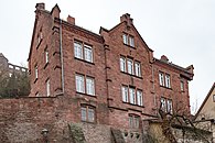
Evang. Church district Wertheim ( Pfarrgasse 5 ) and Post ( Poststrasse 2 )
|
||
- Packhofstrasse
- Park path
- Paulusgasse - in the village of Lindelbach
- Pfarrgasse
- Poststrasse
Q
- Quellenstrasse - in the village of Grünenwört
R.

- Bike path
- Liebliches Taubertal cycle path - also: Taubertal cycle path
- Rainbachstraße - in the village of Grünenwört
- Rain meadows
- City Hall Bridge
- Rathausgasse
- Right Tauberstrasse
- Rich fields
- Reichenberger Strasse
- Reinhardswiesen
- Renztalstraße - in the village of Dertingen
- Rhönstrasse
- Richolfstraße - in the village of Reicholzheim
- Riemenschneiderstrasse - in the village of Mondfeld
- Ringstrasse - in the village of Mondfeld
- Rittergasse
- Robert-Bunsen-Weg
- Roman stairs
- Rose mill
- Rosenweg - in the village of Bettingen
- Red sand
- Rötestrasse - in the village of Lindelbach
- Rotkreuzstraße - between the Besteheider Höhe residential area and the Reinhardshof district; the Rotkreuzklinik Wertheim is on the street
- Rüdenholzweg
- Rudolf-Brand-Strasse - at the Besteheider Höhe residential area
- Rütleinsweg - in the village of Urphar
S.
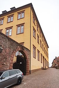
Schlossgasse 9
- Sachsenhausen Street
- Salon-de-Provence-Ring - there has been a twinning with the city of Salon-de-Provence in France since 1964.
- Sandweg - in the village of Mondfeld
- Satzenbergstraße - in the village of Reicholzheim
- Scheffelstrasse - in the village of Reicholzheim
- Schillstrasse - in the village of Reicholzheim
- Schlehenweg - in the village of Bettingen
- Schlossgasse
- Schmiedsgasse - in the village of Sachsenhausen
- Schönebergstrasse - in the village of Lindelbach
- School alley
- Schützenstrasse
- Black Forest Road
- Schwiebogen
- Seewiesenweg - in the village of Sachsenhausen
- Sonnenbergstraße - in the village of Kembach, to the Sonnenberg residential area
- Sonnenstrasse - in the village of Dörlesberg
- Spechtstraße - in the village of Grünenwört
- Spessartblick - in the village of Lindelbach
- Spessart Bridge
- Spessartstrasse
- Spieläcker - in the village of Mondfeld
- Playground path - in the village of Dietenhan
- Sportplatzstraße - in the village of Grünenwört, at the local sports field
- St.-Georg-Straße - in the village of Reicholzheim
- St.-Urban-Straße - in the village of Reicholzheim
- Steigäckerstraße
- Rise
- Rock gardens - in the village of Reicholzheim
- Steinbruchsweg - in the village of Grünenwört
- Steinbuschstraße - in the village of Lindelbach
- Steingasse
- Stoned fields - in the village of Bettingen
- Steinigtweg - in the village of Höhefeld
- Steinwiesenweg
- Stettiner Strasse
- Stichelweg - in the village of Reicholzheim
- Stiegelgasse - in the village of Dietenhan
- Strüthweg - in the village of Höhefeld
- Sudetenstrasse - after the Germans were expelled from Czechoslovakia , numerous Sudeten German families settled in the region
T
- Valley view
- Valley path
- Tannenstrasse - in the village of Dörlesberg
- Tauber promenade
- Tauber Bridge
- Taubergasse
- Taunusstrasse
- Teilbachstrasse - in the village of Sachsenhausen; there begins the partial stream, a left tributary of the Tauber; After leaving Sachsenhausen, Teilbachstrasse leads as K 2879 in the direction of the Wertheimer village of Reicholzheim (where it is known as Alte Heerstrasse )
- Theodor-Heuss-Strasse
- Tiefentaler way
- Deep way
- Tränkgasse - in the village of Bettingen
U
- Uihleinstrasse
- Ulmenweg
- Untere Dorfstraße - in the village of Lindelbach
- Lower village meadows - in the village of Höhefeld
- Lower alley
- Lower Heeg
- Lower liver blade
- Untere Steige - in the village of Mondfeld
- Lower sand - in the village of Mondfeld
- Under the Kapf - in the village of Dertingen
- Below Neuberg
- Urpharer Weg - in the village of Dietenhan
V
- Vaitsgasse
- Venantius-Arnold-Strasse
- Four-acre road - in the village of Mondfeld
- Front alley
W.
- Juniper bushes - in the village of Bettingen
- Waidpfad - in the village of Bettingen
- Waldenbergweg - in the village of Reicholzheim
- Forest corridor
- Forest road - in the village of Grünenwört
- Wartbergweg
- Waseweg
- Water stones
- Wehrgasse
- Wehrkirchstraße - in the village of Urphar, to the fortified church of St. Jakob
- Weidenstrasse - in the village of Sachsenhausen
- Weiherbachweg
- Weinbergstrasse - in the village of Lindelbach
- Weingärtnerstrasse
- Welschdorfgasse
- Wenceslas Square
- Werner-Schuller-Strasse
- Wertheimer way
- Westendstrasse - in the village of Mondfeld
- Wiesenweg - in the village of Bettingen
- Wildbachstrasse
- Wilhelm-Blos-Strasse
- Wilhelm-Langguth-Strasse
- Willy-Brandt-Strasse
- Winterleite - in the village of Reicholzheim
- Winzerweg - in the village of Dietenhan
- Wirtsgasse - in the village of Dertingen
- Wolfsgasse - in the village of Bettingen
- Wolpertsweg
- Wörtweg - in the village of Reicholzheim
- Wurzburger Strasse
Z

Zollgasse 10
- Fences - in the village of Höhefeld
- Fencing path - in the village of Reicholzheim
- Zehntgasse - in the village of Dertingen
- Zieglerweg
- Zinsholzstrasse
- Zollgasse
- Zollhof
- To the crosses - in the village of Reicholzheim; in the direction of the well-known stone cross nest near Reicholzheim , which is the largest stone cross nest collection in southern Germany , with 14 stone crosses made of sandstone, which are embedded in a red sandstone retaining wall. The crosses are on the old high path between Reicholzheim and Bronnbach. According to Fränkische Nachrichten , one of the largest stone cross nests in the world can be discovered in Reicholzheim.
- Zum Eichholz - in the village of Sachsenhausen
- To the perforated wood - in the village of Urphar
- To the Mühltal - in the village of Dörlesberg; towards the Ebenmühle am Schönertsbach, a left tributary of the Tauber
- To the Ottersberg - in the village of Reicholzheim
- To the Satzenberg - in the village of Reicholzheim
- At the stroke - in the village of Reicholzheim
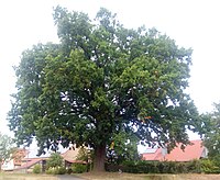
- To the Luth Eiche - in the village of Höhefeld, at the natural monument 1 oak "Luthereiche Steinigt"
- To the redness - in the village of Dietenhan
- To Steinhelle - in the village of Dertingen
Historic street names
- J
- Judengasse - Today: Gerbergasse
- N
- Neben-Judengasse - Today: Wehrgasse
Biking and hiking trails
-
Jakobsweg Main-Taubertal
- Stage 2: Boxtal - Wertheim.
- Stage 3: Wertheim - Gamburg.
- Main cycle path , connection to the Taubertal cycle path
-
Taubertal panorama trail
- Stage 4: Tauberbischofsheim - Wertheim
- Stage 5: Wertheim - Freudenberg
- Taubertal cycle path, connection to the Main cycle path
See also
- List of district roads in the Main-Tauber district
- List of cultural monuments in Wertheim , with the cultural monuments of the city, sorted by street name
Web links
Individual evidence
- ↑ https://www.zippe.de/unternehmen/#ps242
- ↑ a b Reicholzheim. In: www.suehnekreuz.de. Retrieved September 11, 2019 .
- ↑ locations. In: suehnekreuz.de. Retrieved May 23, 2020 .
- ↑ Stone witnesses in the landscape - Franconian news. In: fnweb.de. Retrieved May 22, 2020 .
- ↑ a b Günther E. Ascher (author): Fascination Jakobsweg “Main-Taubertal”: A pilgrimage in 9 stages from Miltenberg am Main to Rothenburg ob der Tauber . RegioKom publishing house, Großheubach 2013.
- ^ A b Tourism Association "Liebliches Taubertal": Hiking - Panorama Trail . Online at www.liebliches-taubertal.de. Accessed January 31, 2018.
