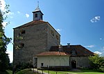
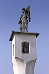
List of listed objects in Hartberg area
The list of listed objects in Hartberg Umgebung contains the 7 listed , immovable objects of the municipality Hartberg Umgebung .
Monuments
| photo | monument | Location | description | Metadata |
|---|---|---|---|---|

|
Kath. Filialkirche St. Anna am Masenberg ObjectID : 81742 |
Flattendorf location KG: Flattendorf |
The church of St. Anna am Masenberg was built in the middle of the 15th century and rebuilt in 1499. |
ObjectID : 81742 Status: § 2a Status of the BDA list: 2020-02-29 Name: Kath. Filialkirche St. Anna am Masenberg GstNr .: 754/2 St. Anna church, Flattendorf, Styria |

|
Local chapel Flattendorf ObjektID : 81756 |
Flattendorf location KG: Flattendorf |
The chapel was built on the site of the village cross that has always stood here at the will of the owner Johann Kainer in 1889. It was completely renovated for the 100th anniversary and returned to its original state.
The chapel is a simple brick building on a square floor plan with a 3/8 end and a roof turret on the western front above the entrance. On the long sides there are two semicircular windows and on the outside on the north side a table of favors. The interior is from the time it was built. |
ObjectID : 81756 Status: § 2a Status of the BDA list: 2020-02-29 Name: Ortskapelle GstNr .: .175 |

|
Neuberg Castle ObjectID : 36394 |
Öffelbach location KG: Löffelbach |
Neuberg Castle is one of the most important fortifications in Styria . It is located west of the district capital, Hartberg, at 520 meters above sea level above the village oföffelbach on the foothills of the Ringkogel . |
ObjectID : 36394 Status : Notification Status of the BDA list: 2020-02-29 Name: Burg Neuberg GstNr .: 1453 Burg Neuberg |

|
Tower and castle chapel Neuberg ObjektID : 36395 |
Öffelbach 119 KG location : Löffelbach |
The almost square castle chapel has been set up on the ground floor of the cannon tower near Neuberg Castle since 1660. The chapel was consecrated in 1661. |
ObjectID : 36395 Status : Notification Status of the BDA list: 2020-02-29 Name: Tower and castle chapel Neuberg GstNr .: 1457 Burg Neuberg |

|
Roman period villa rustica Löffelbach ObjektID : 44787 |
Öffelbach location KG: Löffelbach |
The Villa Rustica in Löffelbach near Hartberg shows the well-preserved foundation walls of a large Roman country estate (palatial peristyle villa with colonnade) from the 2nd and 3rd centuries AD. |
ObjectID : 44787 Status : Notification Status of the BDA list: 2020-02-29 Name: Roman period villa rustica Löffelbach GstNr .: 1229/2; 1230 |

|
Shrine Object ID: 84806 |
at ring 40 location KG: Schildbach |
The plague cross from the 17th century, executed as a Hartberger broad pillar , with explosive gable and tile gable roof shows a fresco of the Pöllauer Schutzmantelmadonna , signed PACHER , in the base niche a purgatory fresco and in the gable niche the dove of the Holy Spirit with the inscription Ren. 1968 . On the west side the wayside shrine shows the cattle patron St. Pancras, in the east St. Florian, on the back wall St. Joseph with child. |
ObjectID : 84806 Status: § 2a Status of the BDA list: 2020-02-29 Name: Bildstock GstNr .: 763/3 |

|
Wayside shrine, Florianisäule ObjectID : 81774 |
KG location : Schildbach |
The wayside shrine called Florianisäule is the old village cross, which was converted in honor of the fire patron after the fire disaster of 1845. In terms of building type, the Floriani column is an irregular late Gothic tabernacle pillar , the semicircular niches of the tabernacle block already speak for the Renaissance and are decorated with enamel icons (St. Martin, St. Pankratius, three mourning women) by Rudolf Huszar from 1976. The original pyramid roof was replaced by a flat plate on the occasion of the rededication and a 135 cm high statue of St. Florians set. |
ObjectID : 81774 Status: § 2a Status of the BDA list: 2020-02-29 Name: Bildstock, Florianisäule GstNr .: 766/1 |
Web links
Commons : Listed objects in Hartberg area - collection of pictures, videos and audio files
Individual evidence
- ↑ a b Styria - immovable and archaeological monuments under monument protection. (PDF), ( CSV ). Federal Monuments Office , as of February 18, 2020.
- ^ Hans Wilfinger: Religious land monuments and places of worship in the parish Hartberg . Ed .: Men's Movement of the Hartberg Parish. Hartberg 1993, p. 84-85 .
- ^ Hans Wilfinger: Religious land monuments and places of worship in the parish Hartberg . Ed .: Men's Movement of the Hartberg Parish. Hartberg 1993, p. 222-223 .
- ^ Hans Wilfinger: Religious land monuments and places of worship in the parish Hartberg . Ed .: Men's Movement of the Hartberg Parish. Hartberg 1993, p. 217-219 .
- ↑ § 2a Monument Protection Act in the legal information system of the Republic of Austria .

