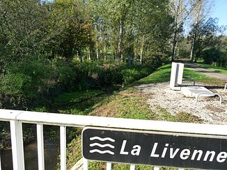
Livenne
| Livenne | ||
|
The river at Chepniers |
||
| Data | ||
| Water code | FR : S03-0400 | |
| location | France , Nouvelle-Aquitaine region | |
| River system | Livenne | |
| source | in the municipality of Montlieu-la-Garde 45 ° 14 ′ 18 ″ N , 0 ° 16 ′ 12 ″ W |
|
| Source height | approx. 130 m | |
| muzzle | on the municipal boundary of Braud-et-Saint-Louis and Anglade in the Atlantic Ocean Coordinates: 45 ° 14 ′ 12 ″ N , 0 ° 41 ′ 36 ″ W 45 ° 14 ′ 12 ″ N , 0 ° 41 ′ 36 ″ W |
|
| Mouth height | approx. 1 m | |
| Height difference | approx. 129 m | |
| Bottom slope | approx. 3 ‰ | |
| length | 43 km | |
| Left tributaries | Martinettes | |
The Livenne is a coastal river in France that runs in the Nouvelle-Aquitaine region . It rises in the municipal area of Montlieu-la-Garde , generally drains in a westerly direction and flows after 43 kilometers at the municipal boundary of Braud-et-Saint-Louis and Anglade just above the Blayais nuclear power plant into the Gironde estuary and thus into the Atlantic Ocean . In its estuary section, the river crosses the wetland Le Montalipan , was developed into a drainage canal and is also known here under the names Canal des Sables and Canal de Saint-Georges . On its way, the Livenne touches the Charente-Maritime and Gironde departments .
Places on the river
(in flow order)
Web links
Commons : Livenne - collection of images, videos and audio files
Individual evidence
- ↑ Source geoportail.gouv.fr
- ↑ estuary geoportail.gouv.fr
- ↑ a b The information on the river length is based on the information about the Livenne at SANDRE (French), accessed on May 28, 2013, rounded to full kilometers.
