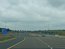
M4 motorway (Ireland)
| M4 motorway in Ireland | |

|
|
| map | |
| Basic data | |
| Operator: | Transport Infrastructure Ireland |
| Start of the street: | M50 motorway (Ireland) Junction 7 |
| End of street: | Kinnegad |
| Overall length: | 44.8 km |
|
Counties : |
|
| Road sign on the M4 near Kinnegad | |
The M4 motorway ( English for "M4", Irish Mótarbhealach M4 ) is a 44.8 km long sections toll trunk road connection in the Republic of Ireland , which from Dublin orbital motorway M50 motorway over a 5,6 km-long joint the national road N4 to West-Northwest to Kinnegad and on as the N4 to Sligo via Longford and Carrick-on-Shannon . In Kinnegad it branches to the motorway M6 , the over Athlone town Galway reached. Further expansion towards Sligo to Mullingar North is planned.
Individual evidence
- ↑ Ordnance Survey Ireland / Ordnance Survey Northern Ireland (Ed.): Official Road Atlas Ireland / Atlas oifigiúil Bóitre Éireann, 7th Edition 2018, ISBN 978-1-908852-83-0


