
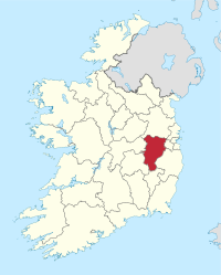
County Kildare
| map | |
|---|---|
  |
|
| Basic data | |
| Country: | Ireland |
| Administrative headquarters: | Naas |
| Province: | Leinster |
| Irish name: | Cill Dara |
| Surface: | 1694 km² |
| Residents: | 222,130 (2016) |
| License Plate: | KE |
Kildare ( Irish Cill Dara , dt. "Oak Church") is a county ( county ) in the east of the Republic of Ireland . The town of the same name is located in West Kildare .
geography
Apart from the volcanic area of the Chair of Kildare, the landscape is predominantly flat land, the appearance of which was shaped by the last Ice Age.
history
The area was conquered by the Anglo-Normans in 1171 ; in 1297 the county was established. The county is home to the Curragh Army Camp , where many Irish nationalists and foreign aircrews were interned during World War II. Kildare was also the scene of the Irish independence movement from 1919 to 1922. In the armed struggle for independence, 11 people died in Kildare, a less violent course compared to the urban centers. With its mass mobilizations, however, the agricultural labor movement in particular played a large part in the struggle for independence locally, even if this is hardly present in public memory. The historian Terence M. Dunne writes: "Although only a minor aspect in today's memory [...] the labor movement - especially the agricultural labor movement - was at the center of the revolution."
economy
Agriculture consists mainly of cattle breeding and horse and sheep farming; arable farming includes the cultivation of barley, wheat and sugar beet. There is a textile and paper industry as well as agricultural machinery. In the west, peat is still extracted for personal consumption. The northeast of the county is part of the Dublin economic catchment area .
politics
The distribution of seats in the county council following the local elections on May 23, 2014
| Political party | Seats |
|---|---|
| Fianna Fáil | 12 |
| Fine Gael | 9 |
| Sinn Féin | 5 |
| Labor Party | 5 |
| Non-party | 9 |
Kildare sends seven MEPs to the Irish Parliament ( Dáil Éireann ). The county is divided into two constituencies. In the 2016 election, Fianna Fáil won 4, Fine Gael 2 and the newly formed Social Democrats won 1 seat.
Cities
Attractions
- Ardrass Church , church
- Broadleas Commons stone circle
- Castledermot , with two Celtic crosses , a round tower and the ruins of a Franciscan monastery
- Dun Aillinne Hillfort
- Longstone Rath (Kildare)
- Menhir from Crehelp
- Menhir of Punchestown
- Moth from Ardscull
- Basement of Killashee
- Bolton Hill ( Bullauns in place)
- Irish National Stud and Japanese Garden
- Kildare, cathedral with high cross and climbable round tower
- Kilgowan (Menhir)
- Moone, church and high cross
- Mullaghmast (Menhir)
- Old Kilculeen, Hochkreuz and Round Tower
- Oughterard, church and round tower
- Rathcoffey, Castle
- Taghadoe, round tower
Personalities
- Arthur Guinness (1725–1803), founder of the famous Guinness beer brand
- Jack Dempsey (The Nonpareil) (1862–1895), world middleweight boxing champion
- Ernest Shackleton (1874–1922), polar explorer
- Thomas Joseph Flanagan (1930–2019), Irish-American clergyman and Roman Catholic auxiliary bishop of San Antonio
- Christy Moore (* 1945), musician
- Damien Rice (* 1973), musician
- Devon Murray (born 1988), actor
literature
- Terence M. Dunne: The Peasant Movement During the Irish Revolution. The case of County Kildare , in: Work - Movement - History , Volume III / 2017, pp. 55–73.
Web links
- Kildare County Council (English)
- Website of Kildare Town (English)
Individual evidence
- ^ Terence M. Dunne: The Peasant Movement During the Irish Revolution. The case of County Kildare , in: Work - Movement - History , Volume III / 2017, pp. 55–73.
Carlow |
Cavan |
Clare |
Cork |
Cork (City) ** |
Donegal |
Dublin * |
Dublin (City) ** |
Dún Laoghaire-Rathdown ** |
Fingal ** |
Galway |
Galway (City) ** |
Kerry |
Kildare |
Kilkenny |
Laois |
Leitrim |
Limerick |
Longford |
Louth |
Mayo |
Meath |
Monaghan |
Offaly |
Roscommon |
Sligo |
South Dublin ** |
Tipperary |
Waterford |
Westmeath |
Wexford |
Wicklow
* historic county, ** newly created county
Coordinates: 53 ° 11 ′ N , 6 ° 49 ′ W