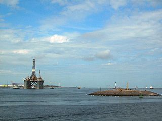
Euro-Maasgeul
| Euro-Maasgeul (Eurogeul and Maasgeul) | |
|---|---|
| location | Netherlands, South Holland |
| length | 57 kilometers (31 nautical miles) |
| Built | 1970 |
| Beginning | North Sea traffic separation area |
| The End | Maasvlakte deep water port |
| Ports | Rotterdam |
| Deep water fairway with a water depth of 26 meters (IM) | |
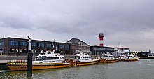
| Meuse estuary view to the west with upper and lower fire of the central fire line | |
Euro-Maasgeuel or Eurogeul ( Dutch ) refers to a waterway for seagoing vessels off the coast of the Netherlands . The man-made fairway ( geul in Dutch ) enables ships with a draft of up to 22.85 meters to call at the deep-water port of Rotterdam . The access route is divided into the Eurogeul of around 46 kilometers (25 nautical miles ) and the subsequent Maasgeul of 11 kilometers (6 nautical miles), which ends in front of the Maasvlakte in the province of South Holland .
Euro owl
In the English Channel between Britain and the Netherlands a network runs from international shipping routes for seagoing vessels with very deep draft. In order to avoid collisions in the busy area, a traffic separation area has been created. Off the coast of the Netherlands, the water depth sinks from 40 meters in the English Channel to less than 20 meters, so that the large ships cannot head for the Dutch ports fully loaded. This is why Rijkswaterstaat , the Dutch authority for the construction and maintenance of waterways, dredged the Eurogeul fairway from 600 to 1200 meters wide, thus creating the connection between the traffic separation area in the North Sea and the deep-water port on the Maasvlakte. The channel was created in the 1970s for seagoing ships with a draft of around 20 meters. Ships with an even greater draft can only call at the port when the tide is high .
Maasgeul
The last six nautical miles off the Maasvlakte be Maasgeul called that for a Tilt starboard starts (right) behind the Eurogeul. The fairway has a basic width of 600 meters and a guaranteed water depth of 24.3 meters ( NAP ). Ships with a maximum draft of 22.85 meters are permitted by the Rijkswaterstaat supervisory authority.
The fairway runs directly towards the harbor entrance (Maasmond) at Hoek van Holland , where the waterway divides. The northern part leads as Nieuwe Waterweg to the port of Rotterdam and the city center with the cruise terminal. The southern part is called the Caland Canal and is the access to Europoort and the Maasvlakte. The Nieuwe Waterweg has a red fire guide as a navigation aid , while a green line guides into the Caland Canal. The central fire line in the middle shines in white. Each guideline consists of two successive beacons of different heights, the lights of which must be on top of each other when they are correctly approached.
Expansion of the fairway
The general trend towards ever larger ships with a correspondingly greater draft led to the planning of the expansion of the Maasvlakte to become the largest deep water port in Europe. As a result, a further increase in ship movements in the Euro-Maasgeul was expected. In order to be able to conduct ship traffic more smoothly and safely, the Ministry of Transport, Public Works and Water Management announced in 2008 that the fairway in the Maasgeul would be widened to 830 meters so that New Panamax ships could also encounter ships in this part . With the opening of Maasvlakte 2 (planned for 2013), the necessary dredging work should be completed.
During the expansion work, turning points with a diameter of 2700 meters were created at the same time at the beginning and at the end of the Eurogeul. Because of their shape, the turning areas are also called "chain guards". The turning areas can also be used as an emergency anchorage and have a guaranteed depth of 25.60 meters NAP.
The technical and nautical management of Eurogeul and Maasgeul is in the hands of Rijkswaterstaat and the Port of Rotterdam Authority. Both services ensure that the nautically guaranteed depths are maintained. In order to keep Eurogeul, anchorages and turning areas at depth, these are constantly checked and, if necessary, dredged. The dredging work produces 5 to 7 million tons of sand every year.
Fairway marking
The beginning of Eurogeul 57 kilometers off the coast is marked by the EURO-E-Buoy (vertical red and white striped light buoy). Towards the Dutch coast is followed by seven yellow light buoys with odd numbers of E1 to 13, in left-hand traffic must be passed by the ships on the starboard (right) side. At the end of Eurogeul there is again a vertical red and white striped light buoy, which is marked with MC . MC means Maas Center and is also the eastern turning point.
Halfway in the Maasgeul, an area is marked that is not specially marked. There, the ship's command is obliged to pay more attention, because a crossing point for pleasure craft shipping has been established there.
Soldering
The port of Rotterdam is one of the busiest ports in the world with around 32,000 ships annually. A ship with maximum draft travels through this fairway every day. In order to ensure safety at sea and to guarantee a smooth flow of traffic, the vast majority of these ships must have a pilot on board when entering and leaving the port. With regard to the compulsory use, three different categories of ships are distinguished:
- Normal ships - with a draft less than 14.30 meters - can approach the Maasmond freely.
- Half-Geul ships - drafts from 14.30 to 17.40 meters - only have to use the Maasgeul.
- Geul ships - draft over 17.40 meters - have to use the Eurogeul and Maasgeul.
If the Eurogeul or Maasgeul is obliged to use it, there is also a pilot obligation for the entire length of the fairway. Therefore, the Geul ships must have a pilot on board before they enter the Eurogeul . These are deposited on the ships with helicopters . The smaller ships that are allowed to head for the Maasgeul directly only take over the pilot at the Maas Center , which is brought by pilot tenders .
All ships with a pilotage requirement are manned by two pilots - a Geul pilot and an experienced Euro Geul pilot. The supervisory authorities do not allow the pilots to use the navigation instruments of the ship to be piloted. Therefore, the pilots bring their own autonomous navigation equipment that works with two satellite antennas. The two antennas form a baseline, which means that the exact position of the ship and the movement of the bow and stern can be precisely followed.
The basis is the Global Positioning System (GPS) of the American and Russian satellites, supplemented by correction signals from the bank. However, the exact satellite navigation remains error-prone, so that the Dutch pilotage system has tried to find an alternative positioning system as a backup. With funding from the Rotterdam port administration, eDLoran was created, which can determine the location with an accuracy of less than five meters. It is based on the radio navigation system LORAN ( LO ng RA nge N avigation) and also uses the signals from towers in England , France and Germany are transferred. The pilots can follow the exact position and course of the ship on a notebook . The map display also shows the port administration's radar signal and information from the Automatic Identification System (AIS). This makes the ships in the immediate vicinity visible to the pilots even when visibility is poor.
In unfavorable weather conditions, smaller ships can also be guided from land, with a specially trained pilot sitting in a radar station. Only when the ship has reached the pier at Hoek van Holland does the assigned pilot physically climb on board. A similar procedure applies to departing ships.
See also
Web links
Individual evidence
- ↑ a b Key figures for the North Sea and the access channels (Dutch)
- ↑ a b c d e f Eurogeul Fahrrinne in sensagent.com (Dutch)
- ↑ The Maasgeul is being expanded
- ↑ Massgeul 830 meters wide (Dutch)
- ↑ The pilot system at the mouth of the Rotterdam Rhine (English)
Coordinates: 52 ° 59 ′ N , 4 ° 4 ′ E


