Maracaibo lake
| Maracaibo lake | ||
|---|---|---|

|
||
| Map of Lake Maracaibo | ||
| Geographical location | Venezuela | |
| Data | ||
| Coordinates | 9 ° 45 ′ N , 71 ° 33 ′ W | |
|
|
||
| surface | 13,512 km² | |
| Maximum depth | 35 m | |
|
particularities |
||
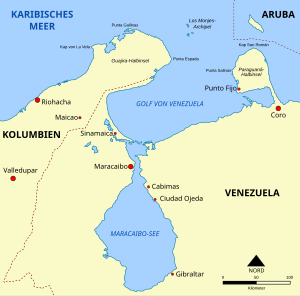
The Maracaibo Lake (Spanish Lago de Maracaibo ) is an inland sea in the northwest of Venezuela . It is located in the Maracaibo Basin and connects to the north with the Gulf of Venezuela , which borders the Caribbean Sea .
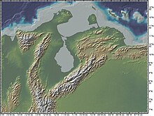
Due to the almost complete separation from the Caribbean Sea, the Maracaibo is often viewed as a lake and would be the largest lake in South America with an area of 13,512 square kilometers . Geological records show that in the past it was actually a lake that, with an age of 20 to 36 million years, is one of the oldest lakes on earth.
geography

The inland sea is 13,512 km² and up to 35 m deep. It is through the 38 km long and 5.5 to 14.6 km wide Strait Canal de San Carlos with the Gulf of Venezuela and the Caribbean , respectively. Because of its short connection to the sea, Lake Maracaibo is also used by ocean- going vessels ; at the mouth are the port cities of Cabimas and Maracaibo .
The total of 135 tributaries of Lake Maracaibo include the Apón, Aricuaisa, Aurare, Bravo, Burro Negro, Catatumbo , Caus, Chama , Escalante , Limón, Machango, Mene, Misoa, Motatán, Onia, Palmar, Santa Ana , Tamare, Tucani as well as Ule. The Catatumbo thunderstorm phenomenon occurs at the mouth of the Catatumbo .
While the northern part of the inland sea still contains brackish water , the southern part is completely sweetened .
Due to the great extent and geological nature of Lake Maracaibo, it has numerous islands, some of them larger. Most of these islands belong to the region of the municipality of Almirante Padilla: Zapara, Toas, San Carlos, Isla de Providencia, Isla de Pescadores, Los Pájaros, Maraca, San Bernardo and Sabaneta de Montiel.
Lake Maracaibo holds the absolute world record of lightning worldwide. Due to its large area between the two northernmost foothills of the Andes and its average water temperature of 30 degrees Celsius, a large amount of water evaporates there during the day. At night, the mountain slopes surrounding the lake cool faster than the warm air over the lake. This temperature contrast promotes cloud formation and creates extremely high source clouds. Strong thunderstorms with correspondingly intense electrical discharges are the result. According to the records of the satellite, there are on average more than 233 lightning flashes per year over every square kilometer of the lake, with most thunderstorms occurring in the night hours of late summer. Occasionally, up to 65 lightning strikes per square kilometer and night were measured there. Lightning strikes in the area repeatedly lead to losses among the extensive herds of cattle that graze in the shallow bank area of the lake. Occasionally, lightning strikes oil wells and sets them on fire. Under the shallow lake there are large reservoirs of hydrocarbons, from which the Venezuelan state oil company extracts oil and gas.
Flora and fauna
The oxygen-rich water of Lake Maracaibo promotes algae growth and leads to a rich biodiversity. These include herons, crocodile caimans , shrimps, iguanas, catfish, perches, mullets, armadillos and brown pelicans as well as Guyana dolphins . The endemic fish in the basin of Lake Maracaibo include the Lamontichthys maracaibero , which belongs to the armor catfish family and reaches a length of up to 21 centimeters, as well as a species of the genus Mylossoma .
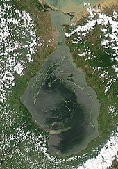
In the summer of 2004 there was a plague on Lake Maracaibo due to the massive spread of the duckweed . The reason for this is seen in the increasing sweetening of the lake water through increased rainfall . In addition, environmental influences from the oil industry should play a role.
In the southwest is the Ciénagas de Juan Manuel National Park . The park is mainly characterized by moorland, tropical forests and a rich population of different bird species. Other fauna include river dolphins, tapirs and big cats.
history
Native people and explorers
The first known settlements in the bay were those of the indigenous people, the Añu (also Paraujano ) belonging to the Arawak . The tribe, whose name translated means "people of the water" or "people of the lagoon", called the Maracaibo Lake Conquibacao or Coquivacoa . Other important tribes during this period were the Wayúu (Guajiro), the Caquetíos and the Quiriquires. Even today there are indigenous settlements in the western border area with Colombia on the Laguna de Sinamaica and in isolated cases in northern Zulia. More of these pile - dwelling settlements, known in Spanish as palafitos , exist in the south and southwest of the lake near Lagunetas and in Santa Rosa, a district of Maracaibo.
On August 24, 1499, Amerigo Vespucci and Alonso de Ojeda drove through a strait into a huge brackish lake, which they called Lago de Bartolomé , after the day saint Bartholomew .
Legend has it that the Ojeda expedition found numerous huts owned by locals that were built on stilts over the water and connected to each other and to the lake shore by wooden walkways. The stilt houses reminded Vespucci of the city of Venice (Italian: Venezia ), so that he baptized the region of Venezuela - in the sense of Little Venice in Italian. The word has the same meaning in Spanish, where the suffix "-uela" is used as a diminutive : for example plazuela becomes plazuela and cazo becomes cazuela.
Although the story of Ojeda and Vespucci remains the most popular and accepted version of Venezuela's name origin, some sources point to Martín Fernández de Enciso , a member of the Vespucci and Ojeda crew. In his work Summa de Geografía he describes that they discovered an indigenous population during the expedition who called themselves the "Veneciuela". This allows the conclusion that the name “Venezuela” can be natively derived from this.
16th to 19th century
From 1528 to 1545 the land around the lake was pledged to the Welsers as Little Venice . In 1529 Neu-Nürnberg, later called Maracaibo , was founded. But the efforts of the Welser were unsuccessful and the fiefdom was withdrawn from them. The lake was later named Lago de Maracaibo : "Maracaibo Lake".
During the seventeenth century, pirate raids continued to occur on Lake Maracaibo . Well-known pirates of this time included Enrique de Gerard (1614), William Jackson (1642), Jean-David Nau "l Olonnés" (1666), Miguel Vascongado (1667), Henry Morgan (1669) and Michel de Grandmont (1678) .
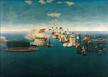
On July 24, 1823, the naval battle of the Maracaibo broke out in the bay , during which the Spanish fleet under Captain Ángel Laborde was defeated by the Republican Navy under Admiral José Prudencio Padilla ; it is considered the last battle of the Wars of Independence in Venezuela . Historians usually consider the Battle of Carabobo on June 24, 1821 under General Simón Bolívar to be the decisive battle in Venezuela's independence.
20th century
In 1917 petroleum was found near Cabimas on the east coast of the lake , and further oil fields followed. Between 1923 and 1953 a fleet of small oil tankers , the so-called mosquito fleet, was used . These had a particularly shallow draft and were used to transport the crude oil to the oil refineries in Aruba and Curaçao as well as to the tankers anchored in front of the bay . The fleet was necessary because the strait connecting the lake with the Gulf of Venezuela and the Caribbean , the Canal de San Carlos , initially only reached depths of four meters due to moving sand bars. The fairway was later deepened and in the late 1940s, construction of oil pipelines to the deep-water port of the Paraguaná Peninsula began.
The General Rafael Urdaneta Bridge (8,678 m), completed in 1962, crosses the Canal de San Carlos on a route south of the center of Maracaibo; it is one of the longest bridges in the world and was considered the longest cable-stayed bridge in the world when it was completed .
On April 6, 1964, the tanker Esso Maracaibo collided with the bridge after its electrical systems failed. The collision caused two pillars to collapse, killing seven people. The tanker accident had no further consequences for the lake.
For the construction of a second bridge, which is to connect Santa Cruz de Mara with Punta de Palmas , preliminary investigations for foundations took place in 2013 [obsolete] . The bridge should enable road and rail traffic and will be 10.8 km long. The overhead line crossing of Lake Maracaibo already connects the two cities.
economy
The economy of Lake Maracaibo is largely based on the oil industry, fishing and tourism.
The lake acts as an important shipping route to the ports of Maracaibo and Cabimas . The surrounding Maracaibo Basin contains large oil deposits, which are a major source of income for Venezuela's economy. Almost a quarter of the Venezuelan population lives near the lake.
According to a survey from 2000, Lake Maracaibo feeds nearly 20,000 fishermen .
literature
- Hanns Simons , Heinz Wind, W. Hans Moser: The bridge over Lake Maracaibo in Venezuela: General Rafael Urdaneta Bridge , Bauverlag, Wiesbaden, Berlin 1963
Individual evidence
- ↑ DEME: Lake Maracaibo ( Memento of the original from January 2, 2009 in the Internet Archive ) Info: The archive link was automatically inserted and not yet checked. Please check the original and archive link according to the instructions and then remove this notice.
- ↑ The Compass of Sigma Gamma Epsilon (1939: 184)
- ^ Ralph Alexander Liddle (1946: 24) The Geology of Venezuela and Trinidad
- ↑ Kenneth Knight Landes (1951: 535) Petroleum Geology
- ^ Lake Profile: Maracaibo . LakeNet.
- ↑ a b Maracaibo, Lake ( Memento of the original from December 21, 2006 in the Internet Archive ) Info: The archive link was automatically inserted and not yet checked. Please check the original and archive link according to the instructions and then remove this notice. . The Columbia Encyclopedia, Sixth Edition.
- ↑ Thunderstorm Research: Africa is the continent of lightning . In: Frankfurter Allgemeine Zeitung . January 27, 2017 ( faz.net ).
- ↑ Krzysztof Dydynski, Charlotte Beech: Venezuela . Lonely Planet, 2004, ISBN 978-1-74104-197-2 , p. 177 (accessed March 10, 2007).
- ^ Hugh Thomas: Rivers of Gold: The Rise of the Spanish Empire, from Columbus to Magellan . Random House, 2005, ISBN 0-375-50204-1 , p. 189.
- ^ Cuadernos Hispanoamericanos ( Spanish ). Instituto de Cultura Hispánica (Agencia Española de Cooperación Internacional), 1958, p. 386.
- ↑ Eljuri-Yunes S. Antonio R. 1985. La Batalla Naval del Lago de Maracaibo. Cuarta Edición. comandancia General de la Armada. Caracas, pp. 204.
- ↑ Vargas, Francisco Alejandro. 1994. Historia Naval de Venezuela. Comandancia General de la Marina. Caracas. 3 volumes. ISBN 980-224-028-1
- ↑ Preparations are underway for a new bridge in Venezuela. worldhighways.com, June 2013, accessed January 1, 2016 .
- ↑ http://www.worldlakes.org/lakedetails.asp?lakeid=9069
- ↑ http://www.businessweek.com/2000/00_51/c3712238.htm


