Merishausertal
| Merishausertal / Mühlental | ||
|---|---|---|
|
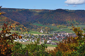
Merishausen in the Merishausertal |
||
| location | Canton of Schaffhausen , Switzerland + Baden-Württemberg , Germany | |
| Waters | Durach | |
| Mountains | Randen and Reiat | |
| Geographical location | 687 781 / 290671 | |
|
|
||
| height | 769 to 458 m above sea level M. | |
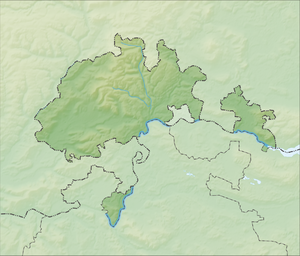
The Merishausertal , resp. Merishuusertaal according to the maps of Swisstopo , is a valley in Switzerland that lies almost entirely in the canton of Schaffhausen and forms the border between the heights of the Rand in the west and the Reiat in the east. It extends from the German Neuhaus am Randen , a district of the city of Blumberg ( Schwarzwald-Baar district ), to the center of the city of Schaffhausen and runs mainly in a south-southeast direction. The northernmost municipality in Switzerland, Bargen , and the eponymous village of Merishausen are located in the Merishausertal . Between these places, the German-Swiss border runs in the valley floor for a short distance near the hamlet of Schlauch ( Wiechs am Randen , City of Tengen ) .
The valley is characterized by agriculture and is traversed by the Durach, which is why the vernacular sometimes speaks of the Durach valley . At the level Merishausen the east branches the Grätental and west facing the Dostental off at the level of Bargen west the Mills .
The A4 motorway leads through the valley to Germany, behind Bargen is the Swiss customs office of the same name, about 2 km above the German customs building before Neuhaus am Randen. In addition, Hauptstrasse 4 and Wanderland Route No. 77 (western arm of the ViaGottardo ) run by SwitzerlandMobility through the Merishausertal.
In the north of Schaffhausen, near the lodging house , where the village of Berslingen stood until around 1200 , the name of the valley changes. From here on it is called Mühlental . The character of the valley is also changing. It becomes narrow, with partly vertically sloping rock walls. Here Johann Conrad Fischer acquired a mill in 1802, which he converted into a foundry and with this laid the foundation for today's Georg Fischer AG . Over time, the up-and-coming company built huge workshops in the narrow valley, in which steel products of all kinds, such as B. Turbines and armor shells were cast.
At Schaffhausen Train the mills ends.
literature
- Walter Ulrich Guyan and Kurt Suter (eds.): The Durachtal. Festschrift for Ernst Lieb . 1968.

