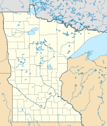
Merrifield, Minnesota
| Merrifield | ||
|---|---|---|
|
Location in Minnesota
|
||
| Basic data | ||
| State : | United States | |
| State : | Minnesota | |
| County : | Crow Wing County | |
| Coordinates : | 46 ° 28 ′ N , 94 ° 10 ′ W | |
| Time zone : | Central ( UTC − 6 / −5 ) | |
| Residents : | 140 (as of 2010) | |
| Population density : | 99.3 inhabitants per km 2 | |
| Area : | 1.41 km 2 (approx. 1 mi 2 ) | |
| Height : | 372 m | |
| Postal code : | 56465 | |
| Area code : | +1 218 | |
| FIPS : | 27-41804 | |
| GNIS ID : | 647778 | |
Merrifield is a settlement on community-free area in Crow Wing County in the northern center of the US -amerikanischen state of Minnesota . For statistical purposes, the place has been combined to form a census-designated place (CDP) . In 2010 , Merrifield had 140 residents.
geography
Merrifield is on the northeast shore of North Long Lake and about 2 km west of the upper Mississippi . The place lies at 46 ° 27'54 "north latitude, 91 ° 10'22" west longitude and extends over 1.41 km². The place is in the Lake Edward Township .
Neighboring towns to Merrifield are Breezy Point, Minnesota (10.3 miles north) and Brainerd (8.9 miles south).
The closest major cities are Minneapolis (214 km southeast), Minnesota's capital Saint Paul (228 km in the same direction), Eau Claire in Wisconsin (357 km southeast), Duluth on Lake Superior (192 km east) and Fargo in North Dakota ( 234 km west).
The Canadian border is 270 km north.
traffic
In Merrifield, several county roads and subordinate highways and dirt roads meet.
From northwest to south, the Paul Bunyan State Trail runs through Merrifield on a former railway line of the then Burlington Northern Railroad , a rail trail named after the legendary lumberjack Paul Bunyan .
With the Brainerd Lakes Regional Airport is 17.1 km southeast of Merrifield a small regional airport. The nearest major airport is Minneapolis-Saint Paul International Airport, 237 km south-southeast .
Demographic data
According to the 2010 census , Merrifield had 140 people in 69 households. The population density was 99.3 people per square kilometer. Statistically, 2.03 people lived in each of the 69 households.
Ethnically, the population consisted only of whites with three exceptions. Regardless of ethnicity, 1.4 percent (two people) of the population were Hispanic or Latino of any race.
7.1 percent of the population were under 18 years old, 65.0 percent were between 18 and 64 and 27.9 percent were 65 years or older. 49.3 percent of the population was female.
The average annual income for a household was 45,156 USD . The per capita income was $ 28,014. Nobody lived below the poverty line.
Individual evidence
- ^ A b American Fact Finder. Retrieved April 20, 2013
- ↑ Distance information according to Google Maps. Accessed April 20, 2013
