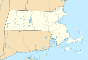
Middleborough
| Middleborough | ||
|---|---|---|
|
Location in Massachusetts
|
||
| Basic data | ||
| Foundation : | 1669 | |
| State : | United States | |
| State : | Massachusetts | |
| County : | Plymouth County | |
| Coordinates : | 41 ° 53 ′ N , 70 ° 54 ′ W | |
| Time zone : | Eastern ( UTC − 5 / −4 ) | |
| Residents : | 23,116 (as of 2010) | |
| Population density : | 129.2 inhabitants per km 2 | |
| Area : | 186.9 km 2 (approx. 72 mi 2 ) of which 178.9 km 2 (approx. 69 mi 2 ) are land |
|
| Height : | 43 m | |
| Postcodes : | 02344, 02346, 02348, 02349 | |
| Area code : | +1 508/774 | |
| FIPS : | 25-40850 | |
| GNIS ID : | 0618346 | |
| Website : | www.middleborough.com | |
 Middleboro Town Hall in the Middleborough Center Historic District |
||
Middlesborough sometimes even Middleboro written, is a town ( Town ) in Plymouth County in the US state of Massachusetts with 23,116 inhabitants (2010).
geography
The city joins Wareham in a north-westerly direction . Boston is 50 kilometers to the northwest and Providence is 45 kilometers to the west. The 495 , which in this area Blue Star Memorial Highway is called runs right through Middlesborough. In the north the city is bounded by the Taunton River .
history
The first European settlers settled on the Nemasket River in 1661 and called the place Nemasket , which means something like "place of fish" in the language of the Wampanoagindians living in the region, but soon changed the name to Middleberry . Tradition has it that this name was chosen because it was halfway between Plymouth and Mount Hope , the home of Massasoit , a chief of the Wampanoag. The official founding of the Town of Middleborough took place in 1669. There are different opinions regarding the name. Some chroniclers believe the name was chosen based on a location in Middlebury , England , which is not documented. It is more likely that the name can be traced back to the city of Middelburg in the province of Zeeland in the Netherlands , as some of the first settlers who reached the North American coast as pilgrims on the Mayflower were part of the Middelburg-based separatist organization of the Brownists .
Initially, the inhabitants lived mainly from agriculture and fishing. In particular, herring ( Clupea harengus ) (herring) were caught during their migrations from the Nemasket River. This tradition is remembered up to the present day with the Herring Run Festival that takes place every spring .
In 1884 the Alden shoe factory started production and developed into the largest shoe manufacturer in North America. The factory is still a major manufacturer of footwear today. Another important industry is the cultivation of cranberries ( Vaccinium macrocarpon ) (English: cranberry ), which is also with the establishment of the headquarters of the company Ocean Spray comes, which is engaged in the production of cranberry products expressed
Some historically valuable buildings and places are on the list of entries on the National Register of Historic Places in Plymouth County, Massachusetts . These include: Middleborough Center Historic District , Muttock Historic and Archeological District , South Middleborough Historic District , Tom Thumb House , Middleborough Waterworks , Peter Pierce Store , US Post Office-Middleborough Main, and Wampanucket Site .
Demographic data
In 2010, a population of 23,116 people was determined, which corresponds to an increase of 15.9% compared to the year 2000. The average age of 41.2 years in 2010 was slightly above the value for Massachusetts, which was 39.2 years.
sons and daughters of the town
- Howard A. Coffin , politician
- Abner B. Thompson , businessman, general, and politician
- Lavinia Warren , actress
Individual evidence
- ↑ US Postal Service - ZIP Codes
- ↑ naming 1
- ^ History
- ↑ naming 2
- ↑ naming 3
- ^ Middleborough Herring Run Festival
- ↑ Alden shoe factory
- ↑ City data
Web links
- oceanspray - Ocean Spray Company
- massarchaeology - Robbins Museum
- middleboroughhistoricalassociation - Middleborough Historical Association


