Wareham (Massachusetts)
| Wareham | ||
|---|---|---|
|
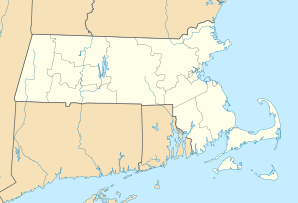
Location in Massachusetts
|
||
| Basic data | ||
| Foundation : | 1739 | |
| State : | United States | |
| State : | Massachusetts | |
| County : | Plymouth County | |
| Coordinates : | 41 ° 46 ′ N , 70 ° 43 ′ W | |
| Time zone : | Eastern ( UTC − 5 / −4 ) | |
| Residents : | 21,822 (as of 2010) | |
| Population density : | 235.4 inhabitants per km 2 | |
| Area : | 119.9 km 2 (approx. 46 mi 2 ) of which 92.7 km 2 (approx. 36 mi 2 ) are land |
|
| Height : | 6 m | |
| Postcodes : | 02571 | |
| Area code : | +1 508 | |
| FIPS : | 25-72985 | |
| GNIS ID : | 0618353 | |
| Website : | www.wareham.ma.us | |
Wareham is a town ( Town ) in Plymouth County in the US state of Massachusetts with 21,822 inhabitants (2010).
geography
The city is located on the northern coast of Buzzards Bay and on the western edge of Cape Cod , about 50 kilometers east of Providence and 70 kilometers southeast of Boston . The highways Interstate 195 and Interstate 495 meet in Wareham, US Highway 6 , which is called the Cranberry Highway in this area , runs through the city.
history
The area was inhabited by Indians until the 17th century . After the King Philip's War , European settlers settled there, whose livelihoods were primarily agriculture and fishing. The Town of Wareham was officially founded on July 10, 1739 and was named after the city of Wareham in England .
In the 18th and 19th centuries , the area of activity expanded to include the steel processing , shipbuilding , salt extraction , mackerel fishing and whaling industries . The first major operation of the city was with mills equipped Tremont Nail Factory . With the commissioning of a railway line in 1847, the production of nails , horseshoes and other products made of iron and steel continued to flourish , as the surrounding towns could now be supplied cheaply by rail. With the influx of more people, most of whom came from Ireland , the population continued to grow.
At the beginning of the 20th century , the previously dominant branches of industry experienced a slight downturn, as more modern technologies made it possible to produce more cheaply elsewhere. New areas of employment developed, namely tourism and the cultivation of cranberries ( Vaccinium macrocarpon ) (English: cranberry ). With the settlement of the AD Makepeace Company , Wareham has developed into a leading manufacturer of cranberry products. This is also expressed by the fact that the city hosts a cranberry festival in October each year, which is attended by many tourists . In tourism, Wareham advertises with the slogan Gateway to Cape Cod (The gateway to Cape Cod).
Some historically valuable buildings and places are on the list of entries on the National Register of Historic Places in Plymouth County, Massachusetts . These include: Tobey Homestead , Tremont Nail Factory District, and Conant's Hill Site .
Demographic data
In 2010 a population of 21,822 people was determined, which means an increase of 7.3% compared to the year 2000. The median age in 2010 was 44.4 years, above Massachusetts' 39.2 years.
sons and daughters of the town
- J. Brian Atwood (born 1942), government official and university professor
- Geena Davis (born 1956), actress and director
- Paul Fearing (1762-1822), politician
- Donald W. Nicholson (1888–1968), politician
- Skipp Sudduth (* 1956), actor and director
- Zephaniah Swift (1759-1823), politician
Individual evidence
Web links
- warehamhistoricalsociety - Wareham Historical Society
- cranberries.org - AD Makepeace Company


