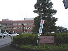
Mifune (Kumamoto)
| Mifune-machi 御 船 町 |
||
|---|---|---|
|
|
||
| Geographical location in Japan | ||
| Region : | Kyushu | |
| Prefecture : | Kumamoto | |
| Coordinates : | 32 ° 43 ' N , 130 ° 48' E | |
| Basic data | ||
| Surface: | 99.00 km² | |
| Residents : | 16,417 (October 1, 2019) |
|
| Population density : | 166 inhabitants per km² | |
| Community key : | 43443-4 | |
| Symbols | ||
| Flag / coat of arms: | ||
| Tree : | Ternstroemia gymnanthera | |
| Flower : | Japanese wisteria | |
| town hall | ||
| Address : |
Mifune Town Hall 995 - 1 , OÁZA Mifune Mifune -machi, Kamimashiki District Kumamoto 861-3296 |
|
| Website URL: | http://www.town.mifune.kumamoto.jp/ | |
| Location Mifunes in Kumamoto Prefecture | ||
Mifune ( Japanese 御 船 町 , - machi ) is a small town in Kamimashiki County in the Japanese prefecture of Kumamoto .
history
Today's Mifune was created on January 1, 1955 from the merger of the old Machi Mifune with 5 other Mura ( 滝 水 村 , 七 滝 村 , 木 倉 村 , 高 木村 and 豊 秋 列 村 ).
traffic
Kumamoto Airport is located in the neighboring city of Mashiki .
- Street:
- Kyushu Highway to Kitakyushu or Kagoshima
- National Road 443 to Ōkawa or Hikawa
- National Road 445 to Kumamoto or Hitoyoshi
Adjacent communities
Web links
Commons : Mifune - collection of pictures, videos and audio files


