Milchbornbach
| Milchbornbach | ||
|
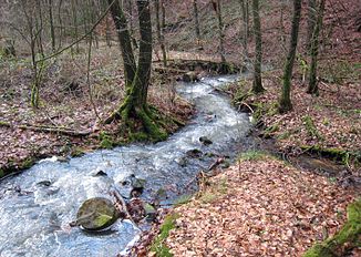
The Milchbornbach in the vicinity of the cadet pond |
||
| Data | ||
| Water code | DE : 27356622 | |
| location |
Bergische plateaus
|
|
| River system | Rhine | |
| Drain over | Saaler Mühlenbach → Frankenforstbach → Faulbach → Rhine → North Sea | |
| source | north of Moitzfeld 50 ° 58 ′ 15 ″ N , 7 ° 11 ′ 11 ″ E |
|
| Source height | approx. 190 m above sea level NN | |
| muzzle | At the Waldstadion Milchborntal Coordinates: 50 ° 58 ′ 13 ″ N , 7 ° 10 ′ 2 ″ E 50 ° 58 ′ 13 ″ N , 7 ° 10 ′ 2 ″ E |
|
| Mouth height | 140 m above sea level NN | |
| Height difference | approx. 50 m | |
| Bottom slope | approx. 30 ‰ | |
| length | 1.6 km | |
| Catchment area | 52.8 ha | |
The Milchbornbach is a 1.6 km long brook that flows into the Saaler Mühlenbach .
The name of the water body Milchbornbach can also be found in settlement names and tub names. The original cadastre records the single homestead Am Milchborn , northwest of Schloss Bensberg, as well as the name Am Milchbornsfeld . The name comes from the whitish-cloudy color of the water, which has an association with milk . Consequently, the stream name Milchborn means a spring from which milky-cloudy water flows.
geography
course
The Milchbornbach rises in Moitzfeld east of the Moitzfeld cemetery. On its way to the Waldstadion Milchborntal, where it flows into the Saaler Mühlenbach , it flows through the Milchborntal in the Bensberg district . On the way he feeds, among other things, the cadet pond .
Historically and in usage today, the area from the mouth of the Milchbornbach to the Bensberger See is also called Milchbornbach, although this is officially a section of the Saaler Mühlenbach.
Catchment area
The 0.528 km² catchment area of the Milchbornbach lies in the Bensberg-Forsbacher mountain range and the Sülz plateau . It lies in a ground moraine with silt , sand and gravel soils .
It borders
- in the southeast to that of the Eschbach , a tributary of the Sülz
- in the north to that of the Lerbach , a tributary of the Strunde
- in the northwest to that of the Scheidtbach , also a tributary of the Strund
- otherwise to that of the receiving Saaler Mühlenbach
It is located in the Hardt nature reserve . The entire course is in the forest area.
literature
- Willi Ommer and Max Morsches : The Milchbornbach from the origin to the Saaler Mühle 1801–1808 , in the Heimatatlas Bergisch Gladbach and surroundings, sheet 15 (a, b and c), published by Bergischer Geschichtsverein Rhein-Berg eV, Bergisch Gladbach 2006
Individual evidence
- ↑ a b Ewald Glässer: Geographical land survey: The natural spatial units on sheet 122/123 Cologne / Aachen. Federal Institute for Regional Studies, Bad Godesberg 1978. → Online map (PDF; 8.7 MB)
- ↑ a b c d Specialized information system ELWAS, Ministry for Climate Protection, Environment, Agriculture, Nature and Consumer Protection NRW ( information )
- ^ Andree Schulte Bergisch Gladbach, City history in street names , Bergisch Gladbach 1995, ISBN 3-9804448-0-5 , p. 165 f.
- ^ Official city map of Bergisch Gladbach , Official city map of the Rheinisch-Bergischer Kreis , 1st edition 2006
