
Moijero
|
Moijero Мойеро́, Мойеро, Мойера (Moijera) |
||
 Location of the Moijero (Мойеро) in the catchment area of the Khatanga |
||
| Data | ||
| Water code | RU : 17040200112117600012181 | |
| location | Krasnoyarsk Region , Russia ( Asia ) | |
| River system | Chatanga | |
| Drain over | Kotui → Chatanga → Arctic Ocean | |
| source | in the Central Siberian highlands 66 ° 56 ′ 0 ″ N , 102 ° 29 ′ 35 ″ E |
|
| Source height | approx. 550 m | |
| muzzle | in the Kotui northeast of the Jesseisees coordinates: 68 ° 44 '15 " N , 103 ° 37' 56" O 68 ° 44 '15 " N , 103 ° 37' 56" O |
|
| Mouth height | 154 m | |
| Height difference | approx. 396 m | |
| Bottom slope | approx. 0.48 ‰ | |
| length | 825 km | |
| Catchment area | 30,900 km² | |
| Left tributaries | Dagaldyn , Mugamgu , Delingdeken , Kotschokan , Delingne , Moijerokan | |
| Right tributaries | Jantschgada , Moijerokan , Togoi-Jurjach | |
| Navigable | Underflow (conditional) | |
The Moijero ( Russian Мойеро́ ; also Мойера , Moijera ; or Mojero called) is a 825 km long, southeast and orographically right tributary of the Kotui in the northern part of the Central Siberian Mountains in the Asian part of Russia .
It is located on the territory of the former Evenks Autonomous Okrug (today Evenki "Nationalrajon" with special status) of the Krasnoyarsk Territory , not far from the border with the Sakha Republic (Yakutia) .
course
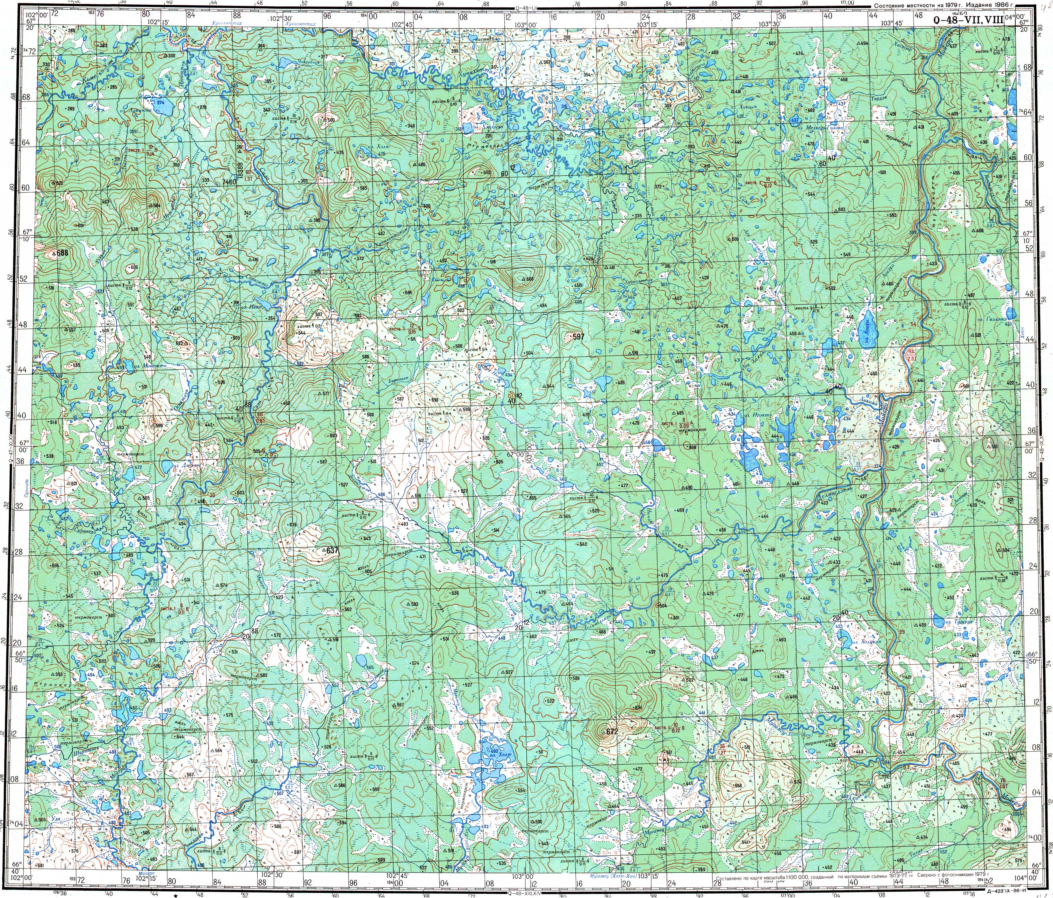
The Moijero rises in the Central Siberian mountainous region in a deserted landscape about 40 km north of the northern ( arctic ) polar circle . Its source is about 550 m above sea level.
Initially, the Moijero flows south, crosses the Arctic Circle, then turns to the east and later again to the north to cross the Arctic Circle again. In the further course of the project, he mainly kept this direction. In doing so, it mostly meanders in wide arches through the mountainous landscape of the forest tundra . In the middle reaches the Moijero cut into a deep and narrow valley; There are a number of rapids there , Mugdeken being the most important. In the lower reaches it also flows in sections to the west and finally in north-westerly directions.
The Moijero flows about 60 km northeast of Lake Jesse (with the settlement Jessei on its west bank ), the water of which reaches the right Chatanga source river Kotui through the Sikasjan , at 154 m altitude into the Kotui.
Tributaries
The most important tributaries are Dagaldyn, Mugamgu (also Cholju-Chan), Delingdeken, Kotschokan, Delingne and Moijerokan from the left and Jantschgada (also called Aptide), Moijerokan (also Moijerokon) and Togoi-Jurjach from the right. The left Moijerokan flows into the Moijero much further below than the most important tributary of the same name, Moijerokan (Moijerokon), which flows into the right.
Hydrology, hydrography and ice drift
The catchment area of the Moijero is 30,900 km². Near the mouth, the river is sometimes more than 100 meters wide and 3 meters deep; the mean flow velocity there is 0.7 m / s.
The Moijero freezes from October to the end of May / June, followed by a summer flood until August.
Infrastructure and settlement
The lower reaches (below the rapids on the middle reaches) are navigable for smaller vehicles. The river is hardly used, however, as it flows through extremely sparsely populated areas: there are no towns on the river; throughout, almost 500,000 square kilometers of the northern part of the former Autonomous Okrug, the Rajon Ilimpijski , live outside the administrative center Tura just over 2,000 people (0,004 inhabitants / km or 1 inhabitants on 250 square kilometers), in this part mainly "Jesseier Yakuts " the ( partly nomadic ) practice reindeer herding , fur hunting and fishing. Any infrastructure in the area through which the Moijero flows is accordingly lacking.
Individual evidence
-
↑ a b topographic map (1: 500,000, sheets Q-48 to A, B, ed. 1987), Moijero source (center left) and a. with Moijero flowing first to the south, then to the east and then to the north and the northern polar circle (in the lower part of the map); on mapq48.narod.ru (with heights above sea level )
see also / compare with:
topographical map (1: 200.000, p. Q-48-VII, VIII, edition 1986), Moijero-Quelle (center lower left) and a. with Moijero flowing first to the south (then outside the map to the east) and then to the north; on maps.vlasenko.net (with heights above sea level) - ↑ a b Topographical map (1: 200.000, Bl. R-48-XXV, XXVI, Ed. 1986), Moijero estuary (bottom right) and a. with Kotui flowing in a south-north direction (right part of the map); on mapr48.narod.ru (with heights above sea level )
- ↑ a b c d e Article Moijero in the Great Soviet Encyclopedia (BSE) , 3rd edition 1969–1978 (Russian)
- ↑ a b c d Moijero in the State Water Register of the Russian Federation (Russian)