Moosach (Salzach)
| Moosach | ||
|
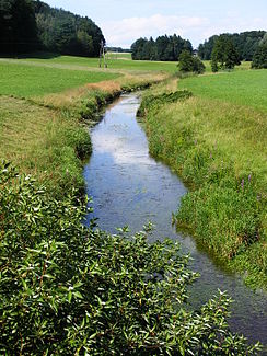
The Moosach near the village of Ölling (municipality of Sankt Georgen near Salzburg) |
||
| Data | ||
| location | Upper Austria and Salzburg | |
| River system | Danube | |
| Drain over | Salzach → Inn → Danube → Black Sea | |
| origin | in Ibmer Moos | |
| Source height | 424 m above sea level A. | |
| muzzle | near Riedersbach in the Salzach Coordinates: 48 ° 1 '13 " N , 12 ° 50' 47" E 48 ° 1 '13 " N , 12 ° 50' 47" E |
|
| Mouth height | 383 m above sea level A. | |
| Height difference | 41 m | |
| Bottom slope | approx. 2.9 ‰ | |
| length | approx. 14 km | |
| Discharge at the Au-St.Georgen gauge near Salzburg A Eo : 88.1 km² Location: 1.25 km above the mouth |
NNQ (07.06.1998) MNQ 1981–2010 MQ 1981–2010 Mq 1981–2010 MHQ 1981–2010 HHQ (02.08.1991) |
6 l / s 210 l / s 1.05 m³ / s 11.9 l / (s km²) 17.1 m³ / s 55.9 m³ / s |
| Left tributaries | Pladenbach | |
|
The Moosach north of St. Pantaleon |
||
The Moosach is an approximately 14 km long orographically right tributary of the Salzach in Austria , which rises in the Ibmermoos basin and flows into the Salzach at Riedersbach .
course
Southwest of the village of Hackenbuch (municipality of Moosdorf ), on the border between the federal states of Salzburg and Upper Austria , the three sources of the Moosach are concentrated: the Franzens Canal , the Holzöstersee- Bach and the main canal (approx. 424 m above sea level ).
On its way to the southwest the Moosach digs deeper and deeper into the surrounding moraine land . It flows south of the Innviertel villages Steinwag, Loidersdorf, Laubenbach, St. Pantaleon , Reith, Mühlach and Kirchberg towards the Salzach Valley and forms the border between the two federal states for about 10 km. At the village of Au in the municipality of Sankt Georgen bei Salzburg it reaches the valley of the Salzach, turns to the northwest and meanders for the remaining 4 km through the Salzachau, and finally near Riedersbach (approx. 383 m above sea level ) into the Salzach to flow.
Backwaters
The Moosach is fed by several smaller streams. The largest tributary is the approximately 18 km long Pladenbach , which rises in the municipality of Dorfbeuern and flows into the Moosach in the Salzachau near the village of Kirchberg.
Regulation and consequences
The Moosach has been subject to major changes in the last few centuries. Drainage projects in the Ibmermoos Basin have replaced natural inflows with canals. The Hackenbucher See, which supplied water for the Moosach, disappeared. The stretch of the river up to the Salzach lowlands was subjected to river regulation in several waves, so that the Moosach has largely lost its natural character on this stretch. Ironically, the most natural part of the Moosach lies in the Salzach floodplains, which in turn were only created in this area through the Salzach regulation.
Economic use
The use of hydropower on the Moosach had a long tradition. Between the village of St. Pantaleon and the Salzach valley there were four locations for such use of the water ( mills , sawmills , later an electricity company ). In the 20th century, however, they were largely abandoned or converted to electricity from the mains.
Bridge of Memory
In the municipality of Sankt Pantaleon there is a memorial to the work education and gypsy detention camp at St. Pantaleon-Weyer, which was operated during the time of National Socialism . In the course of coming to terms with the National Socialist past, the mayors of Sankt Georgen and Sankt Pantaleon, at the suggestion of Andreas Maislinger, declared the bridge over the Moosach next to the memorial a "Bridge of Remembrance".
Web links
Individual evidence
- ↑ Digital Upper Austrian Room Information System (DORIS)
- ↑ Federal Ministry of Agriculture, Forestry, Environment and Water Management (ed.): Hydrographisches Jahrbuch von Österreich 2010. 118th volume. Vienna 2012, p. OG 141, PDF (12.6 MB) on bmlrt.gv.at (2010 yearbook)

