Morro Reuter
| Morro Reuter | ||
|---|---|---|
|
Coordinates: 29 ° 32 ′ S , 51 ° 5 ′ W Morro Reuter on the map of Brazil
|
||
| Basic data | ||
| Country | Brazil | |
| State | Rio Grande do Sul | |
| City foundation | March 20, 1992 | |
| Residents | 6344 (Ber. 2018) | |
| City insignia | ||
| Detailed data | ||
| surface | 87.825 | |
| Population density | 64.76 inhabitants / km 2 | |
| height | 492 m | |
| Time zone | UTC −3 | |
| Website | ||
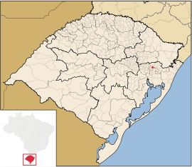
| Location of Morro Reuter in Rio Grande do Sul | ||
Morro Reuter is a municipality in the southernmost Brazilian state of Rio Grande do Sul . The city has 6,344 (2018 estimate) inhabitants, of which around 70% live in the town. It is located about 60 kilometers north of Porto Alegre in the Serra Gaúcha . Before becoming self-employed as a municipality , Morro Reuter was part of Dois Irmãos , before that of São Leopoldo .
Morro Reuter borders (starting in the north clockwise) with Picada Café , Santa Maria do Herval , Sapiranga , Dois Irmãos , Ivoti and Presidente Lucena . The mountainous municipality, which is partly overgrown with primeval forest, rises to an altitude of 700 meters. From the altitude you have impressive views.
history
The original indigenous inhabitants of the region were Bugres , whose traces can only be seen today in caves they dug.
The Reutersberg (the name probably goes back to a hostel run by the Reuter family) has been settled by German colonists since 1829. The first school was built in 1872. In the isolation of the area, which could only be reached on donkey back, the settlers were left to fend for themselves. They created community facilities and cultivated their German heritage. In 1907 the cooperative bank Caixa Rural União Popular de São José do Herval , based on ideas from Raiffeisen , was founded. From 1938 and during the Second World War , the use of the German language was increasingly prohibited under Getúlio Dornelles Vargas .
In a plebiscite in November 1991, the majority of the residents decided to form their own municipality. It consists of the central districts of Belvedere and Linha Görgen as well as the villages of Walachai, São José do Herval, Picada São Paulo, Linha Cristo Rei, Fazenda Padre Eterno, Birckental, Frankental, Muckental and Batatental .
traffic
In 1942 Morro Reuter got a connection to the road network via the main road from Porto Alegre to Caxias do Sul . The road was paved in 1956. Morro Reuter is on the Rota Romântica holiday route .
Web links
- Morro Reuter prefecture website (Portuguese)
- IBGE to Morro Reuter. Retrieved July 1, 2019 .


