Motte swan mill
| Motte swan mill | ||
|---|---|---|
|
Ramparts in the forest |
||
| Alternative name (s): | Schwanenburg | |
| Creation time : | before 1300 | |
| Castle type : | Niederungsburg, moth | |
| Conservation status: | Wall systems and castle mounds are available | |
| Place: | Langenfeld - Wiescheid | |
| Geographical location | 51 ° 8 '30.7 " N , 6 ° 58' 31.8" E | |
| Height: | 63 m above sea level NN | |
|
|
||
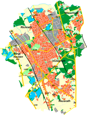
The Motte Schwanenmühle , also popularly known as " Schwanenburg ", is an early / high medieval fortification in the Langenfeld district of Wiescheid near the city limits of Solingen on the western edge of the Bergisches Land ( North Rhine-Westphalia ). The ramparts and the actual tower hill of the tower hill castle (Motte) for the residential tower ( keep ) of the lord of the castle are still preserved from the complex .
Brief description and location
The ruins of the Motte, registered as a ground monument, are located around 800 meters as the crow flies northwest of the moated castle Haus Graven , which was presumably built around 1300 as the successor castle to the Motte Schwanenmühle. The moth itself is believed to date from the eleventh or twelfth century. Today's restaurant Schwanenmühle is about 150 meters north, within sight of the Motte. The motte is west of the street Zur Schwanenmühle in an extensive forest and swamp area. The Viehbach delimits the Motte to the north. After a few kilometers, after the Riethrather Mühle , this is called the Riethrath Bach and flows into the Garath Mühlenbach in the Garath Castle Park . The state of preservation of the castle stables still allows the facility to be flooded, which was achieved in earlier times by damming the stream . Numerous parts of the castle are still regularly under water due to impermeable layers, rainfall and possible flooding by the stream, and thus show the functionality of the former fortifications. In the Wiescheider population there is also a rumor that there was an underground passage from the Graven house that was used as a tunnel for escape in times of armed conflict . The facility can be easily reached via the Posthornweg and Klingenpfad circular hiking trails .
Research findings
The Motte Schwanenmühle got its name from the experts who first examined the plant in 1968. They measured the Burgstall on behalf of the Rheinische Landesmuseums Bonn , but without undertaking archaeological excavations. In their opinion it is "one of the best-preserved weir systems of this type in the entire Vorderberg area". When evaluating their survey work, findings from the excavations at the Motte Husterknupp near Frimmersdorf in the Neuss district were also included. The moth was described by the experts as follows (literally quoted in Rolf Müller, Stadtgeschichte, summarized here):
The moth consists of two distinct parts. In the eastern part of the complex, the main castle is in the form of a rounded hill measuring around 20 × 30 m in diameter . The surface of this hill is flattened. It rises 1 m above the original terrain level surrounding it . Around the hill is a flat-bottomed, 8-10 m wide moat with an average depth of 2 m. In particular, the northern part of this circular trench system is often under water , which is supplied by the passing cattle stream. (Note: This does not apply to the same extent to the southern moat , which also often carries water in dry times, see above). To the west of this tower hill (a kind of donjon ) is an elongated outer bailey with a kidney-shaped shape. It is bordered on the edge by an artificially raised wall 1 to 2 m high. The area enclosed by walls measures around 75 m in the east-west direction and around 40 m in the north-south direction. The outer bailey is also enclosed by protective trenches 1 to 2 m deep, also equipped with a flat floor. To the outside, the oval trenches surrounding the outer bailey are again lined with ramparts. Viehbach and Vorburggraben are separated in the north by a 35 m long rampart 1 to 2 m high. Its function was to prevent an uncontrolled influx of water. Only at the western and eastern end of the wall existed passages to the cattle stream. "These passages, however," the researchers sum up, "which could be safely closed, made it possible, without a doubt, to submerge the entire system - or its trenches - in the event of danger and thus create natural protection ..."
- Pictures show the area further east
Individual evidence
- ↑ a b Rolf Müller, " local history Langenfeld Rheinland ", published by the city archives Langenfeld 1992
- ^ Friedhelm Görgens, Langenfeld , Droste, Düsseldorf 1984
- ^ Falk city map, Monheim, Langenfeld, Leichlingen, 8th edition.
- ↑ Claus-Peter Peters, " Langenfeld im Wandel der Zeiten ", self-published 2013
- ↑ ritter-pitter.de, to town and author access September 14, 2014
- ↑ Schwanenmühle (Viehbach), accessed July 11, 2009
- ↑ Heimatkalender 1973, Land an Wupper und Rhein, page 104 ff., Under the title: Medieval fortifications in the Rhein-Wupper-Kreis, by Dr. W. Janssen, Dr. A. Herrnbrodt and K. Grewe (Bonn).


