Montagne d'Ambre National Park
|
Montagne d'Ambre
|
||
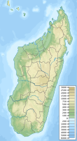
| location | Diana , Madagascar | |
| Area / extent | 226.36 km² / 30 km | |
| WDPA ID | 2314 | |
| Geographical location | 12 ° 36 ′ S , 49 ° 10 ′ E | |
|
|
||
| Sea level | from 1000 m to 1445 m | |
| Setup date | 1958 | |
The Montagne d'Ambre National Park is a national park in Madagascar that was designated in 1958 . Its area is 18,200 hectares and it is located at an altitude of 1000 to 1445 m . It is best reached from Antsiranana 30 kilometers south to Ambohitra (Joffreville). The area is a rock mass of volcanic origin with several waterfalls and crater lakes, with many species of birds (e.g. the Ambrerötel ), lemurs ( Propithecus verreauxi , Eulemur fulvus , Cheirogaleus andysabini ) and orchids .
Web links
Commons : Montagne d'Ambre National Park - Collection of images, videos and audio files


