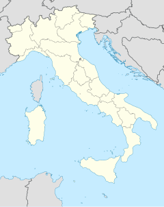
Monti Sibillini National Park
| Monti Sibillini National Park | ||
|---|---|---|
| Mountains within the national park in winter | ||
|
|
||
| Location: | Ascoli Piceno , Fermo , Macerata , Perugia , Italy | |
| Next city: | Norcia , Visso , Sarnano | |
| Surface: | 697.22 km² | |
| Founding: | August 6, 1993 | |
| Address: | Duck Parco Nazionale dei Monti Sibillini Piazza del Forno, 1 |
|
The Monti Sibillini National Park ( Italian Parco nazionale dei Monti Sibillini ) is a national park in Italy . The approx. 70,000 hectare park includes essential parts of the Sibillini Mountains , part of the Apennines . It has existed since 1993 and is located in the provinces of Ascoli Piceno , Fermo , Macerata and Perugia .
The lower layers of the national park are mostly forested. The higher elevations are all overgrown with grass. The highest mountain is the Monte Vettore ( 2476 m slm ) with ascent from Forca di Presta.
Web links
Commons : Monti Sibillini - album with pictures, videos and audio files
- Parco Nazionale dei Monti Sibillini (Italian and English)
- World Database on Protected Areas - Monti Sibillini National Park (English)


