Taganai National Park
| Taganai National Park | ||
|---|---|---|
|
|
||
| Location: | Chelyabinsk , Russia | |
| Next city: | Zlatoust | |
| Surface: | 568 km² | |
| Length: | 52 km | |
| Founding: | March 5, 1991 | |
| Visitors: | approx. 80,000 (2013) | |
| Address: | ul.Shishkina 3a 456209 Slatoust Russia http://www.taganay.org |
|
| Rock formation at "Dwuglawaja Sopka" | ||
| View over the southern national park, in the background the city of Zlatoust | ||
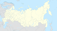
The National Park Taganai ( Russian Национальный парк Таганай , Nazionalny park Taganai ) is a Russian National Park in the Chelyabinsk region . It is located in the southern Urals near the city of Slatoust , about 150 km west of the regional capital, Chelyabinsk . The national park was established on March 5, 1991 . The name of the Taganai mountain range - a foothill of the Ural Mountains, which runs through the national park.
Characteristics
The park is located on the northeastern outskirts of Zlatoust and extends from north to south over 52 km and from west to east between 10 and 15 km. The area of the national park is 568 km² and 93% is covered with forest. Three percent of the area falls into fallow land, another two percent to courtyards in the park. The density of hiking and forest trails is not high. A total of around 170–180 km of paths and trails run through the park. Forestry equipment can only be used during the frosty period in winter or after a long period of drought. The International Union for Conservation of Nature IUCN assigns the park to Category II .
etymology
The name of the national park is derived from the mountain ranges that run through it. The word Taganai ( Russian Таганай ) has its origins probably in the Bashkir language and derives from the words таған ( German support, stand, (under) frame ) and ай ( German moon ). Accordingly, Taganai could be translated as the pillar of the moon .
Another explanation considers the also Bashirish phrase тыуған ай тау to be decisive. The word тыуған means ( German ascending ), тау ( German mountain ). Accordingly, this phrase could be translated as mountain of the rising / young moon .
relief
National park is crossed by several mountain ranges. The largest is the Great Taganai (Большой Таганай) , which runs through the park from the north-east to the south-west. There are several essentially small mountain ranges in the vicinity: In the southern part, the Middle Taganai (Средний Таганай) and the Little Taganai (Малый Таганай) run parallel on the western side . North of the main mountain range joins the Jurma (Юрма) in the northeast . To the east is the Izyl (Ицыл) , which together with the Urals form the eastern border of the park. The mountain ranges Mys (Мыс) and Nasminski (Назминский) also run parallel to the Great Taganai but southwest of it . The Chernoretschensky mountain range (Чернореченский) runs along the western border of the national park . The highest point in the park is the Krugliza mountain at 1178 m.
The following other peaks are located in the national park (over 1000 m):
| Surname | location | height | Mountain range, specialty | image |
|---|---|---|---|---|
| Kruglitsa (Круглица) | 55 ° 19 ' N , 59 ° 50' E | 1178 m | Great Taganai |

|
| Otkliknoi Greben (Откликной Гребень) | 55 ° 18 ' N , 59 ° 49' E | 1155 m | Great Taganai |

|
| Dalni Taganai (Дальний Таганай) | 55 ° 22 ' N , 59 ° 54' E | 1112 m | Großer Taganai, mountain station on the summit in the old weather station |
|
| Izyl (Ицыл) (north peak) | 55 ° 20 ' N , 59 ° 58' E | 1068 m | Izyl | |
| Izyl (Ицыл) (south peak) | 55 ° 20 ' N , 59 ° 58' E | 1049 m | Izyl | |
| Dwuglawaja Sopka (Двуглавая сопка) (north peak) |
55 ° 16 ' N , 59 ° 47' E | 1041 m | Great Taganai |

|
| Dwuglawaja Sopka (Двуглавая сопка) (South Summit) |
55 ° 16 ' N , 59 ° 47' E | 1034 m | Great Taganai |

|
| Montblanc (Монблан) | 55 ° 16 ' N , 59 ° 52' E | 1033 m | Little Taganai | |
| Jurma (Юрма) | 55 ° 29 ' N , 59 ° 59' E | 1002 m | Jurma |
climate
The climate is continental and therefore associated with large temperature differences over the year. The winters are long: the first snow falls on November 9th, lies between 160 and 190 days and thaws again on April 8th. The frost-free period lasts between 70 and 105 days annually. The climate on the mountain peaks is of course very different from that in the valleys. The annual average temperature on the mountain top is around 3 Kelvin lower than in the valleys, the frost period lasts around a month longer. Storms and snow storms are much more frequent. The annual rainfall is between 500 and 1000 mm. A weather station has existed on Dalni Taganai Mountain at an altitude of 1108 m since August 20, 1932 . It was the highest weather station in the Urals until its dissolution in 2005 . The highest temperature ever recorded was 38 ° C, the lowest -50 ° C. Today the old weather station serves as a mountain station where hikers can spend the night.
Hydrology
The Taganai mountain range , which gives it its name, runs through the park and , as part of the southern Urals, also forms the watershed between the river systems of the Volga on the European side and the Ob on the Asian side. A total of 54 hectares of the park are covered with water. Including 16 small rivers and mountain streams. The longest river is the 46 km long Great Kialim , which has its source in the park and flows into the Miass near Karabash . The second longest river, the Great Tesma , has been dammed on the southwestern edge of the park for drinking water production since the mid-1970s. Around a third of the city's drinking water requirements are met from the reservoir. However, the reservoir is no longer part of the national park area.
flora
The park is located in the transition region between two vegetation zones : the boreal coniferous forest (taiga) and the summer green deciduous forest , the easternmost branches of which from the European side end here. So far, 743 different plants have been registered in the national park, around 30 of them tree species.
The trees are dominated by the Siberian spruce and the Siberian fir , which form forests (so-called dark taiga ) , especially in the slightly more humid western and central parts of the park . In the somewhat drier eastern part of the park, forest pines and hanging birches form mixed forests, which in places have a high proportion of Siberian larches ( light taiga ). In the north-western part of the park there are deciduous forests on the south-western slopes, in which Norway maple , sycamore elm and winter linden , and more rarely hazel bushes, occur. Tens of thousands of years ago, these forests covered large parts of the park that are now covered with dark taiga.
Due to its boreal location, the tree line in the park is between only 600–900 m. Croup forms of conifers can be found in groups. After the tree line, various small shrubs grow in the herb layer , such as dwarf juniper , whitebeam or bilberry bushes and sweet grasses . On the slopes there are sometimes large log heaps and smaller mountain meadows.
On the mountain peaks, which are extensively covered by scree and only sparsely overgrown, the vegetation form of the mountain tundra occurs extra-zonally . Dwarf shrubs such as the net willow or the alpine bearberry and herbs such as the spring chickweed , nodule knotweed or rock sedge can be found here.
The azonal swamps have only 14 hectares of a small portion of the parking area. Nevertheless, they are of great importance for the plant world, because around 19% of the plant species in the protected area occur here - for example the protected round and long-leaved sundew or different types of berries such as cranberries or bogberries .
fauna
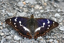
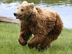
56 species of mammals (including otters , fire weasels , ermines , Eurasian wolves , brown bears and elk ), 181 species of birds, six reptile species, four amphibian species and nine fish species (including the boneless fish Taimen ) live in the national park . Furthermore, about 1000 different invertebrates have been registered so far. Among them are various butterflies and the very rare great saw-hoppers .
tourism
The number of tourists has increased continuously in recent years and reached the record level of around 80,000 in 2013. More than half of the park visitors come from the Chelyabinsk Oblast surrounding the protected area , 13% of the visitors come from the Urals Federal District and another 16% from the rest of Russia. The proportion of foreign guests is around one percent.
There are five lodgings in the form of huts distributed over the area of the national park, in which you can stay overnight and, depending on the nature, cook Camping and longer rest periods are only allowed in selected places.
Transport links
The central entrance to the national park is on its south side in the Slatouster district of Pushkinski ( Lage ). It can be reached by car after driving through the urban area. Zlatoust train station is about 4 km from the park entrance. Long-distance trains run daily from Chelyabinsk to Zlatoust without stopping and electrichkas . The national park administration is located in Zlatoust.
Events
The following events take place annually on the grounds of the national park:
- Cross-country skiing competition "Loipe in die Wolken" (Лыжня за облака) : The competition takes place on the third weekend in February over distances of 10 km and 35 km. (Since 1993)
- Festival of songwriters “Black Rock” (Черная скала) : The festival lasts three days and is traditionally on the third weekend in June. It takes place in the open air, closer to the eponymous rock formation. (since 1999)
- Marathon "Run in the clouds" (Забег за облака) : A cross-country run through the national park, which takes place annually at the end of August over distances of 10 km, 30 km or 42 km (with 1400 meters of altitude on the marathon distance). (1991–1993 and since 1999)
Web links
- Homepage of the National Park Administration (Russian)
- Taganai National Park on the side of the Russian Ministry of Environment (Russian)
- Center for the Protection of Wildlife (Russian)
Individual evidence
- ↑ Report on the animal census in the National Park 2014 ( memento of the original from January 16, 2015 in the Internet Archive ) Info: The archive link was inserted automatically and has not yet been checked. Please check the original and archive link according to the instructions and then remove this notice.
- ↑ Report on animal counting in the National Park 2014 ( memento of the original from January 16, 2015 in the Internet Archive ) Info: The archive link was inserted automatically and has not yet been checked. Please check the original and archive link according to the instructions and then remove this notice.
- ↑ World Database on Protected Areas - Taganai National Park (English)
- ↑ Tourist map of the park with all mountain ranges ( Memento of the original from January 16, 2015 in the Internet Archive ) Info: The archive link was inserted automatically and has not yet been checked. Please check the original and archive link according to the instructions and then remove this notice.
- ↑ Description of the climate in the national park ( Memento of the original from January 15, 2015 in the Internet Archive ) Info: The archive link was inserted automatically and has not yet been checked. Please check the original and archive link according to the instructions and then remove this notice.
- ↑ For the 70th anniversary: Report on the previous work on the weather station
- ↑ Information on the reservoir on the Great Tesma
- ↑ Description of the flora of the national park ( Memento of the original from January 15, 2015 in the Internet Archive ) Info: The archive link was inserted automatically and has not yet been checked. Please check the original and archive link according to the instructions and then remove this notice.
- ↑ On its website for the Taganai National Park in 2011, the Russian Ministry of the Environment assumes a different distribution:> 50 species of mammals, 130 species of birds, six species of reptiles, three species of amphibians, six species of fish
- ↑ List of endangered plants and animals in the national park
- ↑ Description of the wildlife of the national park ( Memento of the original from April 14, 2016 in the Internet Archive ) Info: The archive link was inserted automatically and has not yet been checked. Please check the original and archive link according to the instructions and then remove this notice.
- ↑ Announcement on the tourism report of the park 2013 ( Memento of the original from March 4, 2016 in the Internet Archive ) Info: The archive link was inserted automatically and has not yet been checked. Please check the original and archive link according to the instructions and then remove this notice.
- ↑ Huts on the grounds of the park with description and pictures ( Memento of the original from January 15, 2015 in the Internet Archive ) Info: The archive link was inserted automatically and has not yet been checked. Please check the original and archive link according to the instructions and then remove this notice.
- ↑ List of rest areas in the park ( Memento of the original from January 15, 2015 in the Internet Archive ) Info: The archive link has been inserted automatically and has not yet been checked. Please check the original and archive link according to the instructions and then remove this notice.
- ↑ Directions map to the park entrance ( Memento of the original from January 15, 2015 in the Internet Archive ) Info: The archive link has been inserted automatically and has not yet been checked. Please check the original and archive link according to the instructions and then remove this notice.
- ^ Report on the use of faster suburban trains from Chelyabinsk to Zlatoust
- ↑ You-Tube video for the 10th cross-country skiing competition "Loipe in die Wolken".
- ↑ Information on the Festival of Songwriters 2012. ( Memento of the original from July 2, 2016 in the Internet Archive ) Info: The archive link was inserted automatically and has not yet been checked. Please check the original and archive link according to the instructions and then remove this notice.
- ↑ Homepage of the marathon through the Taganai National Park.


