Down
| Down | |
|---|---|
| State : |
|
| Canton : |
|
| District : | West Raron |
| BFS no. : | 6198 |
| Postal code : | 3942 |
| Coordinates : | 626 432 / 129110 |
| Height : | 639 m above sea level M. |
| Height range : | 627–3303 m above sea level M. |
| Area : | 17.63 km² |
| Residents: | 710 (December 31, 2018) |
| Population density : | 40 inhabitants per km² |
| Website: | www.niedergesteln.ch |
|
Niedergesteln with the ruins of the Gestelnburg castle |
|
| Location of the municipality | |
Niedergesteln ( Walser German : Geschtillu [geʃdɪlˑʊ] or [geʃtilːu] , fr. Chatillon-le-Bas ) is a Munizipalgemeinde and a Burgergemeinde with a Burgerrart the district West Raron and a Parish of Dekanats Raron in Swiss Kanton Wallis .
geography
The parish covers a total area of 1746 hectares; 1213 hectares of which belong to the UNESCO World Natural Heritage Area Swiss Alps Jungfrau-Aletsch . It is one of 23 communities that own land in the World Heritage region.
The village is located in the north of the Swiss Rhone Valley at the foot of the Gestelnburg, built in the 12th century by the Lords of Turn , who ruled their properties from here. Sights include the walkable and illuminated ice age cave inside the castle rock. The village image is shaped on the one hand by the village center, on the other hand by the Jolibach Gorge. Along this gorge, hiking trails, suonen and the south ramp of the BLS - Lötschberg mountain route lead into the Jolital, which is part of the UNESCO World Heritage.
history
The first documentary mentions of the place are Chastellon (1179/1184) and Castellion (1224). The place name goes back to Latin-Romanesque castelliône , which is the diminutive of Latin castellum "fortified camp, castle".
population
| Population development | ||||||||
|---|---|---|---|---|---|---|---|---|
| year | 1850 | 1900 | 1950 | 2000 | 2010 | 2012 | 2014 | 2016 |
| Residents | 176 | 240 | 344 | 573 | 679 | 684 | 679 | 696 |
Attractions
- Catholic priory and parish church of St. Maria
- Gestelnburg ruins
- Ice age cave on the Gestelnburg ruin
- Wafa-Hüs (Wefa House)
- Parish center
- Well-preserved old part of the village
- UNESCO World Natural Heritage Swiss Alps - Entrance Gate (Info Point)
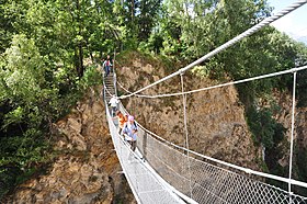
- Suspension bridge over the Jolischlucht
- Joli Gorge
- BLS Railway Bridge Lüegilchin Viaduct
- Hiking area Niedergesteln - Joli
- Suonen hikes near Niedergesteln and in Jolital
- Baggilla (small lake on the Rhone )
Hamlets and districts
- Gesch (Geesch)
- Alpe Tatz
- Voralpe Liden
- Voralpe Brägji (Bregy)
- Lüegjiu
- Alpe Joli
- Alpe Mattachru (Mattackern)
- Water pipe
literature
- Philipp Kalbermatter: Niedergesteln. In: Historical Lexicon of Switzerland . 2017 .
Web links
- Niedergesteln on the platform ETHorama
- Official website of the Niedergesteln municipality
- Swiss Alps World Heritage Site
- Gestelnburg Pro Castellione Foundation
Individual evidence
- ↑ Permanent and non-permanent resident population by year, canton, district, municipality, population type and gender (permanent resident population). In: bfs. admin.ch . Federal Statistical Office (FSO), August 31, 2019, accessed on December 22, 2019 .
- ^ Linguistic Atlas of German-speaking Switzerland , Volume V 1b.
- ↑ a b Lexicon of Swiss municipality names . Edited by the Center de Dialectologie at the University of Neuchâtel under the direction of Andres Kristol. Frauenfeld / Lausanne 2005, p. 646.


