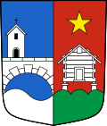
Steg-Hohtenn
| Steg-Hohtenn | |
|---|---|
| State : |
|
| Canton : |
|
| District : | West Raron |
| BFS no. : | 6204 |
| Postal code : | 3940 footbridge 3949 Hohtenn |
| Coordinates : | 624 751 / 129 895 |
| Height : | 640 m above sea level M. |
| Height range : | 626-3025 m above sea level M. |
| Area : | 14.03 km² |
| Residents: | 1591 (December 31, 2018) |
| Population density : | 113 inhabitants per km² |
| Website: | www.steg-hohtenn.ch |
|
Gampel (right) and Steg (left) |
|
| Location of the municipality | |
Steg-Hohtenn is a political municipality and a civil parish in the Westlich Raron district in the canton of Valais in Switzerland.
geography
Steg-Hohtenn is located in the German-speaking part of the canton of Valais and consists of the villages of Steg, approx. 1350 inhabitants, and Hohtenn, approx. 250 inhabitants. The municipality is a typical place of residence without major tourism and an important location for industry and commerce in Upper Valais. The community has a train station (Gampel-Steg) on the Simplon line and a stop (Hohtenn) on the Lötschberg mountain route . The Hohtenn train station is the starting point of the well-known BLS-Südrampe hiking trail to Ausserberg-Eggerberg-Brig. In addition, bus routes connect the community with Visp , Leuk and the Lötschental . The community also has two half-connections to the A9 .
The village of Steg is located at the southern exit of the Lötschental valley , in the west Steg borders the Lonza River , which also marks the district boundary, and the border with the village of Gampel . The village of Hohtenn is located on a terrace at the eastern exit of the Lötschental around 200 meters above the Rhone Valley, above Steg. In the east and south, Steg-Hohtenn borders the municipality of Niedergesteln , in the north on the municipality of Ferden in the Lötschental.
history
Steg-Hohtenn was created on January 1st, 2009 from the merger of the two communities of Steg and Hohtenn . The merger is based on a resolution passed by the voters of both communities on December 16, 2007.
Attractions
Personalities
- Wilhelm Schnyder (* 1943), Grand Councilor (1977–1989), Grand Council President (1988–1989), Councilor of State (1993–2005)
- Raphael Wicky (* 1977), soccer player
literature
- Editor: Steg-Hohtenn. In: Historical Lexicon of Switzerland . 2017 .
- Philipp Kalbermatter: Benken (VS). In: Historical Lexicon of Switzerland . 2017 .
Web links
Individual evidence
- ↑ Permanent and non-permanent resident population by year, canton, district, municipality, population type and gender (permanent resident population). In: bfs. admin.ch . Federal Statistical Office (FSO), August 31, 2019, accessed on December 22, 2019 .


