Nienwalde
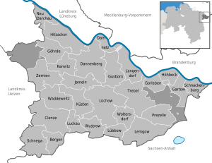
Location Nienwaldes in the Lüchow-Dannenberg district. |
Nienwalde is a district of Gartow in Lower Saxony and has about 300 inhabitants.
geography
Nienwalde is located in the Lüchow-Dannenberg district on the border with Saxony-Anhalt . The village is connected to the main town Gartow by the K 34, and there is also a connection road to Bömenzien .
The neighboring towns are Elbholz in the north, Sonnenhof , Holtorf , Schnackenburg , Kapern , Gummern and Stresow in the northeast, Klein Wanzer in the east, Wanzer , Aulosen , Bömenzien , Drösede and Gollensdorf in the southeast, Wirl and Prezelle settlement in the southwest, Rucksmoor in the west, as well Falkenmoor , Buchhorst , Gartow and Quarnstedt in the north-west.
history
In 1360 Nienwalde was mentioned as Nygendorp for the first time. After Nygendorp fell to the Electorate of Hanover in 1690, it was renamed Niendorf . On May 24, 1836, a fire destroyed 20 houses in the area of today's old courtyards. After only seven weeks, the village was rebuilt a few hundred meters further south on a slight hill in four rectangles surrounded by roads. There were six courtyards in each of the rectangles. To prevent further fires, oaks were planted between the courtyards.
In addition, Niendorf was often flooded due to its proximity to the Elbe . In 1936 the community, now called Niendorf bei Gartow , was renamed Nienwalde. The village was only a kilometer away from the former border with the German Democratic Republic . In 1977 a dike from Gartow to the state border was built for further flood protection .
On July 1, 1972, Nienwalde was incorporated into the Gartow district.
nature
In the nature reserve Upper Seegeniederung is the 2007, this 15-meter-high observation tower Klaus-Bahlsen-tower , among other things, to observe eagles serves. There is also a beaver observation trail near the village . The “Green Belt” nature trail also leads through the town. To the south there is a large pine forest , the Gartower firs , which form a community-free area .
Individual evidence
- ↑ Map services of the Federal Agency for Nature Conservation ( information )
- ↑ Lower Saxony State Office, Institute for the Preservation of Monuments (ed.): List of architectural monuments according to § 4 (NDSchG). Lüchow-Dannenberg district. Status: October 1, 1986. In: Monument topography of the Federal Republic of Germany. Architectural monuments in Lower Saxony. Volume 21, Friedrich Vieweg & Sohn, Braunschweig 1986, ISBN 3-528-06206-1
- ^ Federal Statistical Office (ed.): Historical municipality directory for the Federal Republic of Germany. Name, border and key number changes in municipalities, counties and administrative districts from May 27, 1970 to December 31, 1982 . W. Kohlhammer GmbH, Stuttgart / Mainz 1983, ISBN 3-17-003263-1 , p. 231 .
- ↑ Welcome to the Klaus Bahlsen Tower (PDF; 2 MB) on the website of the NABU Landesverband Niedersachsen
- ^ NABU Lower Saxony: Inauguration of the Klaus Bahlsen tower in Nienwalde. Archived from the original on April 13, 2014 ; Retrieved December 18, 2015 .
Web links
Coordinates: 53 ° 0 ′ N , 11 ° 29 ′ E


