North Brandenburg plateau and hill country
| North Brandenburg plateau and hill country | |||
|---|---|---|---|
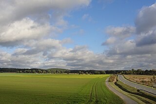
| Landscape near Perleberg | |||
| surface | 5 086 km² | ||
| Systematics according to | Handbook of the natural spatial structure of Germany | ||
| Greater region 1st order | North German Lowlands | ||
| Greater region 2nd order | Central North German Lowland | ||
| Greater region 3rd order | 76–89 → East German plateau and heathland |
||
| Natural space |
77 → North Brandenburg plateau and hill country |
||
| Highest peak | Ruhner Berg ( 176.8 m ) | ||
| Geographical location | |||
| Coordinates | 53 ° 5 '0 " N , 12 ° 21' 0" E | ||
|
|||
| state | Brandenburg , Mecklenburg-Western Pomerania , Saxony-Anhalt | ||
| Country | Germany | ||
The North Brandenburg plateau and hill country is a natural area in the north-west of Brandenburg and, to a lesser extent, in the south-west of Mecklenburg-Western Pomerania and north-east Saxony-Anhalt . It represents the main unit group 77 in the natural division of Germany into large regions . The Brandenburg part of the North Brandenburg plateau and hill country essentially coincides with the natural area designated as Prignitz and Ruppiner Land in the structural atlas of the state of Brandenburg.
location
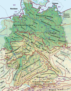
The North Brandenburg plateau and hill country is part of the North German lowlands. It stretches from the Elden lowlands in the west to the middle of northern Brandenburg towards the Havel. Neighboring natural landscapes are the southwestern foreland of the Mecklenburg Lake District in the northwest, the Mecklenburg Lake District in the northeast, the Luchland in the southeast and the Elbe valley in the southwest.
description
Several ground moraine plates of Saale and Vistula Ice Age origins form the core of the North Brandenburg plateau and hill country . In addition, there are sands and valley sand areas as well as the compression and terminal moraine hills of the Ruhner Mountains with a height of up to 176.8 m above sea level. NHN .
With the exception of the Granseer Platte in the east, the land mainly slopes from north to south. Accordingly, the landscape of Elde , Löcknitz , Stepenitz , Dosse and Rhin with their tributaries to the Rhinluch and the Elbe is drained. The middle of the lake is criss-crossed by long channel lakes with the Kyritz chain of lakes and the chain around the Ruppiner See . In the east of the landscape there are also ground moraine lakes , in the west the Rudower See .
Natural structure
The North Brandenburg plateau and hill country is subdivided as follows:
-
77 North Brandenburg plateau and hill country
- 770 Prignitz (1599 km²)
- 771 Ruhner Mountains (156 km²)
- 772 Parchim-Meyenburg sand areas (581 km²)
- 773 Kyritzer Platte (401.5 km²)
- 774 Perleberger Heide (323 km²)
- 775 Dosseniederung (362 km²)
- 776–779 Ruppiner Heiden and Platten (1663.5 km²)
- 776 Wittstock-Ruppiner Heide (504 km²)
- 777 Ruppiner Platte (485 km²)
- 778 Granseer Platte (577 km²)
- 779 Rüthnicker Heide (97.5 km²)
The unit Ruppiner Heiden and Platten is seen as just one main unit, despite four three-digit numbers assigned.
literature
- Emil Meynen, Josef Schmithüsen et al. (Ed.): Handbook of the natural spatial structure of Germany . Federal Institute for Regional Studies, Remagen / Bad Godesberg 1953–1962 (8th delivery 1961). Pp. 1091-1105, author H. Siggel.
- Eberhard Scholz: The natural spatial structure of Brandenburg . Pedagogical District Cabinet, Potsdam 1962, p. 74 ff .
Individual evidence
- ↑ Natural spatial structure 2007. (PDF; 803 kB) (No longer available online.) In: Structural Atlas. Brandenburg State Office for Building and Transport, spatial observation, archived from the original on July 25, 2014 ; Retrieved October 30, 2012 . Info: The archive link was inserted automatically and has not yet been checked. Please check the original and archive link according to the instructions and then remove this notice.

